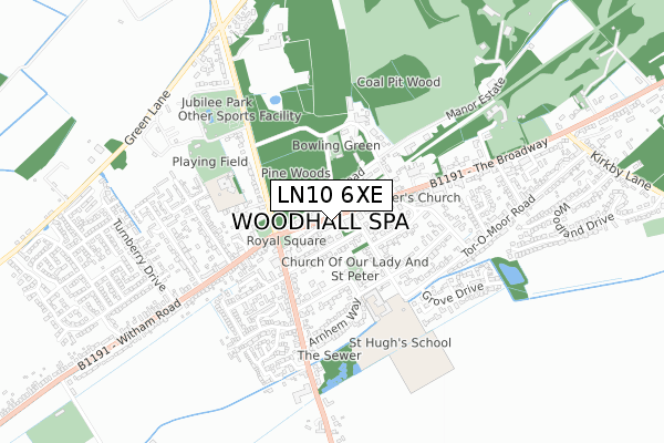
LN10 6XE is located in the Woodhall Spa electoral ward, within the local authority district of East Lindsey and the English Parliamentary constituency of Louth and Horncastle. The Sub Integrated Care Board (ICB) Location is NHS Lincolnshire ICB - 71E and the police force is Lincolnshire. This postcode has been in use since May 2019.


GetTheData
Source: OS Open Zoomstack (Ordnance Survey)
Licence: Open Government Licence (requires attribution)
Attribution: Contains OS data © Crown copyright and database right 2025
Source: Open Postcode Geo
Licence: Open Government Licence (requires attribution)
Attribution: Contains OS data © Crown copyright and database right 2025; Contains Royal Mail data © Royal Mail copyright and database right 2025; Source: Office for National Statistics licensed under the Open Government Licence v.3.0
| Easting | 519452 |
| Northing | 363126 |
| Latitude | 53.151908 |
| Longitude | -0.215215 |
GetTheData
Source: Open Postcode Geo
Licence: Open Government Licence
| Country | England |
| Postcode District | LN10 |
➜ See where LN10 is on a map ➜ Where is Woodhall Spa? | |
GetTheData
Source: Land Registry Price Paid Data
Licence: Open Government Licence
| Ward | Woodhall Spa |
| Constituency | Louth And Horncastle |
GetTheData
Source: ONS Postcode Database
Licence: Open Government Licence
| Clarence Road (Station Road) | Woodhall Spa | 50m |
| Woodhall Spa Hotel (The Broadway) | Woodhall Spa | 51m |
| Woodhall Spa Hotel (The Broadway) | Woodhall Spa | 60m |
| Iddesleigh Road (Stanhope Avenue) | Woodhall Spa | 159m |
| Iddesleigh Road (Stanhope Avenue) | Woodhall Spa | 202m |
GetTheData
Source: NaPTAN
Licence: Open Government Licence
GetTheData
Source: ONS Postcode Database
Licence: Open Government Licence


➜ Get more ratings from the Food Standards Agency
GetTheData
Source: Food Standards Agency
Licence: FSA terms & conditions
| Last Collection | |||
|---|---|---|---|
| Location | Mon-Fri | Sat | Distance |
| Woodhall Spa Post Office | 17:30 | 12:00 | 18m |
| Stixwold Road | 17:00 | 08:00 | 231m |
| The Broadway | 16:45 | 11:00 | 276m |
GetTheData
Source: Dracos
Licence: Creative Commons Attribution-ShareAlike
The below table lists the International Territorial Level (ITL) codes (formerly Nomenclature of Territorial Units for Statistics (NUTS) codes) and Local Administrative Units (LAU) codes for LN10 6XE:
| ITL 1 Code | Name |
|---|---|
| TLF | East Midlands (England) |
| ITL 2 Code | Name |
| TLF3 | Lincolnshire |
| ITL 3 Code | Name |
| TLF30 | Lincolnshire CC |
| LAU 1 Code | Name |
| E07000137 | East Lindsey |
GetTheData
Source: ONS Postcode Directory
Licence: Open Government Licence
The below table lists the Census Output Area (OA), Lower Layer Super Output Area (LSOA), and Middle Layer Super Output Area (MSOA) for LN10 6XE:
| Code | Name | |
|---|---|---|
| OA | E00132619 | |
| LSOA | E01026120 | East Lindsey 016G |
| MSOA | E02005439 | East Lindsey 016 |
GetTheData
Source: ONS Postcode Directory
Licence: Open Government Licence
| LN10 6TZ | Clarence Road | 49m |
| LN10 6QL | Station Road | 122m |
| LN10 6TY | Victoria Avenue | 127m |
| LN10 6PZ | Spa Road | 154m |
| LN10 6ST | The Broadway | 155m |
| LN10 6SP | Stanhope Avenue | 207m |
| LN10 6TU | Cornwall Terrace | 212m |
| LN10 6QJ | Tattershall Road | 233m |
| LN10 6SR | Iddesleigh Road | 255m |
| LN10 6TT | Tattershall Road | 258m |
GetTheData
Source: Open Postcode Geo; Land Registry Price Paid Data
Licence: Open Government Licence