Property/Postcode Data Search:
LN1 2YT maps, stats, and open data
LN1 2YT is located in the Scampton electoral ward, within the local authority district of West Lindsey and the English Parliamentary constituency of Gainsborough. The Sub Integrated Care Board (ICB) Location is NHS Lincolnshire ICB - 71E and the police force is Lincolnshire. This postcode has been in use since October 2019.
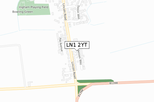
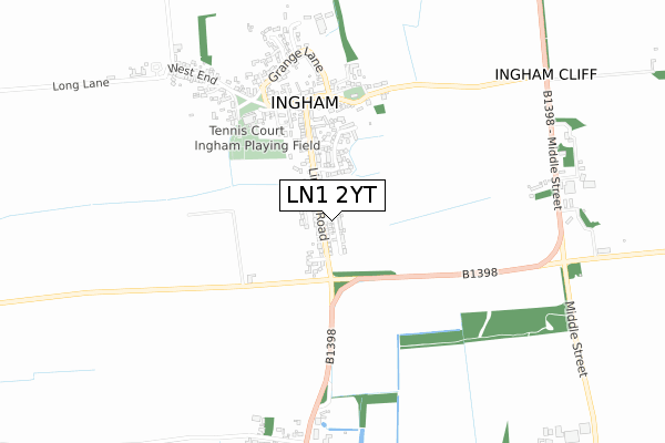
LN1 2YT maps


Source: OS Open Zoomstack (Ordnance Survey)
Licence: Open Government Licence (requires attribution)
Attribution: Contains OS data © Crown copyright and database right 2025
Source: Open Postcode Geo
Licence: Open Government Licence (requires attribution)
Attribution: Contains OS data © Crown copyright and database right 2025; Contains Royal Mail data © Royal Mail copyright and database right 2025; Source: Office for National Statistics licensed under the Open Government Licence v.3.0
Licence: Open Government Licence (requires attribution)
Attribution: Contains OS data © Crown copyright and database right 2025
Source: Open Postcode Geo
Licence: Open Government Licence (requires attribution)
Attribution: Contains OS data © Crown copyright and database right 2025; Contains Royal Mail data © Royal Mail copyright and database right 2025; Source: Office for National Statistics licensed under the Open Government Licence v.3.0
LN1 2YT geodata
| Easting | 494933 |
| Northing | 382958 |
| Latitude | 53.335045 |
| Longitude | -0.575824 |
Where is LN1 2YT?
| Country | England |
| Postcode District | LN1 |
Politics
| Ward | Scampton |
|---|---|
| Constituency | Gainsborough |
House Prices
Sales of detached houses in LN1 2YT
2025 26 FEB £336,000 |
3, WESSEX WAY, INGHAM, LINCOLN, LN1 2YT 2023 9 MAR £335,000 |
15, WESSEX WAY, INGHAM, LINCOLN, LN1 2YT 2021 14 MAY £435,000 |
8, WESSEX WAY, INGHAM, LINCOLN, LN1 2YT 2021 19 MAR £320,000 |
6, WESSEX WAY, INGHAM, LINCOLN, LN1 2YT 2021 19 MAR £335,000 |
21, WESSEX WAY, INGHAM, LINCOLN, LN1 2YT 2021 18 MAR £440,000 |
7, WESSEX WAY, INGHAM, LINCOLN, LN1 2YT 2021 12 MAR £435,000 |
19, WESSEX WAY, INGHAM, LINCOLN, LN1 2YT 2021 29 JAN £285,000 |
9, WESSEX WAY, INGHAM, LINCOLN, LN1 2YT 2021 28 JAN £345,000 |
1, WESSEX WAY, INGHAM, LINCOLN, LN1 2YT 2020 11 NOV £325,000 |
Source: HM Land Registry Price Paid Data
Licence: Contains HM Land Registry data © Crown copyright and database right 2025. This data is licensed under the Open Government Licence v3.0.
Licence: Contains HM Land Registry data © Crown copyright and database right 2025. This data is licensed under the Open Government Licence v3.0.
Transport
Nearest bus stops to LN1 2YT
| Sidney Chase (Lincoln Road) | Ingham | 127m |
| Surgery (Lincoln Road) | Ingham | 128m |
| Sidney Chase (Lincoln Road) | Ingham | 130m |
| Surgery (Lincoln Road) | Ingham | 155m |
| Demand Responsive Area | Ingham | 417m |
Deprivation
40.2% of English postcodes are less deprived than LN1 2YT:Food Standards Agency
Three nearest food hygiene ratings to LN1 2YT (metres)
Lincolnshire Co-operative Ltd

107 High Street
535m
The Black Horse

Black Horse Inn
555m
Little Acorns

Ingham Village Hall
559m
➜ Get more ratings from the Food Standards Agency
Nearest post box to LN1 2YT
| Last Collection | |||
|---|---|---|---|
| Location | Mon-Fri | Sat | Distance |
| Ingham Post Office | 16:15 | 11:30 | 638m |
| Cammeringham | 16:30 | 11:00 | 797m |
| Lincoln Road | 16:30 | 11:00 | 2,105m |
LN1 2YT ITL and LN1 2YT LAU
The below table lists the International Territorial Level (ITL) codes (formerly Nomenclature of Territorial Units for Statistics (NUTS) codes) and Local Administrative Units (LAU) codes for LN1 2YT:
| ITL 1 Code | Name |
|---|---|
| TLF | East Midlands (England) |
| ITL 2 Code | Name |
| TLF3 | Lincolnshire |
| ITL 3 Code | Name |
| TLF30 | Lincolnshire CC |
| LAU 1 Code | Name |
| E07000142 | West Lindsey |
LN1 2YT census areas
The below table lists the Census Output Area (OA), Lower Layer Super Output Area (LSOA), and Middle Layer Super Output Area (MSOA) for LN1 2YT:
| Code | Name | |
|---|---|---|
| OA | E00134132 | |
| LSOA | E01026399 | West Lindsey 005C |
| MSOA | E02005496 | West Lindsey 005 |
Nearest postcodes to LN1 2YT
| LN1 2YY | Sidney Chase | 123m |
| LN1 2YP | Stow Lane | 160m |
| LN1 2XQ | The Avenue | 179m |
| LN1 2XF | Lincoln Road | 195m |
| LN1 2FP | Saxon Way | 331m |
| LN1 2XH | Fieldside | 359m |
| LN1 2FN | Glebe Close | 374m |
| LN1 2XA | Walnut Court | 391m |
| LN1 2YR | Sycamore Court | 457m |
| LN1 2XJ | Churchfield | 457m |