LN1 2FA maps, stats, and open data
- Home
- Postcode
- LN
- LN1
- LN1 2
LN1 2FA is located in the Saxilby electoral ward, within the local authority district of West Lindsey and the English Parliamentary constituency of Gainsborough. The Sub Integrated Care Board (ICB) Location is NHS Lincolnshire ICB - 71E and the police force is Lincolnshire. This postcode has been in use since April 2018.
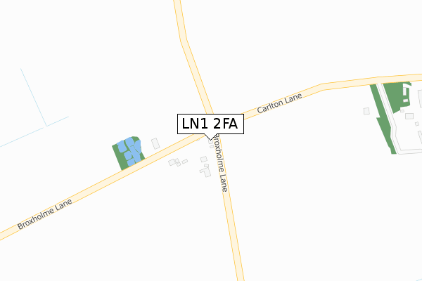
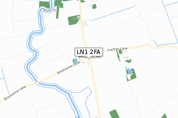
LN1 2FA maps


Source: OS Open Zoomstack (Ordnance Survey)
Licence: Open Government Licence (requires attribution)
Attribution: Contains OS data © Crown copyright and database right 2025
Source: Open Postcode GeoLicence: Open Government Licence (requires attribution)
Attribution: Contains OS data © Crown copyright and database right 2025; Contains Royal Mail data © Royal Mail copyright and database right 2025; Source: Office for National Statistics licensed under the Open Government Licence v.3.0
LN1 2FA geodata
| Easting | 491151 |
| Northing | 377136 |
| Latitude | 53.283391 |
| Longitude | -0.634271 |
Where is LN1 2FA?
| Country | England |
| Postcode District | LN1 |
Politics
| Ward | Saxilby |
|---|
| Constituency | Gainsborough |
|---|
Transport
Nearest bus stops to LN1 2FA
| Village Lane End (Broxholme Lane) | Broxholme | 21m |
| Village Lane End (Carlton Lane) | Broxholme | 47m |
| Manor Road (Mill Lane) | Saxilby | 1,879m |
| Manor Road (Mill Lane) | Saxilby | 1,893m |
Nearest railway stations to LN1 2FA
Broadband
Broadband access in LN1 2FA (2020 data)
| Percentage of properties with Next Generation Access | 100.0% |
| Percentage of properties with Superfast Broadband | 0.0% |
| Percentage of properties with Ultrafast Broadband | 0.0% |
| Percentage of properties with Full Fibre Broadband | 0.0% |
Superfast Broadband is between 30Mbps and 300Mbps
Ultrafast Broadband is > 300Mbps
Broadband limitations in LN1 2FA (2020 data)
| Percentage of properties unable to receive 2Mbps | 0.0% |
| Percentage of properties unable to receive 5Mbps | 0.0% |
| Percentage of properties unable to receive 10Mbps | 50.0% |
| Percentage of properties unable to receive 30Mbps | 100.0% |
Deprivation
32.1% of English postcodes are less deprived than
LN1 2FA:
Food Standards Agency
Three nearest food hygiene ratings to LN1 2FA (metres)
Broxholme Farm Shop
Premier Extra Convenience Store
FLAT ABOVE 97 LITTLEFIELD LANE
1,748m
Sunflowers Nursery School
The Old Schoolhouse
1,950m
➜ Get more ratings from the Food Standards Agency
Nearest post box to LN1 2FA
| | Last Collection | |
|---|
| Location | Mon-Fri | Sat | Distance |
|---|
| Bransby | 16:00 | 08:30 | 2,408m |
| Odder | 17:15 | 12:45 | 2,707m |
| Thorpe Lane End | 16:00 | 07:45 | 3,146m |
LN1 2FA ITL and LN1 2FA LAU
The below table lists the International Territorial Level (ITL) codes (formerly Nomenclature of Territorial Units for Statistics (NUTS) codes) and Local Administrative Units (LAU) codes for LN1 2FA:
| ITL 1 Code | Name |
|---|
| TLF | East Midlands (England) |
| ITL 2 Code | Name |
|---|
| TLF3 | Lincolnshire |
| ITL 3 Code | Name |
|---|
| TLF30 | Lincolnshire CC |
| LAU 1 Code | Name |
|---|
| E07000142 | West Lindsey |
LN1 2FA census areas
The below table lists the Census Output Area (OA), Lower Layer Super Output Area (LSOA), and Middle Layer Super Output Area (MSOA) for LN1 2FA:
| Code | Name |
|---|
| OA | E00134125 | |
|---|
| LSOA | E01026397 | West Lindsey 009B |
|---|
| MSOA | E02005500 | West Lindsey 009 |
|---|
Nearest postcodes to LN1 2FA


