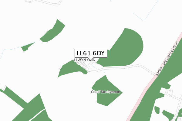
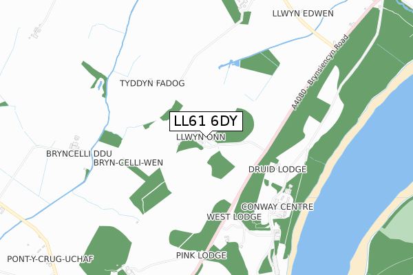
LL61 6DY is located in the Bodowyr electoral ward, within the unitary authority of Isle of Anglesey and the Welsh Parliamentary constituency of Ynys Môn. The Local Health Board is Betsi Cadwaladr University and the police force is North Wales. This postcode has been in use since April 2018.


GetTheData
Source: OS Open Zoomstack (Ordnance Survey)
Licence: Open Government Licence (requires attribution)
Attribution: Contains OS data © Crown copyright and database right 2025
Source: Open Postcode Geo
Licence: Open Government Licence (requires attribution)
Attribution: Contains OS data © Crown copyright and database right 2025; Contains Royal Mail data © Royal Mail copyright and database right 2025; Source: Office for National Statistics licensed under the Open Government Licence v.3.0
| Easting | 251621 |
| Northing | 370370 |
| Latitude | 53.209640 |
| Longitude | -4.223301 |
GetTheData
Source: Open Postcode Geo
Licence: Open Government Licence
| Country | Wales |
| Postcode District | LL61 |
➜ See where LL61 is on a map | |
GetTheData
Source: Land Registry Price Paid Data
Licence: Open Government Licence
| Ward | Bodowyr |
| Constituency | Ynys Môn |
GetTheData
Source: ONS Postcode Database
Licence: Open Government Licence
| Plas Newydd (Brynsiencyn Road) | Llanfairpwllgwyngyll | 641m |
| Plas Newydd (Brynsiencyn Road) | Llanfairpwllgwyngyll | 642m |
| Llwynonn Logde (Brynsiencyn Road) | Llanfairpwllgwyngyll | 741m |
| Llwynonn Lodge (Brynsiencyn Road) | Llanfairpwllgwyngyll | 741m |
| Victoria Cottages (Brynsiencyn Road) | Llanfairpwllgwyngyll | 973m |
| Llanfairpwll Station | 1.6km |
GetTheData
Source: NaPTAN
Licence: Open Government Licence
| Percentage of properties with Next Generation Access | 0.0% |
| Percentage of properties with Superfast Broadband | 0.0% |
| Percentage of properties with Ultrafast Broadband | 0.0% |
| Percentage of properties with Full Fibre Broadband | 0.0% |
Superfast Broadband is between 30Mbps and 300Mbps
Ultrafast Broadband is > 300Mbps
| Median download speed | 3.6Mbps |
| Average download speed | 3.4Mbps |
| Maximum download speed | 4.14Mbps |
| Median upload speed | 0.8Mbps |
| Average upload speed | 0.7Mbps |
| Maximum upload speed | 0.88Mbps |
| Percentage of properties unable to receive 2Mbps | 0.0% |
| Percentage of properties unable to receive 5Mbps | 100.0% |
| Percentage of properties unable to receive 10Mbps | 100.0% |
| Percentage of properties unable to receive 30Mbps | 100.0% |
GetTheData
Source: Ofcom
Licence: Ofcom Terms of Use (requires attribution)
GetTheData
Source: ONS Postcode Database
Licence: Open Government Licence


➜ Get more ratings from the Food Standards Agency
GetTheData
Source: Food Standards Agency
Licence: FSA terms & conditions
| Last Collection | |||
|---|---|---|---|
| Location | Mon-Fri | Sat | Distance |
| Llanedwen | 10:00 | 09:45 | 1,416m |
| Pringle | 16:30 | 10:00 | 1,544m |
| Star | 12:15 | 10:30 | 1,662m |
GetTheData
Source: Dracos
Licence: Creative Commons Attribution-ShareAlike
The below table lists the International Territorial Level (ITL) codes (formerly Nomenclature of Territorial Units for Statistics (NUTS) codes) and Local Administrative Units (LAU) codes for LL61 6DY:
| ITL 1 Code | Name |
|---|---|
| TLL | Wales |
| ITL 2 Code | Name |
| TLL1 | West Wales and The Valleys |
| ITL 3 Code | Name |
| TLL11 | Isle of Anglesey |
| LAU 1 Code | Name |
| W06000001 | Isle of Anglesey |
GetTheData
Source: ONS Postcode Directory
Licence: Open Government Licence
The below table lists the Census Output Area (OA), Lower Layer Super Output Area (LSOA), and Middle Layer Super Output Area (MSOA) for LL61 6DY:
| Code | Name | |
|---|---|---|
| OA | W00000132 | |
| LSOA | W01000027 | Isle of Anglesey 009C |
| MSOA | W02000009 | Isle of Anglesey 009 |
GetTheData
Source: ONS Postcode Directory
Licence: Open Government Licence
| LL61 6PE | Tyddyn Pwyth | 1146m |
| LL61 6EQ | 1247m | |
| LL61 6PB | Ffordd Brynsiencyn | 1369m |
| LL61 5YX | Ffordd Caergybi | 1469m |
| LL60 6HE | 1487m | |
| LL61 5YA | Bryn Salem | 1503m |
| LL60 6EP | 1521m | |
| LL61 5UJ | Ffordd Caergybi | 1609m |
| LL61 5DZ | 1610m | |
| LL61 6PA | Ffordd Brynsiencyn | 1612m |
GetTheData
Source: Open Postcode Geo; Land Registry Price Paid Data
Licence: Open Government Licence