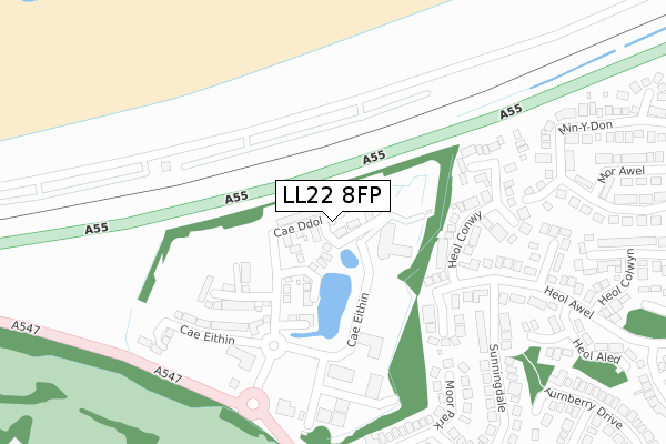
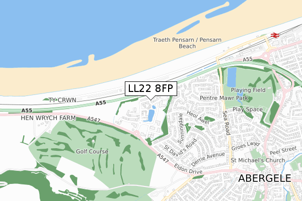
LL22 8FP is located in the Pen-sarn Pentre Mawr electoral ward, within the unitary authority of Conwy and the Welsh Parliamentary constituency of Clwyd West. The Local Health Board is Betsi Cadwaladr University and the police force is North Wales. This postcode has been in use since January 2020.


GetTheData
Source: OS Open Zoomstack (Ordnance Survey)
Licence: Open Government Licence (requires attribution)
Attribution: Contains OS data © Crown copyright and database right 2025
Source: Open Postcode Geo
Licence: Open Government Licence (requires attribution)
Attribution: Contains OS data © Crown copyright and database right 2025; Contains Royal Mail data © Royal Mail copyright and database right 2025; Source: Office for National Statistics licensed under the Open Government Licence v.3.0
| Easting | 293574 |
| Northing | 378173 |
| Latitude | 53.289816 |
| Longitude | -3.598022 |
GetTheData
Source: Open Postcode Geo
Licence: Open Government Licence
| Country | Wales |
| Postcode District | LL22 |
➜ See where LL22 is on a map ➜ Where is Abergele? | |
GetTheData
Source: Land Registry Price Paid Data
Licence: Open Government Licence
| Ward | Pen-sarn Pentre Mawr |
| Constituency | Clwyd West |
GetTheData
Source: ONS Postcode Database
Licence: Open Government Licence
2025 19 MAR £285,000 |
6, CAE DDOL, ABERGELE, LL22 8FP 2025 17 MAR £278,000 |
10, CAE DDOL, ABERGELE, LL22 8FP 2023 27 OCT £350,000 |
2022 21 JAN £349,000 |
2022 21 JAN £269,000 |
48, CAE DDOL, ABERGELE, LL22 8FP 2021 30 SEP £269,995 |
49, CAE DDOL, ABERGELE, LL22 8FP 2021 30 SEP £319,995 |
50, CAE DDOL, ABERGELE, LL22 8FP 2021 13 AUG £264,995 |
53, CAE DDOL, ABERGELE, LL22 8FP 2021 12 AUG £289,995 |
54, CAE DDOL, ABERGELE, LL22 8FP 2021 30 JUN £232,995 |
GetTheData
Source: HM Land Registry Price Paid Data
Licence: Contains HM Land Registry data © Crown copyright and database right 2025. This data is licensed under the Open Government Licence v3.0.
| North Wales Business Park (Grounds) | Groeslwyd | 214m |
| Sunningdale (Troon Way) | Abergele | 433m |
| Min-y-don | Pentre Mawr Park | 563m |
| Eldon Drive (Market Street) | Abergele | 683m |
| Castle Gates (Abergele Road) | Abergele | 758m |
| Abergele & Pensarn Station | 1.2km |
GetTheData
Source: NaPTAN
Licence: Open Government Licence
GetTheData
Source: ONS Postcode Database
Licence: Open Government Licence


➜ Get more ratings from the Food Standards Agency
GetTheData
Source: Food Standards Agency
Licence: FSA terms & conditions
| Last Collection | |||
|---|---|---|---|
| Location | Mon-Fri | Sat | Distance |
| Marford Drive | 16:45 | 11:00 | 752m |
| Tan Yr Wylfa | 16:45 | 11:00 | 897m |
| Lon Dirion | 16:45 | 11:00 | 1,520m |
GetTheData
Source: Dracos
Licence: Creative Commons Attribution-ShareAlike
The below table lists the International Territorial Level (ITL) codes (formerly Nomenclature of Territorial Units for Statistics (NUTS) codes) and Local Administrative Units (LAU) codes for LL22 8FP:
| ITL 1 Code | Name |
|---|---|
| TLL | Wales |
| ITL 2 Code | Name |
| TLL1 | West Wales and The Valleys |
| ITL 3 Code | Name |
| TLL13 | Conwy and Denbighshire |
| LAU 1 Code | Name |
| W06000003 | Conwy |
GetTheData
Source: ONS Postcode Directory
Licence: Open Government Licence
The below table lists the Census Output Area (OA), Lower Layer Super Output Area (LSOA), and Middle Layer Super Output Area (MSOA) for LL22 8FP:
| Code | Name | |
|---|---|---|
| OA | W00000952 | |
| LSOA | W01000179 | Conwy 010F |
| MSOA | W02000036 | Conwy 010 |
GetTheData
Source: ONS Postcode Directory
Licence: Open Government Licence
| LL22 7US | Heol Elwy | 240m |
| LL22 7UT | Heol Conwy | 288m |
| LL22 7UA | Moor Park | 325m |
| LL22 7TY | Troon Way | 334m |
| LL22 7UQ | Heol Awel | 366m |
| LL22 7UB | Sunningdale | 368m |
| LL22 7UW | Heol Bodran | 394m |
| LL22 7UR | Heol Aled | 412m |
| LL22 7LY | Min Y Don | 418m |
| LL22 7TT | Troon Way | 431m |
GetTheData
Source: Open Postcode Geo; Land Registry Price Paid Data
Licence: Open Government Licence