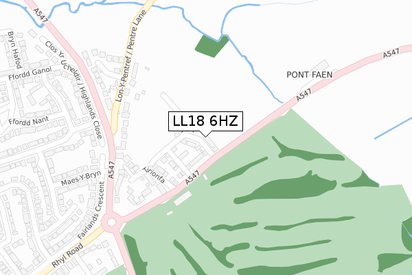
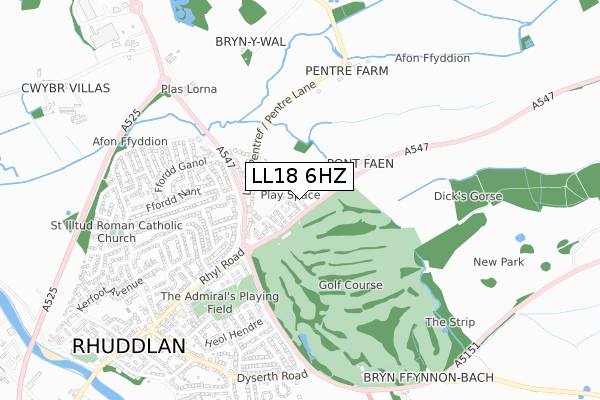
LL18 6HZ is located in the Rhuddlan electoral ward, within the unitary authority of Denbighshire and the Welsh Parliamentary constituency of Vale of Clwyd. The Local Health Board is Betsi Cadwaladr University and the police force is North Wales. This postcode has been in use since January 2020.


GetTheData
Source: OS Open Zoomstack (Ordnance Survey)
Licence: Open Government Licence (requires attribution)
Attribution: Contains OS data © Crown copyright and database right 2025
Source: Open Postcode Geo
Licence: Open Government Licence (requires attribution)
Attribution: Contains OS data © Crown copyright and database right 2025; Contains Royal Mail data © Royal Mail copyright and database right 2025; Source: Office for National Statistics licensed under the Open Government Licence v.3.0
| Easting | 302982 |
| Northing | 378780 |
| Latitude | 53.297078 |
| Longitude | -3.457123 |
GetTheData
Source: Open Postcode Geo
Licence: Open Government Licence
| Country | Wales |
| Postcode District | LL18 |
➜ See where LL18 is on a map ➜ Where is Rhuddlan? | |
GetTheData
Source: Land Registry Price Paid Data
Licence: Open Government Licence
| Ward | Rhuddlan |
| Constituency | Vale Of Clwyd |
GetTheData
Source: ONS Postcode Database
Licence: Open Government Licence
15, FFORDD PORTHDY, RHUDDLAN, RHYL, LL18 6HZ 2024 23 FEB £360,000 |
2023 16 JUN £425,000 |
17, FFORDD PORTHDY, RHUDDLAN, RHYL, LL18 6HZ 2022 19 AUG £375,000 |
2021 20 DEC £400,000 |
16, FFORDD PORTHDY, RHUDDLAN, RHYL, LL18 6HZ 2021 30 APR £269,995 |
38, FFORDD PORTHDY, RHUDDLAN, RHYL, LL18 6HZ 2021 31 MAR £294,995 |
22, FFORDD PORTHDY, RHUDDLAN, RHYL, LL18 6HZ 2021 30 MAR £294,995 |
23, FFORDD PORTHDY, RHUDDLAN, RHYL, LL18 6HZ 2021 29 MAR £329,995 |
21, FFORDD PORTHDY, RHUDDLAN, RHYL, LL18 6HZ 2021 19 MAR £329,995 |
27, FFORDD PORTHDY, RHUDDLAN, RHYL, LL18 6HZ 2021 19 MAR £229,995 |
GetTheData
Source: HM Land Registry Price Paid Data
Licence: Contains HM Land Registry data © Crown copyright and database right 2025. This data is licensed under the Open Government Licence v3.0.
| Maes Y Bryn (A547) | Pen-y-ffordd | 174m |
| Highland Close (Fairlands Crescent) | Rhuddlan | 200m |
| Haulfre (Rhyl Road) | Pen-y-ffordd | 393m |
| Ffordd Dewi (Rhyl Road) | Pen-y-ffordd | 483m |
| Bryn Cwybr (A547) | Rhuddlan | 576m |
| Rhyl Station | 3.2km |
| Prestatyn Station | 5.5km |
GetTheData
Source: NaPTAN
Licence: Open Government Licence
GetTheData
Source: ONS Postcode Database
Licence: Open Government Licence


➜ Get more ratings from the Food Standards Agency
GetTheData
Source: Food Standards Agency
Licence: FSA terms & conditions
| Last Collection | |||
|---|---|---|---|
| Location | Mon-Fri | Sat | Distance |
| St Margarets Drive | 17:15 | 11:00 | 681m |
| Cwm Road | 17:15 | 09:00 | 2,737m |
| Dyserth Post Office | 17:20 | 11:00 | 2,923m |
GetTheData
Source: Dracos
Licence: Creative Commons Attribution-ShareAlike
The below table lists the International Territorial Level (ITL) codes (formerly Nomenclature of Territorial Units for Statistics (NUTS) codes) and Local Administrative Units (LAU) codes for LL18 6HZ:
| ITL 1 Code | Name |
|---|---|
| TLL | Wales |
| ITL 2 Code | Name |
| TLL1 | West Wales and The Valleys |
| ITL 3 Code | Name |
| TLL13 | Conwy and Denbighshire |
| LAU 1 Code | Name |
| W06000004 | Denbighshire |
GetTheData
Source: ONS Postcode Directory
Licence: Open Government Licence
The below table lists the Census Output Area (OA), Lower Layer Super Output Area (LSOA), and Middle Layer Super Output Area (MSOA) for LL18 6HZ:
| Code | Name | |
|---|---|---|
| OA | W00001204 | |
| LSOA | W01000224 | Denbighshire 009C |
| MSOA | W02000050 | Denbighshire 009 |
GetTheData
Source: ONS Postcode Directory
Licence: Open Government Licence
| LL18 2TL | Rhyl Road | 141m |
| LL18 6LT | Tirionfa | 151m |
| LL18 6HY | Pentre Lane | 166m |
| LL18 6HJ | Llys Penyffordd | 233m |
| LL18 2RU | Highlands Close | 255m |
| LL18 2RY | Barrfield Road | 275m |
| LL18 2SA | Highlands Road | 276m |
| LL18 2TE | Maes Y Bryn | 290m |
| LL18 2SN | Ffordd Nant | 325m |
| LL18 2RX | Barrfield Close | 326m |
GetTheData
Source: Open Postcode Geo; Land Registry Price Paid Data
Licence: Open Government Licence