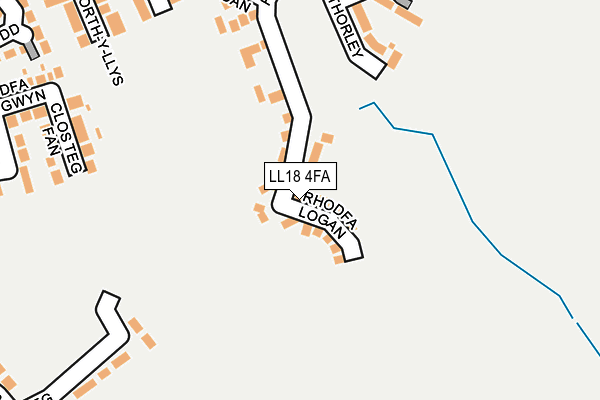
LL18 4FA is located in the Rhyl Trellewelyn electoral ward, within the unitary authority of Denbighshire and the Welsh Parliamentary constituency of Vale of Clwyd. The Local Health Board is Betsi Cadwaladr University and the police force is North Wales. This postcode has been in use since July 2017.


GetTheData
Source: OS OpenMap – Local (Ordnance Survey)
Source: OS VectorMap District (Ordnance Survey)
Licence: Open Government Licence (requires attribution)
| Easting | 303136 |
| Northing | 380836 |
| Latitude | 53.315581 |
| Longitude | -3.455442 |
GetTheData
Source: Open Postcode Geo
Licence: Open Government Licence
| Country | Wales |
| Postcode District | LL18 |
➜ See where LL18 is on a map ➜ Where is Rhyl? | |
GetTheData
Source: Land Registry Price Paid Data
Licence: Open Government Licence
| Ward | Rhyl Trellewelyn |
| Constituency | Vale Of Clwyd |
GetTheData
Source: ONS Postcode Database
Licence: Open Government Licence
2022 19 DEC £262,500 |
2021 23 JUN £315,000 |
2021 25 JAN £275,000 |
2019 2 DEC £192,000 |
5, RHODFA LOGAN, RHYL, LL18 4FA 2019 7 NOV £269,995 |
13, RHODFA LOGAN, RHYL, LL18 4FA 2019 15 MAR £294,995 |
2019 22 FEB £204,995 |
12, RHODFA LOGAN, RHYL, LL18 4FA 2019 22 FEB £222,995 |
16, RHODFA LOGAN, RHYL, LL18 4FA 2019 22 FEB £201,995 |
7, RHODFA LOGAN, RHYL, LL18 4FA 2019 15 FEB £299,995 |
GetTheData
Source: HM Land Registry Price Paid Data
Licence: Contains HM Land Registry data © Crown copyright and database right 2025. This data is licensed under the Open Government Licence v3.0.
| Ffordd Bruton (Bro Deg) | Rhyl | 450m |
| Lon Ystrad (Ffordd Dyserth) | Bryhedydd Bay | 473m |
| Bruton Park (Maes Menlli) | Rhyl | 474m |
| Lon Ystrad (Ffordd Dyserth) | Bryhedydd Bay | 484m |
| New Pines Caravan Park (Grounds) | Rhyl | 494m |
| Rhyl Station | 2.3km |
| Prestatyn Station | 4km |
GetTheData
Source: NaPTAN
Licence: Open Government Licence
| Percentage of properties with Next Generation Access | 100.0% |
| Percentage of properties with Superfast Broadband | 100.0% |
| Percentage of properties with Ultrafast Broadband | 0.0% |
| Percentage of properties with Full Fibre Broadband | 0.0% |
Superfast Broadband is between 30Mbps and 300Mbps
Ultrafast Broadband is > 300Mbps
| Median download speed | 40.0Mbps |
| Average download speed | 44.4Mbps |
| Maximum download speed | 71.96Mbps |
| Median upload speed | 9.9Mbps |
| Average upload speed | 10.6Mbps |
| Maximum upload speed | 20.00Mbps |
| Percentage of properties unable to receive 2Mbps | 0.0% |
| Percentage of properties unable to receive 5Mbps | 0.0% |
| Percentage of properties unable to receive 10Mbps | 0.0% |
| Percentage of properties unable to receive 30Mbps | 0.0% |
GetTheData
Source: Ofcom
Licence: Ofcom Terms of Use (requires attribution)
GetTheData
Source: ONS Postcode Database
Licence: Open Government Licence


➜ Get more ratings from the Food Standards Agency
GetTheData
Source: Food Standards Agency
Licence: FSA terms & conditions
| Last Collection | |||
|---|---|---|---|
| Location | Mon-Fri | Sat | Distance |
| Marine Drive | 16:45 | 10:30 | 2,406m |
| St Margarets Drive | 17:15 | 11:00 | 2,454m |
| Cwm Road | 17:15 | 09:00 | 3,201m |
GetTheData
Source: Dracos
Licence: Creative Commons Attribution-ShareAlike
The below table lists the International Territorial Level (ITL) codes (formerly Nomenclature of Territorial Units for Statistics (NUTS) codes) and Local Administrative Units (LAU) codes for LL18 4FA:
| ITL 1 Code | Name |
|---|---|
| TLL | Wales |
| ITL 2 Code | Name |
| TLL1 | West Wales and The Valleys |
| ITL 3 Code | Name |
| TLL13 | Conwy and Denbighshire |
| LAU 1 Code | Name |
| W06000004 | Denbighshire |
GetTheData
Source: ONS Postcode Directory
Licence: Open Government Licence
The below table lists the Census Output Area (OA), Lower Layer Super Output Area (LSOA), and Middle Layer Super Output Area (MSOA) for LL18 4FA:
| Code | Name | |
|---|---|---|
| OA | W00001254 | |
| LSOA | W01000234 | Denbighshire 017G |
| MSOA | W02000419 | Denbighshire 017 |
GetTheData
Source: ONS Postcode Directory
Licence: Open Government Licence
| LL18 4FB | Ffordd Aberkinsey | 137m |
| LL18 4FH | Cae Thorley | 243m |
| LL18 4RQ | Maes Bryn Melyd | 297m |
| LL18 4JB | Clos Teg Fan | 307m |
| LL18 4FG | Clos Bodrhyddan | 322m |
| LL18 4FN | Golygfa Clwyd | 335m |
| LL18 4TJ | Maes Maenefa | 336m |
| LL18 4EF | Porth Y Llys | 341m |
| LL18 4FJ | Clos Gracie | 344m |
| LL18 4EH | Pen Y Llys | 358m |
GetTheData
Source: Open Postcode Geo; Land Registry Price Paid Data
Licence: Open Government Licence