Property/Postcode Data Search:
LL14 6EP maps, stats, and open data
LL14 6EP is located in the Penycae and Ruabon South electoral ward, within the unitary authority of Wrexham and the Welsh Parliamentary constituency of Clwyd South. The Local Health Board is Betsi Cadwaladr University and the police force is North Wales. This postcode has been in use since June 2019.
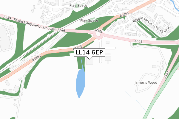
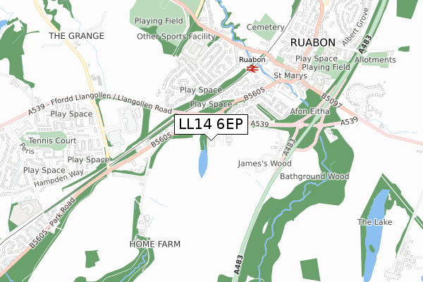
LL14 6EP maps


Source: OS Open Zoomstack (Ordnance Survey)
Licence: Open Government Licence (requires attribution)
Attribution: Contains OS data © Crown copyright and database right 2025
Source: Open Postcode Geo
Licence: Open Government Licence (requires attribution)
Attribution: Contains OS data © Crown copyright and database right 2025; Contains Royal Mail data © Royal Mail copyright and database right 2025; Source: Office for National Statistics licensed under the Open Government Licence v.3.0
Licence: Open Government Licence (requires attribution)
Attribution: Contains OS data © Crown copyright and database right 2025
Source: Open Postcode Geo
Licence: Open Government Licence (requires attribution)
Attribution: Contains OS data © Crown copyright and database right 2025; Contains Royal Mail data © Royal Mail copyright and database right 2025; Source: Office for National Statistics licensed under the Open Government Licence v.3.0
LL14 6EP geodata
| Easting | 329812 |
| Northing | 343401 |
| Latitude | 52.983349 |
| Longitude | -3.046889 |
Where is LL14 6EP?
| Country | Wales |
| Postcode District | LL14 |
Politics
| Ward | Penycae And Ruabon South |
|---|---|
| Constituency | Clwyd South |
Transport
Nearest bus stops to LL14 6EP
| Pont Adam Playground (Pont Adam Crescent) | Ruabon | 374m |
| Plas Newydd (Pont Adam Crescent) | Ruabon | 419m |
| Plas Newydd (Pont Adam Crescent) | Ruabon | 424m |
| Station Road (Bridge Street) | Ruabon | 452m |
| Station Road (Bridge Street) | Ruabon | 456m |
Nearest railway stations to LL14 6EP
| Ruabon Station | 0.5km |
Deprivation
15.7% of Welsh postcodes are less deprived than LL14 6EP:Food Standards Agency
Three nearest food hygiene ratings to LL14 6EP (metres)
Greggs

Ruabon Park Service Station James Park Way
104m
Subway

Ruabon Park Service Station James Park Way
104m
Ruabon Service Station Londis

Ruabon Park Service Station James Park Way
104m
➜ Get more ratings from the Food Standards Agency
Nearest post box to LL14 6EP
| Last Collection | |||
|---|---|---|---|
| Location | Mon-Fri | Sat | Distance |
| Park St | 09:00 | 08:15 | 630m |
| Alwyn | 10:45 | 10:00 | 648m |
| Plas Isa (Rhosymedre) | 16:15 | 10:45 | 1,172m |
LL14 6EP ITL and LL14 6EP LAU
The below table lists the International Territorial Level (ITL) codes (formerly Nomenclature of Territorial Units for Statistics (NUTS) codes) and Local Administrative Units (LAU) codes for LL14 6EP:
| ITL 1 Code | Name |
|---|---|
| TLL | Wales |
| ITL 2 Code | Name |
| TLL2 | East Wales |
| ITL 3 Code | Name |
| TLL23 | Flintshire and Wrexham |
| LAU 1 Code | Name |
| W06000006 | Wrexham |
LL14 6EP census areas
The below table lists the Census Output Area (OA), Lower Layer Super Output Area (LSOA), and Middle Layer Super Output Area (MSOA) for LL14 6EP:
| Code | Name | |
|---|---|---|
| OA | W00002172 | |
| LSOA | W01000407 | Wrexham 016C |
| MSOA | W02000093 | Wrexham 016 |
Nearest postcodes to LL14 6EP
| LL14 6TA | Cil Y Coed | 252m |
| LL14 6TB | Llwyn Bach | 262m |
| LL14 6TE | Spinney Walk | 325m |
| LL14 6EJ | Wynnstay Gardens | 338m |
| LL14 6DP | Wynnstay Yard | 369m |
| LL14 6EG | Pont Adam Crescent | 390m |
| LL14 6EE | Pont Adam Crescent | 409m |
| LL14 6EH | Pont Adam Crescent | 416m |
| LL14 6RW | Llangollen Road | 418m |
| LL14 6TD | Church View | 419m |