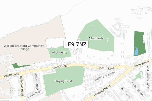
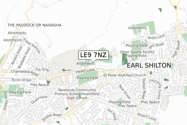
LE9 7NZ maps, stats, and open data
LE9 7NZ is located in the Earl Shilton electoral ward, within the local authority district of Hinckley and Bosworth and the English Parliamentary constituency of Bosworth. The Sub Integrated Care Board (ICB) Location is NHS Leicester, Leicestershire and Rutland ICB - 04V and the police force is Leicestershire. This postcode has been in use since April 2019.
LE9 7NZ maps


Licence: Open Government Licence (requires attribution)
Attribution: Contains OS data © Crown copyright and database right 2025
Source: Open Postcode Geo
Licence: Open Government Licence (requires attribution)
Attribution: Contains OS data © Crown copyright and database right 2025; Contains Royal Mail data © Royal Mail copyright and database right 2025; Source: Office for National Statistics licensed under the Open Government Licence v.3.0
LE9 7NZ geodata
| Easting | 445723 |
| Northing | 297800 |
| Latitude | 52.576120 |
| Longitude | -1.326717 |
Where is LE9 7NZ?
| Country | England |
| Postcode District | LE9 |
Politics
| Ward | Earl Shilton |
|---|---|
| Constituency | Bosworth |
House Prices
Sales of detached houses in LE9 7NZ
2022 8 APR £270,000 |
2021 21 SEP £250,000 |
16, TOMMY BROWN CLOSE, EARL SHILTON, LEICESTER, LE9 7NZ 2020 12 OCT £305,000 |
5, TOMMY BROWN CLOSE, EARL SHILTON, LEICESTER, LE9 7NZ 2020 3 JUL £165,000 |
14, TOMMY BROWN CLOSE, EARL SHILTON, LEICESTER, LE9 7NZ 2019 22 NOV £230,000 |
12, TOMMY BROWN CLOSE, EARL SHILTON, LEICESTER, LE9 7NZ 2019 24 OCT £230,000 |
2019 15 OCT £225,000 |
10, TOMMY BROWN CLOSE, EARL SHILTON, LEICESTER, LE9 7NZ 2019 19 SEP £230,000 |
2019 30 AUG £230,000 |
9, TOMMY BROWN CLOSE, EARL SHILTON, LEICESTER, LE9 7NZ 2019 16 AUG £339,950 |
Licence: Contains HM Land Registry data © Crown copyright and database right 2025. This data is licensed under the Open Government Licence v3.0.
Transport
Nearest bus stops to LE9 7NZ
| New Street (Hinckley Road) | Earl Shilton | 335m |
| New Street (Hinckley Road) | Earl Shilton | 335m |
| Field Way (Hinckley Road) | Earl Shilton | 378m |
| Field Way (Hinckley Road) | Earl Shilton | 396m |
| Moore Road (Belle Vue Road) | Earl Shilton | 419m |
Nearest railway stations to LE9 7NZ
| Hinckley Station | 5.5km |
Broadband
Broadband access in LE9 7NZ (2020 data)
| Percentage of properties with Next Generation Access | 21.1% |
| Percentage of properties with Superfast Broadband | 21.1% |
| Percentage of properties with Ultrafast Broadband | 21.1% |
| Percentage of properties with Full Fibre Broadband | 21.1% |
Superfast Broadband is between 30Mbps and 300Mbps
Ultrafast Broadband is > 300Mbps
Broadband limitations in LE9 7NZ (2020 data)
| Percentage of properties unable to receive 2Mbps | 0.0% |
| Percentage of properties unable to receive 5Mbps | 0.0% |
| Percentage of properties unable to receive 10Mbps | 0.0% |
| Percentage of properties unable to receive 30Mbps | 0.0% |
Deprivation
36.3% of English postcodes are less deprived than LE9 7NZ:Food Standards Agency
Three nearest food hygiene ratings to LE9 7NZ (metres)


➜ Get more ratings from the Food Standards Agency
Nearest post box to LE9 7NZ
| Last Collection | |||
|---|---|---|---|
| Location | Mon-Fri | Sat | Distance |
| Doctors Fields | 17:30 | 09:15 | 472m |
| Shentons Oak | 17:45 | 11:30 | 3,407m |
| Barwell Lane | 17:45 | 11:30 | 3,469m |
LE9 7NZ ITL and LE9 7NZ LAU
The below table lists the International Territorial Level (ITL) codes (formerly Nomenclature of Territorial Units for Statistics (NUTS) codes) and Local Administrative Units (LAU) codes for LE9 7NZ:
| ITL 1 Code | Name |
|---|---|
| TLF | East Midlands (England) |
| ITL 2 Code | Name |
| TLF2 | Leicestershire, Rutland and Northamptonshire |
| ITL 3 Code | Name |
| TLF22 | Leicestershire CC and Rutland |
| LAU 1 Code | Name |
| E07000132 | Hinckley and Bosworth |
LE9 7NZ census areas
The below table lists the Census Output Area (OA), Lower Layer Super Output Area (LSOA), and Middle Layer Super Output Area (MSOA) for LE9 7NZ:
| Code | Name | |
|---|---|---|
| OA | E00131131 | |
| LSOA | E01025840 | Hinckley and Bosworth 006B |
| MSOA | E02005382 | Hinckley and Bosworth 006 |
Nearest postcodes to LE9 7NZ
| LE9 7PE | Heath Lane | 136m |
| LE9 7PL | Gartree Crescent | 209m |
| LE9 7PG | Heath Lane South | 214m |
| LE9 7LZ | Bird Close | 242m |
| LE9 7PD | Heath Lane | 270m |
| LE9 7PB | Heath Lane | 276m |
| LE9 7JZ | Yeoman Road | 303m |
| LE9 7LD | Hinckley Road | 308m |
| LE9 7PH | Mallory Street | 317m |
| LE9 7LB | Hinckley Road | 323m |