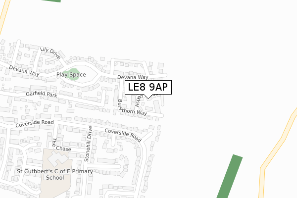
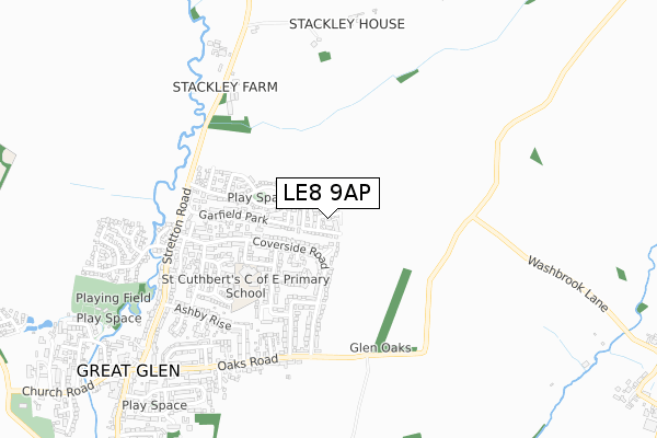
LE8 9AP is located in the Glen electoral ward, within the local authority district of Harborough and the English Parliamentary constituency of Harborough. The Sub Integrated Care Board (ICB) Location is NHS Leicester, Leicestershire and Rutland ICB - 03W and the police force is Leicestershire. This postcode has been in use since April 2020.


GetTheData
Source: OS Open Zoomstack (Ordnance Survey)
Licence: Open Government Licence (requires attribution)
Attribution: Contains OS data © Crown copyright and database right 2025
Source: Open Postcode Geo
Licence: Open Government Licence (requires attribution)
Attribution: Contains OS data © Crown copyright and database right 2025; Contains Royal Mail data © Royal Mail copyright and database right 2025; Source: Office for National Statistics licensed under the Open Government Licence v.3.0
| Easting | 465517 |
| Northing | 297891 |
| Latitude | 52.574919 |
| Longitude | -1.034651 |
GetTheData
Source: Open Postcode Geo
Licence: Open Government Licence
| Country | England |
| Postcode District | LE8 |
➜ See where LE8 is on a map ➜ Where is Great Glen? | |
GetTheData
Source: Land Registry Price Paid Data
Licence: Open Government Licence
| Ward | Glen |
| Constituency | Harborough |
GetTheData
Source: ONS Postcode Database
Licence: Open Government Licence
| Bindley Lane (Church Road) | Great Glen | 14m |
| Bindley Lane (Church Road) | Great Glen | 18m |
| Village Hall (Main Street) | Great Glen | 139m |
| Village Hall (Main Street) | Great Glen | 141m |
| War Memorial (Main Street) | Great Glen | 357m |
GetTheData
Source: NaPTAN
Licence: Open Government Licence
GetTheData
Source: ONS Postcode Database
Licence: Open Government Licence


➜ Get more ratings from the Food Standards Agency
GetTheData
Source: Food Standards Agency
Licence: FSA terms & conditions
| Last Collection | |||
|---|---|---|---|
| Location | Mon-Fri | Sat | Distance |
| Stretton Road | 17:30 | 12:00 | 196m |
| Ashbourne Street/Mere Road | 17:30 | 12:00 | 2,404m |
| Elizabeth Drive | 17:30 | 12:00 | 3,005m |
GetTheData
Source: Dracos
Licence: Creative Commons Attribution-ShareAlike
The below table lists the International Territorial Level (ITL) codes (formerly Nomenclature of Territorial Units for Statistics (NUTS) codes) and Local Administrative Units (LAU) codes for LE8 9AP:
| ITL 1 Code | Name |
|---|---|
| TLF | East Midlands (England) |
| ITL 2 Code | Name |
| TLF2 | Leicestershire, Rutland and Northamptonshire |
| ITL 3 Code | Name |
| TLF22 | Leicestershire CC and Rutland |
| LAU 1 Code | Name |
| E07000131 | Harborough |
GetTheData
Source: ONS Postcode Directory
Licence: Open Government Licence
The below table lists the Census Output Area (OA), Lower Layer Super Output Area (LSOA), and Middle Layer Super Output Area (MSOA) for LE8 9AP:
| Code | Name | |
|---|---|---|
| OA | E00130815 | |
| LSOA | E01025782 | Harborough 003B |
| MSOA | E02005369 | Harborough 003 |
GetTheData
Source: ONS Postcode Directory
Licence: Open Government Licence
| LE8 9FE | Church Road | 40m |
| LE8 9FA | Bindleys Lane | 87m |
| LE8 9FJ | High Street | 113m |
| LE8 9HD | The Crescent | 124m |
| LE8 9GH | Main Street | 155m |
| LE8 9FX | Meadow Hill | 158m |
| LE8 9FR | The Glebelands | 169m |
| LE8 9GG | Main Street | 182m |
| LE8 9GR | Ruperts Way | 182m |
| LE8 9FG | Fordview Close | 199m |
GetTheData
Source: Open Postcode Geo; Land Registry Price Paid Data
Licence: Open Government Licence