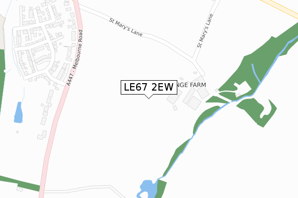
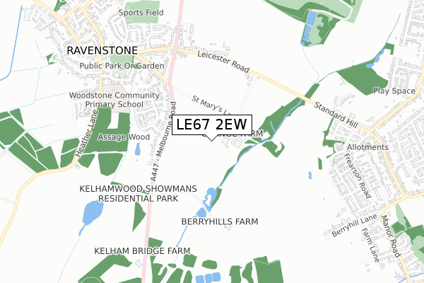
LE67 2EW is located in the Hugglescote St John's electoral ward, within the local authority district of North West Leicestershire and the English Parliamentary constituency of North West Leicestershire. The Sub Integrated Care Board (ICB) Location is NHS Leicester, Leicestershire and Rutland ICB - 04V and the police force is Leicestershire. This postcode has been in use since April 2020.


GetTheData
Source: OS Open Zoomstack (Ordnance Survey)
Licence: Open Government Licence (requires attribution)
Attribution: Contains OS data © Crown copyright and database right 2025
Source: Open Postcode Geo
Licence: Open Government Licence (requires attribution)
Attribution: Contains OS data © Crown copyright and database right 2025; Contains Royal Mail data © Royal Mail copyright and database right 2025; Source: Office for National Statistics licensed under the Open Government Licence v.3.0
| Easting | 442833 |
| Northing | 313046 |
| Latitude | 52.713404 |
| Longitude | -1.367387 |
GetTheData
Source: Open Postcode Geo
Licence: Open Government Licence
| Country | England |
| Postcode District | LE67 |
➜ See where LE67 is on a map ➜ Where is Hugglescote? | |
GetTheData
Source: Land Registry Price Paid Data
Licence: Open Government Licence
| Ward | Hugglescote St John's |
| Constituency | North West Leicestershire |
GetTheData
Source: ONS Postcode Database
Licence: Open Government Licence
| Fairfield Road (Central Road) | Hugglescote | 271m |
| Post Office (Central Road) | Hugglescote | 276m |
| Fairfield Road (Central Road) | Hugglescote | 302m |
| Post Office (Central Road) | Hugglescote | 307m |
| Station Road | Hugglescote | 410m |
GetTheData
Source: NaPTAN
Licence: Open Government Licence
GetTheData
Source: ONS Postcode Database
Licence: Open Government Licence


➜ Get more ratings from the Food Standards Agency
GetTheData
Source: Food Standards Agency
Licence: FSA terms & conditions
| Last Collection | |||
|---|---|---|---|
| Location | Mon-Fri | Sat | Distance |
| Central Road | 17:00 | 12:00 | 308m |
| Central Road/Fairfield Road | 17:15 | 12:00 | 673m |
| Ashburton Road | 17:15 | 12:15 | 798m |
GetTheData
Source: Dracos
Licence: Creative Commons Attribution-ShareAlike
The below table lists the International Territorial Level (ITL) codes (formerly Nomenclature of Territorial Units for Statistics (NUTS) codes) and Local Administrative Units (LAU) codes for LE67 2EW:
| ITL 1 Code | Name |
|---|---|
| TLF | East Midlands (England) |
| ITL 2 Code | Name |
| TLF2 | Leicestershire, Rutland and Northamptonshire |
| ITL 3 Code | Name |
| TLF22 | Leicestershire CC and Rutland |
| LAU 1 Code | Name |
| E07000134 | North West Leicestershire |
GetTheData
Source: ONS Postcode Directory
Licence: Open Government Licence
The below table lists the Census Output Area (OA), Lower Layer Super Output Area (LSOA), and Middle Layer Super Output Area (MSOA) for LE67 2EW:
| Code | Name | |
|---|---|---|
| OA | E00131625 | |
| LSOA | E01025937 | North West Leicestershire 011B |
| MSOA | E02005407 | North West Leicestershire 011 |
GetTheData
Source: ONS Postcode Directory
Licence: Open Government Licence
| LE67 2BU | Mill Dam | 148m |
| LE67 2GT | Peggs Grange | 175m |
| LE67 2BA | Mill Pond | 182m |
| LE67 3SR | Baron Close | 185m |
| LE67 2DA | Wainwright Road | 210m |
| LE67 2BG | Quelch Close | 217m |
| LE67 2BW | Links Close | 221m |
| LE67 2FR | Holly Bank | 241m |
| LE67 2FD | Central Road | 259m |
| LE67 2DB | River Sence Way | 259m |
GetTheData
Source: Open Postcode Geo; Land Registry Price Paid Data
Licence: Open Government Licence