LE67 1PD maps, stats, and open data
LE67 1PD is located in the Ellistown & Battleflat electoral ward, within the local authority district of North West Leicestershire and the English Parliamentary constituency of North West Leicestershire. The Sub Integrated Care Board (ICB) Location is NHS Leicester, Leicestershire and Rutland ICB - 04V and the police force is Leicestershire. This postcode has been in use since October 2019.
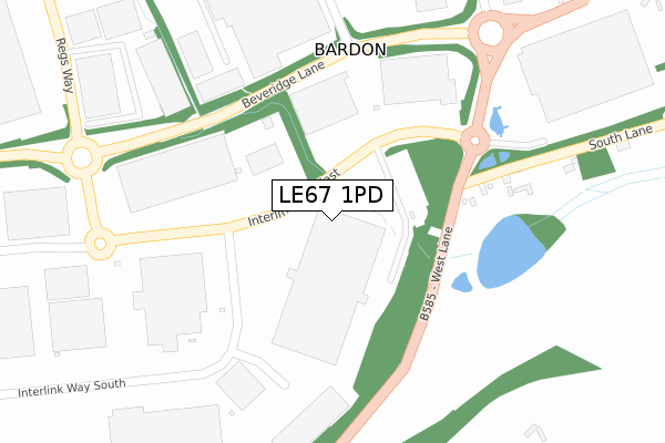
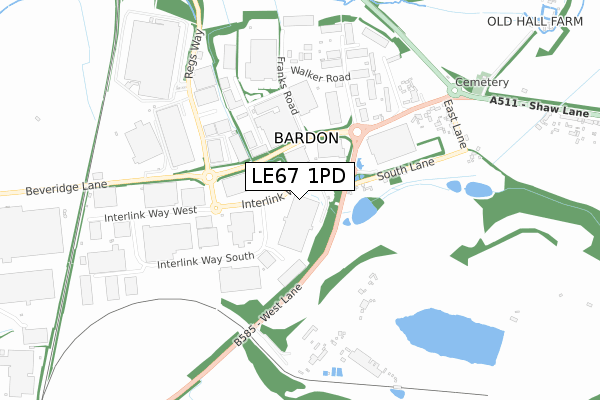
LE67 1PD maps


Licence: Open Government Licence (requires attribution)
Attribution: Contains OS data © Crown copyright and database right 2025
Source: Open Postcode Geo
Licence: Open Government Licence (requires attribution)
Attribution: Contains OS data © Crown copyright and database right 2025; Contains Royal Mail data © Royal Mail copyright and database right 2025; Source: Office for National Statistics licensed under the Open Government Licence v.3.0
LE67 1PD geodata
| Easting | 445137 |
| Northing | 311432 |
| Latitude | 52.698709 |
| Longitude | -1.333505 |
Where is LE67 1PD?
| Country | England |
| Postcode District | LE67 |
Politics
| Ward | Ellistown & Battleflat |
|---|---|
| Constituency | North West Leicestershire |
Transport
Nearest bus stops to LE67 1PD
| Dhl (Regs Way) | Bardon | 495m |
| Dhl (Regs Way) | Bardon | 520m |
| Charnwood Arms (Beveridge Lane) | Bardon | 591m |
| Charnwood Arms (Beveridge Lane) | Bardon | 649m |
| Beveridge Lane (Bardon Road) | Bardon | 769m |
Deprivation
31.7% of English postcodes are less deprived than LE67 1PD:Food Standards Agency
Three nearest food hygiene ratings to LE67 1PD (metres)


➜ Get more ratings from the Food Standards Agency
Nearest post box to LE67 1PD
| Last Collection | |||
|---|---|---|---|
| Location | Mon-Fri | Sat | Distance |
| Central Road | 17:00 | 12:00 | 2,952m |
| Central Road/Fairfield Road | 17:15 | 12:00 | 3,317m |
| Ashburton Road | 17:15 | 12:15 | 3,355m |
LE67 1PD ITL and LE67 1PD LAU
The below table lists the International Territorial Level (ITL) codes (formerly Nomenclature of Territorial Units for Statistics (NUTS) codes) and Local Administrative Units (LAU) codes for LE67 1PD:
| ITL 1 Code | Name |
|---|---|
| TLF | East Midlands (England) |
| ITL 2 Code | Name |
| TLF2 | Leicestershire, Rutland and Northamptonshire |
| ITL 3 Code | Name |
| TLF22 | Leicestershire CC and Rutland |
| LAU 1 Code | Name |
| E07000134 | North West Leicestershire |
LE67 1PD census areas
The below table lists the Census Output Area (OA), Lower Layer Super Output Area (LSOA), and Middle Layer Super Output Area (MSOA) for LE67 1PD:
| Code | Name | |
|---|---|---|
| OA | E00131632 | |
| LSOA | E01025939 | North West Leicestershire 013B |
| MSOA | E02005409 | North West Leicestershire 013 |
Nearest postcodes to LE67 1PD
| LE67 1PG | Interlink Way South | 416m |
| LE67 1TG | 454m | |
| LE67 1TB | Beveridge Lane | 484m |
| LE67 1FL | Regs Way | 591m |
| LE67 1TU | Walker Road | 644m |
| LE67 1UE | Cartwright Way | 650m |
| LE67 1UD | Walker Road | 753m |
| LE67 1PH | Interlink Way South | 850m |
| LE67 1TD | Bardon Road | 996m |
| LE67 1FF | Stanton Lane | 1144m |