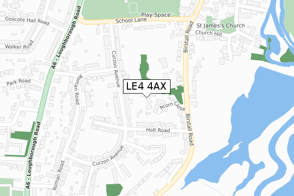
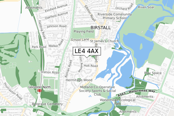
LE4 4AX is located in the Birstall East & Wanlip electoral ward, within the local authority district of Charnwood and the English Parliamentary constituency of Charnwood. The Sub Integrated Care Board (ICB) Location is NHS Leicester, Leicestershire and Rutland ICB - 04V and the police force is Leicestershire. This postcode has been in use since June 2019.


GetTheData
Source: OS Open Zoomstack (Ordnance Survey)
Licence: Open Government Licence (requires attribution)
Attribution: Contains OS data © Crown copyright and database right 2025
Source: Open Postcode Geo
Licence: Open Government Licence (requires attribution)
Attribution: Contains OS data © Crown copyright and database right 2025; Contains Royal Mail data © Royal Mail copyright and database right 2025; Source: Office for National Statistics licensed under the Open Government Licence v.3.0
| Easting | 459392 |
| Northing | 308611 |
| Latitude | 52.671980 |
| Longitude | -1.123098 |
GetTheData
Source: Open Postcode Geo
Licence: Open Government Licence
| Country | England |
| Postcode District | LE4 |
➜ See where LE4 is on a map ➜ Where is Birstall? | |
GetTheData
Source: Land Registry Price Paid Data
Licence: Open Government Licence
| Ward | Birstall East & Wanlip |
| Constituency | Charnwood |
GetTheData
Source: ONS Postcode Database
Licence: Open Government Licence
4, PINE VIEW, CURZON AVENUE, BIRSTALL, LEICESTER, LE4 4AX 2020 18 MAR £535,000 |
2020 30 JAN £532,500 |
5, PINE VIEW, CURZON AVENUE, BIRSTALL, LEICESTER, LE4 4AX 2019 5 JUN £670,000 |
3, PINE VIEW, CURZON AVENUE, BIRSTALL, LEICESTER, LE4 4AX 2019 29 MAY £565,000 |
2007 18 OCT £740,000 |
GetTheData
Source: HM Land Registry Price Paid Data
Licence: Contains HM Land Registry data © Crown copyright and database right 2025. This data is licensed under the Open Government Licence v3.0.
| Acorn Close (Birstall Road) | Birstall | 161m |
| Acorn Close (Birstall Road) | Birstall | 176m |
| Church Hill (Birstall Road) | Birstall | 177m |
| Church Hill (Birstall Road) | Birstall | 199m |
| Sports Ground (Birstall Road) | Birstall | 333m |
| Leicester North (Great Central Railway) | Birstall | 884m |
| Syston Station | 3.7km |
| Leicester Station | 4.5km |
GetTheData
Source: NaPTAN
Licence: Open Government Licence
| Percentage of properties with Next Generation Access | 100.0% |
| Percentage of properties with Superfast Broadband | 100.0% |
| Percentage of properties with Ultrafast Broadband | 100.0% |
| Percentage of properties with Full Fibre Broadband | 0.0% |
Superfast Broadband is between 30Mbps and 300Mbps
Ultrafast Broadband is > 300Mbps
| Percentage of properties unable to receive 2Mbps | 0.0% |
| Percentage of properties unable to receive 5Mbps | 0.0% |
| Percentage of properties unable to receive 10Mbps | 0.0% |
| Percentage of properties unable to receive 30Mbps | 0.0% |
GetTheData
Source: Ofcom
Licence: Ofcom Terms of Use (requires attribution)
GetTheData
Source: ONS Postcode Database
Licence: Open Government Licence


➜ Get more ratings from the Food Standards Agency
GetTheData
Source: Food Standards Agency
Licence: FSA terms & conditions
| Last Collection | |||
|---|---|---|---|
| Location | Mon-Fri | Sat | Distance |
| Curzon Avenue | 17:00 | 12:00 | 116m |
| Front Street | 17:00 | 12:00 | 448m |
| Birstall Road | 17:00 | 12:00 | 550m |
GetTheData
Source: Dracos
Licence: Creative Commons Attribution-ShareAlike
The below table lists the International Territorial Level (ITL) codes (formerly Nomenclature of Territorial Units for Statistics (NUTS) codes) and Local Administrative Units (LAU) codes for LE4 4AX:
| ITL 1 Code | Name |
|---|---|
| TLF | East Midlands (England) |
| ITL 2 Code | Name |
| TLF2 | Leicestershire, Rutland and Northamptonshire |
| ITL 3 Code | Name |
| TLF22 | Leicestershire CC and Rutland |
| LAU 1 Code | Name |
| E07000130 | Charnwood |
GetTheData
Source: ONS Postcode Directory
Licence: Open Government Licence
The below table lists the Census Output Area (OA), Lower Layer Super Output Area (LSOA), and Middle Layer Super Output Area (MSOA) for LE4 4AX:
| Code | Name | |
|---|---|---|
| OA | E00130313 | |
| LSOA | E01025681 | Charnwood 019C |
| MSOA | E02005363 | Charnwood 019 |
GetTheData
Source: ONS Postcode Directory
Licence: Open Government Licence
| LE4 4BZ | Acorn Close | 63m |
| LE4 4AB | Curzon Avenue | 64m |
| LE4 4AQ | Holt Road | 94m |
| LE4 4AF | Curzon Avenue | 109m |
| LE4 4AP | Holt Road | 127m |
| LE4 4DG | Birstall Road | 129m |
| LE4 4AW | Park House Close | 170m |
| LE4 4AH | Clarke Grove | 187m |
| LE4 4AA | Curzon Avenue | 203m |
| LE4 4AE | Curzon Avenue | 213m |
GetTheData
Source: Open Postcode Geo; Land Registry Price Paid Data
Licence: Open Government Licence