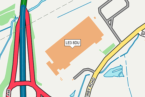
LE3 8DU is located in the Glenfield Ellis electoral ward, within the local authority district of Blaby and the English Parliamentary constituency of Charnwood. The Sub Integrated Care Board (ICB) Location is NHS Leicester, Leicestershire and Rutland ICB - 03W and the police force is Leicestershire. This postcode has been in use since February 2017.


GetTheData
Source: OS OpenMap – Local (Ordnance Survey)
Source: OS VectorMap District (Ordnance Survey)
Licence: Open Government Licence (requires attribution)
| Easting | 452887 |
| Northing | 305565 |
| Latitude | 52.645272 |
| Longitude | -1.219777 |
GetTheData
Source: Open Postcode Geo
Licence: Open Government Licence
| Country | England |
| Postcode District | LE3 |
➜ See where LE3 is on a map | |
GetTheData
Source: Land Registry Price Paid Data
Licence: Open Government Licence
| Ward | Glenfield Ellis |
| Constituency | Charnwood |
GetTheData
Source: ONS Postcode Database
Licence: Open Government Licence
| Forge Close (Elm Tree Avenue) | Glenfield | 632m |
| Forge Close (Elm Tree Avenue) | Glenfield | 634m |
| Elm Tree Avenue (Kirby Road) | Glenfield | 722m |
| Foresters Close (Elm Tree Avenue) | Glenfield | 749m |
| Foresters Close (Elm Tree Avenue) | Glenfield | 763m |
GetTheData
Source: NaPTAN
Licence: Open Government Licence
GetTheData
Source: ONS Postcode Database
Licence: Open Government Licence


➜ Get more ratings from the Food Standards Agency
GetTheData
Source: Food Standards Agency
Licence: FSA terms & conditions
| Last Collection | |||
|---|---|---|---|
| Location | Mon-Fri | Sat | Distance |
| Laundon Way | 16:00 | 08:45 | 1,038m |
| Highfield Road | 16:00 | 08:30 | 1,604m |
| Ratby Post Office | 16:00 | 11:30 | 1,748m |
GetTheData
Source: Dracos
Licence: Creative Commons Attribution-ShareAlike
The below table lists the International Territorial Level (ITL) codes (formerly Nomenclature of Territorial Units for Statistics (NUTS) codes) and Local Administrative Units (LAU) codes for LE3 8DU:
| ITL 1 Code | Name |
|---|---|
| TLF | East Midlands (England) |
| ITL 2 Code | Name |
| TLF2 | Leicestershire, Rutland and Northamptonshire |
| ITL 3 Code | Name |
| TLF22 | Leicestershire CC and Rutland |
| LAU 1 Code | Name |
| E07000129 | Blaby |
GetTheData
Source: ONS Postcode Directory
Licence: Open Government Licence
The below table lists the Census Output Area (OA), Lower Layer Super Output Area (LSOA), and Middle Layer Super Output Area (MSOA) for LE3 8DU:
| Code | Name | |
|---|---|---|
| OA | E00130028 | |
| LSOA | E01025624 | Blaby 013C |
| MSOA | E02006820 | Blaby 013 |
GetTheData
Source: ONS Postcode Directory
Licence: Open Government Licence
| LE3 8HW | Keepers Close | 390m |
| LE3 8HT | May Drive | 438m |
| LE3 8HS | Weavers Close | 443m |
| LE3 8HR | Birch Lane | 486m |
| LE3 8GW | Rowan Road | 527m |
| LE3 8HJ | Birch Lane | 531m |
| LE3 8GY | Stanley Avenue | 556m |
| LE3 8FZ | Rowan Road | 557m |
| LE3 8FX | Farriers Avenue | 571m |
| LE3 8QF | Forge Close | 588m |
GetTheData
Source: Open Postcode Geo; Land Registry Price Paid Data
Licence: Open Government Licence