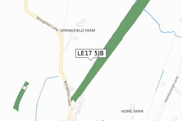
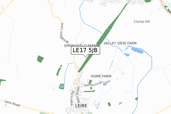
LE17 5JB is located in the Broughton Astley South & Leire electoral ward, within the local authority district of Harborough and the English Parliamentary constituency of South Leicestershire. The Sub Integrated Care Board (ICB) Location is NHS Leicester, Leicestershire and Rutland ICB - 03W and the police force is Leicestershire. This postcode has been in use since November 2019.


GetTheData
Source: OS Open Zoomstack (Ordnance Survey)
Licence: Open Government Licence (requires attribution)
Attribution: Contains OS data © Crown copyright and database right 2025
Source: Open Postcode Geo
Licence: Open Government Licence (requires attribution)
Attribution: Contains OS data © Crown copyright and database right 2025; Contains Royal Mail data © Royal Mail copyright and database right 2025; Source: Office for National Statistics licensed under the Open Government Licence v.3.0
| Easting | 452625 |
| Northing | 290861 |
| Latitude | 52.513123 |
| Longitude | -1.225976 |
GetTheData
Source: Open Postcode Geo
Licence: Open Government Licence
| Country | England |
| Postcode District | LE17 |
➜ See where LE17 is on a map | |
GetTheData
Source: Land Registry Price Paid Data
Licence: Open Government Licence
| Ward | Broughton Astley South & Leire |
| Constituency | South Leicestershire |
GetTheData
Source: ONS Postcode Database
Licence: Open Government Licence
| The Green (Frolesworth Road) | Leire | 889m |
| The Green (Frolesworth Road) | Leire | 910m |
| Leire Lane (Dunton Road) | Leire | 935m |
| Poplar Farm (Leire Lane) | Leire | 996m |
| Shops (Darwin Close) | Broughton Astley | 1,279m |
GetTheData
Source: NaPTAN
Licence: Open Government Licence
GetTheData
Source: ONS Postcode Database
Licence: Open Government Licence


➜ Get more ratings from the Food Standards Agency
GetTheData
Source: Food Standards Agency
Licence: FSA terms & conditions
| Last Collection | |||
|---|---|---|---|
| Location | Mon-Fri | Sat | Distance |
| Leire Rso | 16:40 | 10:30 | 616m |
| Station Road | 16:45 | 10:00 | 1,454m |
| Cross Roads | 16:20 | 10:00 | 1,974m |
GetTheData
Source: Dracos
Licence: Creative Commons Attribution-ShareAlike
The below table lists the International Territorial Level (ITL) codes (formerly Nomenclature of Territorial Units for Statistics (NUTS) codes) and Local Administrative Units (LAU) codes for LE17 5JB:
| ITL 1 Code | Name |
|---|---|
| TLF | East Midlands (England) |
| ITL 2 Code | Name |
| TLF2 | Leicestershire, Rutland and Northamptonshire |
| ITL 3 Code | Name |
| TLF22 | Leicestershire CC and Rutland |
| LAU 1 Code | Name |
| E07000131 | Harborough |
GetTheData
Source: ONS Postcode Directory
Licence: Open Government Licence
The below table lists the Census Output Area (OA), Lower Layer Super Output Area (LSOA), and Middle Layer Super Output Area (MSOA) for LE17 5JB:
| Code | Name | |
|---|---|---|
| OA | E00130790 | |
| LSOA | E01025777 | Harborough 006A |
| MSOA | E02005372 | Harborough 006 |
GetTheData
Source: ONS Postcode Directory
Licence: Open Government Licence
| LE17 5ER | Andrews Close | 256m |
| LE17 5HA | Broughton Lane | 360m |
| LE17 5EX | Stemborough Lane | 401m |
| LE17 5HB | White House Close | 416m |
| LE17 5EU | Main Street | 541m |
| LE17 5EZ | Back Lane | 593m |
| LE17 5FG | Eaglesfield End | 643m |
| LE17 5HE | Main Street | 671m |
| LE17 5HF | Main Street | 711m |
| LE17 5ET | St Peters Close | 781m |
GetTheData
Source: Open Postcode Geo; Land Registry Price Paid Data
Licence: Open Government Licence