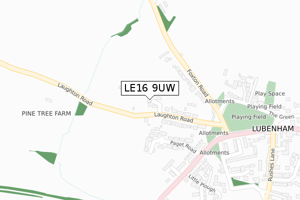
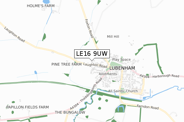
LE16 9UW is located in the Lubenham electoral ward, within the local authority district of Harborough and the English Parliamentary constituency of Harborough. The Sub Integrated Care Board (ICB) Location is NHS Leicester, Leicestershire and Rutland ICB - 03W and the police force is Leicestershire. This postcode has been in use since August 2017.


GetTheData
Source: OS Open Zoomstack (Ordnance Survey)
Licence: Open Government Licence (requires attribution)
Attribution: Contains OS data © Crown copyright and database right 2025
Source: Open Postcode Geo
Licence: Open Government Licence (requires attribution)
Attribution: Contains OS data © Crown copyright and database right 2025; Contains Royal Mail data © Royal Mail copyright and database right 2025; Source: Office for National Statistics licensed under the Open Government Licence v.3.0
| Easting | 470115 |
| Northing | 287472 |
| Latitude | 52.480695 |
| Longitude | -0.969006 |
GetTheData
Source: Open Postcode Geo
Licence: Open Government Licence
| Country | England |
| Postcode District | LE16 |
➜ See where LE16 is on a map ➜ Where is Lubenham? | |
GetTheData
Source: Land Registry Price Paid Data
Licence: Open Government Licence
| Ward | Lubenham |
| Constituency | Harborough |
GetTheData
Source: ONS Postcode Database
Licence: Open Government Licence
2021 26 FEB £425,000 |
4, LAUGHTON COURT, LUBENHAM, MARKET HARBOROUGH, LE16 9UW 2018 19 APR £475,000 |
2018 20 FEB £371,250 |
5, LAUGHTON COURT, LUBENHAM, MARKET HARBOROUGH, LE16 9UW 2017 21 DEC £298,000 |
2, LAUGHTON COURT, LUBENHAM, MARKET HARBOROUGH, LE16 9UW 2017 13 DEC £490,000 |
1, LAUGHTON COURT, LUBENHAM, MARKET HARBOROUGH, LE16 9UW 2017 6 JUL £397,000 |
GetTheData
Source: HM Land Registry Price Paid Data
Licence: Contains HM Land Registry data © Crown copyright and database right 2025. This data is licensed under the Open Government Licence v3.0.
| Paget Road (Main Street) | Lubenham | 242m |
| Paget Road (Main Street) | Lubenham | 266m |
| The Green (Main Street) | Lubenham | 341m |
| The Green (Main Street) | Lubenham | 406m |
| Bramfield Mobile Park (Theddingworth Road) | Lubenham | 1,508m |
| Market Harborough Station | 4.1km |
GetTheData
Source: NaPTAN
Licence: Open Government Licence
| Percentage of properties with Next Generation Access | 100.0% |
| Percentage of properties with Superfast Broadband | 100.0% |
| Percentage of properties with Ultrafast Broadband | 0.0% |
| Percentage of properties with Full Fibre Broadband | 0.0% |
Superfast Broadband is between 30Mbps and 300Mbps
Ultrafast Broadband is > 300Mbps
| Median download speed | 33.8Mbps |
| Average download speed | 29.1Mbps |
| Maximum download speed | 55.00Mbps |
| Median upload speed | 7.1Mbps |
| Average upload speed | 6.2Mbps |
| Maximum upload speed | 10.00Mbps |
| Percentage of properties unable to receive 2Mbps | 0.0% |
| Percentage of properties unable to receive 5Mbps | 0.0% |
| Percentage of properties unable to receive 10Mbps | 0.0% |
| Percentage of properties unable to receive 30Mbps | 0.0% |
GetTheData
Source: Ofcom
Licence: Ofcom Terms of Use (requires attribution)
GetTheData
Source: ONS Postcode Database
Licence: Open Government Licence


➜ Get more ratings from the Food Standards Agency
GetTheData
Source: Food Standards Agency
Licence: FSA terms & conditions
| Last Collection | |||
|---|---|---|---|
| Location | Mon-Fri | Sat | Distance |
| Bramfield Park (A427) | 10:45 | 07:30 | 1,549m |
| Marston Trussell | 16:30 | 07:00 | 1,838m |
| Lubenham Hill | 17:30 | 10:15 | 2,154m |
GetTheData
Source: Dracos
Licence: Creative Commons Attribution-ShareAlike
The below table lists the International Territorial Level (ITL) codes (formerly Nomenclature of Territorial Units for Statistics (NUTS) codes) and Local Administrative Units (LAU) codes for LE16 9UW:
| ITL 1 Code | Name |
|---|---|
| TLF | East Midlands (England) |
| ITL 2 Code | Name |
| TLF2 | Leicestershire, Rutland and Northamptonshire |
| ITL 3 Code | Name |
| TLF22 | Leicestershire CC and Rutland |
| LAU 1 Code | Name |
| E07000131 | Harborough |
GetTheData
Source: ONS Postcode Directory
Licence: Open Government Licence
The below table lists the Census Output Area (OA), Lower Layer Super Output Area (LSOA), and Middle Layer Super Output Area (MSOA) for LE16 9UW:
| Code | Name | |
|---|---|---|
| OA | E00130844 | |
| LSOA | E01025789 | Harborough 007A |
| MSOA | E02005373 | Harborough 007 |
GetTheData
Source: ONS Postcode Directory
Licence: Open Government Licence
| LE16 9TE | Laughton Road | 120m |
| LE16 9TB | Foxton Road | 153m |
| LE16 9TL | Paget Road | 163m |
| LE16 9TG | Main Street | 263m |
| LE16 9TS | Westgate Lane | 326m |
| LE16 9TH | Mill Hill | 353m |
| LE16 9UN | Westland Close | 366m |
| LE16 9TD | The Green | 408m |
| LE16 9SP | Acorn Close | 414m |
| LE16 9TN | Rushes Lane | 454m |
GetTheData
Source: Open Postcode Geo; Land Registry Price Paid Data
Licence: Open Government Licence