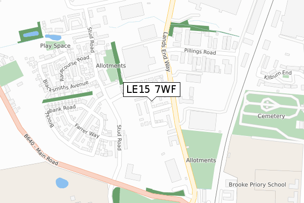
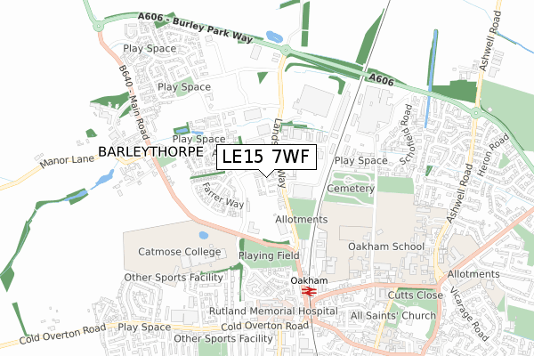
LE15 7WF is located in the Barleythorpe electoral ward, within the unitary authority of Rutland and the English Parliamentary constituency of Rutland and Melton. The Sub Integrated Care Board (ICB) Location is NHS Leicester, Leicestershire and Rutland ICB - 03W and the police force is Leicestershire. This postcode has been in use since September 2018.


GetTheData
Source: OS Open Zoomstack (Ordnance Survey)
Licence: Open Government Licence (requires attribution)
Attribution: Contains OS data © Crown copyright and database right 2025
Source: Open Postcode Geo
Licence: Open Government Licence (requires attribution)
Attribution: Contains OS data © Crown copyright and database right 2025; Contains Royal Mail data © Royal Mail copyright and database right 2025; Source: Office for National Statistics licensed under the Open Government Licence v.3.0
| Easting | 485476 |
| Northing | 309486 |
| Latitude | 52.676364 |
| Longitude | -0.737206 |
GetTheData
Source: Open Postcode Geo
Licence: Open Government Licence
| Country | England |
| Postcode District | LE15 |
➜ See where LE15 is on a map ➜ Where is Oakham? | |
GetTheData
Source: Land Registry Price Paid Data
Licence: Open Government Licence
| Ward | Barleythorpe |
| Constituency | Rutland And Melton |
GetTheData
Source: ONS Postcode Database
Licence: Open Government Licence
2025 10 JAN £365,000 |
2, BLACKWATER ROAD, BARLEYTHORPE, OAKHAM, LE15 7WF 2021 29 SEP £374,995 |
8, BLACKWATER ROAD, BARLEYTHORPE, OAKHAM, LE15 7WF 2021 28 SEP £279,995 |
12, BLACKWATER ROAD, BARLEYTHORPE, OAKHAM, LE15 7WF 2021 28 SEP £361,245 |
10, BLACKWATER ROAD, BARLEYTHORPE, OAKHAM, LE15 7WF 2021 20 SEP £374,995 |
2021 15 JUL £320,000 |
1, BLACKWATER ROAD, BARLEYTHORPE, OAKHAM, LE15 7WF 2021 31 MAR £264,995 |
13, BLACKWATER ROAD, BARLEYTHORPE, OAKHAM, LE15 7WF 2021 26 MAR £414,995 |
2021 24 FEB £275,000 |
7, BLACKWATER ROAD, BARLEYTHORPE, OAKHAM, LE15 7WF 2021 29 JAN £344,995 |
GetTheData
Source: HM Land Registry Price Paid Data
Licence: Contains HM Land Registry data © Crown copyright and database right 2025. This data is licensed under the Open Government Licence v3.0.
| Allotments (Lands End Way) | Oakham | 145m |
| Allotments (Lands End Way) | Oakham | 186m |
| Huntsmans Drive (Barleythorpe Road) | Oakham | 200m |
| Huntsmans Drive (Barleythorpe Road) | Oakham | 221m |
| Pillings Road | Oakham | 233m |
| Oakham Station | 0.5km |
GetTheData
Source: NaPTAN
Licence: Open Government Licence
| Percentage of properties with Next Generation Access | 100.0% |
| Percentage of properties with Superfast Broadband | 100.0% |
| Percentage of properties with Ultrafast Broadband | 100.0% |
| Percentage of properties with Full Fibre Broadband | 100.0% |
Superfast Broadband is between 30Mbps and 300Mbps
Ultrafast Broadband is > 300Mbps
| Median download speed | 360.0Mbps |
| Average download speed | 360.0Mbps |
| Maximum download speed | 360.00Mbps |
| Median upload speed | 360.0Mbps |
| Average upload speed | 360.0Mbps |
| Maximum upload speed | 360.00Mbps |
| Percentage of properties unable to receive 2Mbps | 0.0% |
| Percentage of properties unable to receive 5Mbps | 0.0% |
| Percentage of properties unable to receive 10Mbps | 0.0% |
| Percentage of properties unable to receive 30Mbps | 0.0% |
GetTheData
Source: Ofcom
Licence: Ofcom Terms of Use (requires attribution)
GetTheData
Source: ONS Postcode Database
Licence: Open Government Licence


➜ Get more ratings from the Food Standards Agency
GetTheData
Source: Food Standards Agency
Licence: FSA terms & conditions
| Last Collection | |||
|---|---|---|---|
| Location | Mon-Fri | Sat | Distance |
| Pillings Road | 17:30 | 08:00 | 290m |
| Barleythorpe | 17:00 | 07:00 | 529m |
| Westfield Avenue | 17:30 | 11:00 | 625m |
GetTheData
Source: Dracos
Licence: Creative Commons Attribution-ShareAlike
The below table lists the International Territorial Level (ITL) codes (formerly Nomenclature of Territorial Units for Statistics (NUTS) codes) and Local Administrative Units (LAU) codes for LE15 7WF:
| ITL 1 Code | Name |
|---|---|
| TLF | East Midlands (England) |
| ITL 2 Code | Name |
| TLF2 | Leicestershire, Rutland and Northamptonshire |
| ITL 3 Code | Name |
| TLF22 | Leicestershire CC and Rutland |
| LAU 1 Code | Name |
| E06000017 | Rutland |
GetTheData
Source: ONS Postcode Directory
Licence: Open Government Licence
The below table lists the Census Output Area (OA), Lower Layer Super Output Area (LSOA), and Middle Layer Super Output Area (MSOA) for LE15 7WF:
| Code | Name | |
|---|---|---|
| OA | E00069608 | |
| LSOA | E01013801 | Rutland 002C |
| MSOA | E02002864 | Rutland 002 |
GetTheData
Source: ONS Postcode Directory
Licence: Open Government Licence
| LE15 7UU | Gretton Street | 186m |
| LE15 7GD | Stud Road | 202m |
| LE15 7GG | Farrer Way | 214m |
| LE15 7TN | Stud Road | 246m |
| LE15 7TH | Martingale Mews | 295m |
| LE15 7TG | Bridle Close | 321m |
| LE15 7TD | Blacksmiths Avenue | 323m |
| LE15 6RA | Midland Court | 328m |
| LE15 6RQ | Mallard Court | 329m |
| LE15 6FT | Ellingworth Close | 344m |
GetTheData
Source: Open Postcode Geo; Land Registry Price Paid Data
Licence: Open Government Licence