Property/Postcode Data Search:
LE12 9PE maps, stats, and open data
LE12 9PE is located in the Shepshed West electoral ward, within the local authority district of Charnwood and the English Parliamentary constituency of Loughborough. The Sub Integrated Care Board (ICB) Location is NHS Leicester, Leicestershire and Rutland ICB - 04V and the police force is Leicestershire. This postcode has been in use since January 2019.
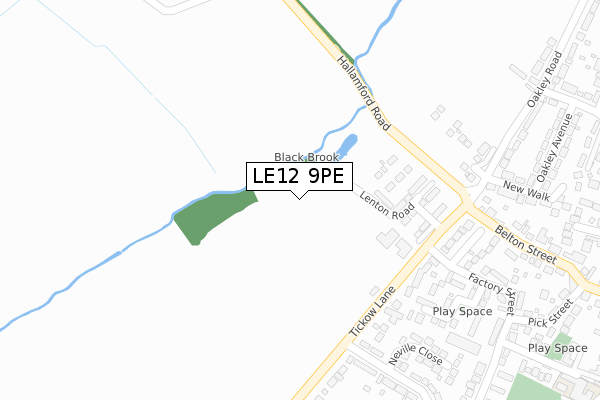
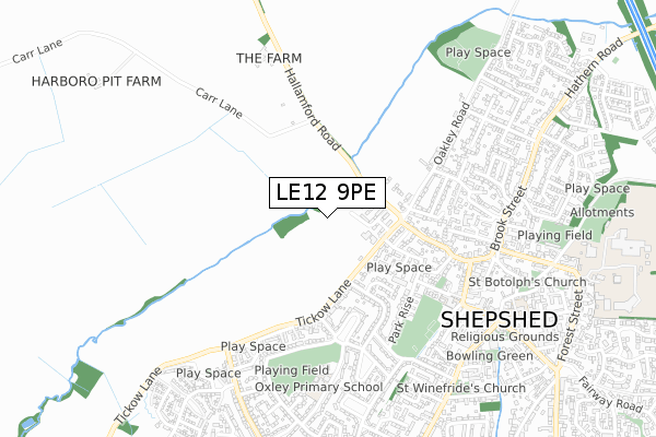
LE12 9PE maps


Source: OS Open Zoomstack (Ordnance Survey)
Licence: Open Government Licence (requires attribution)
Attribution: Contains OS data © Crown copyright and database right 2025
Source: Open Postcode Geo
Licence: Open Government Licence (requires attribution)
Attribution: Contains OS data © Crown copyright and database right 2025; Contains Royal Mail data © Royal Mail copyright and database right 2025; Source: Office for National Statistics licensed under the Open Government Licence v.3.0
Licence: Open Government Licence (requires attribution)
Attribution: Contains OS data © Crown copyright and database right 2025
Source: Open Postcode Geo
Licence: Open Government Licence (requires attribution)
Attribution: Contains OS data © Crown copyright and database right 2025; Contains Royal Mail data © Royal Mail copyright and database right 2025; Source: Office for National Statistics licensed under the Open Government Licence v.3.0
LE12 9PE geodata
| Easting | 447344 |
| Northing | 319956 |
| Latitude | 52.775143 |
| Longitude | -1.299625 |
Where is LE12 9PE?
| Country | England |
| Postcode District | LE12 |
Politics
| Ward | Shepshed West |
|---|---|
| Constituency | Loughborough |
Transport
Nearest bus stops to LE12 9PE
| Neville Close (Glenmore Avenue) | Shepshed | 335m |
| Mccarthy Road (Tickow Lane) | Shepshed | 427m |
| Lambert Avenue (Glenmore Avenue) | Shepshed | 444m |
| Park Rise (Glenmore Avenue) | Shepshed | 565m |
| Market Place (Brook Street) | Shepshed | 623m |
Deprivation
44.5% of English postcodes are less deprived than LE12 9PE:Food Standards Agency
Three nearest food hygiene ratings to LE12 9PE (metres)
Westroyd Residential Homes

Tickow Lane
300m
Glenmore Community Centre

Shepshed Food Bank Glenmore Community Centre
577m
Spice Lounge

32-34 Britannia Street
593m
➜ Get more ratings from the Food Standards Agency
Nearest post box to LE12 9PE
| Last Collection | |||
|---|---|---|---|
| Location | Mon-Fri | Sat | Distance |
| Oakley Road | 16:45 | 08:15 | 277m |
| Glenfield | 16:45 | 09:15 | 477m |
| Shepshed Post Office | 17:30 | 10:45 | 664m |
LE12 9PE ITL and LE12 9PE LAU
The below table lists the International Territorial Level (ITL) codes (formerly Nomenclature of Territorial Units for Statistics (NUTS) codes) and Local Administrative Units (LAU) codes for LE12 9PE:
| ITL 1 Code | Name |
|---|---|
| TLF | East Midlands (England) |
| ITL 2 Code | Name |
| TLF2 | Leicestershire, Rutland and Northamptonshire |
| ITL 3 Code | Name |
| TLF22 | Leicestershire CC and Rutland |
| LAU 1 Code | Name |
| E07000130 | Charnwood |
LE12 9PE census areas
The below table lists the Census Output Area (OA), Lower Layer Super Output Area (LSOA), and Middle Layer Super Output Area (MSOA) for LE12 9PE:
| Code | Name | |
|---|---|---|
| OA | E00130623 | |
| LSOA | E01025746 | Charnwood 005C |
| MSOA | E02005349 | Charnwood 005 |
Nearest postcodes to LE12 9PE
| LE12 9LY | Tickow Lane | 299m |
| LE12 9BT | Stableford Close | 299m |
| LE12 9BD | Manor Gardens | 311m |
| LE12 9NG | Neville Close | 337m |
| LE12 9AQ | Factory Street | 387m |
| LE12 9AP | New Walks | 393m |
| LE12 9AR | Oakley Estate Oakley Avenue | 403m |
| LE12 9AA | Belton Street | 426m |
| LE12 9LH | Glenmore Avenue | 435m |
| LE12 9LP | Mccarthy Road | 438m |