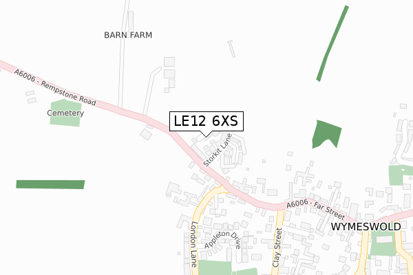
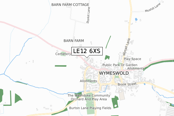
LE12 6XS is located in the The Wolds electoral ward, within the local authority district of Charnwood and the English Parliamentary constituency of Loughborough. The Sub Integrated Care Board (ICB) Location is NHS Leicester, Leicestershire and Rutland ICB - 04V and the police force is Leicestershire. This postcode has been in use since August 2018.


GetTheData
Source: OS Open Zoomstack (Ordnance Survey)
Licence: Open Government Licence (requires attribution)
Attribution: Contains OS data © Crown copyright and database right 2025
Source: Open Postcode Geo
Licence: Open Government Licence (requires attribution)
Attribution: Contains OS data © Crown copyright and database right 2025; Contains Royal Mail data © Royal Mail copyright and database right 2025; Source: Office for National Statistics licensed under the Open Government Licence v.3.0
| Easting | 459889 |
| Northing | 323722 |
| Latitude | 52.807752 |
| Longitude | -1.112998 |
GetTheData
Source: Open Postcode Geo
Licence: Open Government Licence
| Country | England |
| Postcode District | LE12 |
➜ See where LE12 is on a map | |
GetTheData
Source: Land Registry Price Paid Data
Licence: Open Government Licence
| Ward | The Wolds |
| Constituency | Loughborough |
GetTheData
Source: ONS Postcode Database
Licence: Open Government Licence
| Three Crowns (Far Street) | Wymeswold | 430m |
| Hoton Road (Brook Street) | Wymeswold | 445m |
| Hoton Road (Brook Street) | Wymeswold | 449m |
| Rectory Place (The Stockwell) | Wymeswold | 474m |
| Rectory Place (The Stockwell) | Wymeswold | 481m |
GetTheData
Source: NaPTAN
Licence: Open Government Licence
| Percentage of properties with Next Generation Access | 100.0% |
| Percentage of properties with Superfast Broadband | 100.0% |
| Percentage of properties with Ultrafast Broadband | 0.0% |
| Percentage of properties with Full Fibre Broadband | 0.0% |
Superfast Broadband is between 30Mbps and 300Mbps
Ultrafast Broadband is > 300Mbps
| Median download speed | 39.8Mbps |
| Average download speed | 41.7Mbps |
| Maximum download speed | 77.21Mbps |
| Median upload speed | 10.0Mbps |
| Average upload speed | 8.6Mbps |
| Maximum upload speed | 19.53Mbps |
| Percentage of properties unable to receive 2Mbps | 0.0% |
| Percentage of properties unable to receive 5Mbps | 0.0% |
| Percentage of properties unable to receive 10Mbps | 0.0% |
| Percentage of properties unable to receive 30Mbps | 0.0% |
GetTheData
Source: Ofcom
Licence: Ofcom Terms of Use (requires attribution)
GetTheData
Source: ONS Postcode Database
Licence: Open Government Licence


➜ Get more ratings from the Food Standards Agency
GetTheData
Source: Food Standards Agency
Licence: FSA terms & conditions
| Last Collection | |||
|---|---|---|---|
| Location | Mon-Fri | Sat | Distance |
| Clay Street/Far Street | 16:10 | 11:00 | 241m |
| Wymeswold Post Office | 16:30 | 11:00 | 477m |
| Brook Street | 16:15 | 11:00 | 622m |
GetTheData
Source: Dracos
Licence: Creative Commons Attribution-ShareAlike
The below table lists the International Territorial Level (ITL) codes (formerly Nomenclature of Territorial Units for Statistics (NUTS) codes) and Local Administrative Units (LAU) codes for LE12 6XS:
| ITL 1 Code | Name |
|---|---|
| TLF | East Midlands (England) |
| ITL 2 Code | Name |
| TLF2 | Leicestershire, Rutland and Northamptonshire |
| ITL 3 Code | Name |
| TLF22 | Leicestershire CC and Rutland |
| LAU 1 Code | Name |
| E07000130 | Charnwood |
GetTheData
Source: ONS Postcode Directory
Licence: Open Government Licence
The below table lists the Census Output Area (OA), Lower Layer Super Output Area (LSOA), and Middle Layer Super Output Area (MSOA) for LE12 6XS:
| Code | Name | |
|---|---|---|
| OA | E00130703 | |
| LSOA | E01025761 | Charnwood 008B |
| MSOA | E02005352 | Charnwood 008 |
GetTheData
Source: ONS Postcode Directory
Licence: Open Government Licence
| LE12 6UE | Rempstone Road | 151m |
| LE12 6TS | Appleton Drive | 257m |
| LE12 6UB | London Lane | 305m |
| LE12 6TY | Clay Street | 324m |
| LE12 6TZ | Far Street | 327m |
| LE12 6UJ | Cross Hill Close | 332m |
| LE12 6TA | White Horse Court | 348m |
| LE12 6TH | Marys Close | 389m |
| LE12 6UQ | Trinity Crescent | 407m |
| LE12 6UL | Rectory Place | 457m |
GetTheData
Source: Open Postcode Geo; Land Registry Price Paid Data
Licence: Open Government Licence