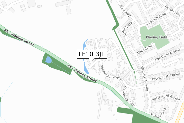
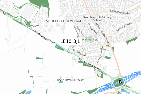
LE10 3JL is located in the Burbage Sketchley and Stretton electoral ward, within the local authority district of Hinckley and Bosworth and the English Parliamentary constituency of Bosworth. The Sub Integrated Care Board (ICB) Location is NHS Leicester, Leicestershire and Rutland ICB - 04V and the police force is Leicestershire. This postcode has been in use since March 2018.


GetTheData
Source: OS Open Zoomstack (Ordnance Survey)
Licence: Open Government Licence (requires attribution)
Attribution: Contains OS data © Crown copyright and database right 2025
Source: Open Postcode Geo
Licence: Open Government Licence (requires attribution)
Attribution: Contains OS data © Crown copyright and database right 2025; Contains Royal Mail data © Royal Mail copyright and database right 2025; Source: Office for National Statistics licensed under the Open Government Licence v.3.0
| Easting | 442580 |
| Northing | 291621 |
| Latitude | 52.520830 |
| Longitude | -1.373883 |
GetTheData
Source: Open Postcode Geo
Licence: Open Government Licence
| Country | England |
| Postcode District | LE10 |
➜ See where LE10 is on a map ➜ Where is Hinckley? | |
GetTheData
Source: Land Registry Price Paid Data
Licence: Open Government Licence
| Ward | Burbage Sketchley And Stretton |
| Constituency | Bosworth |
GetTheData
Source: ONS Postcode Database
Licence: Open Government Licence
14, CRAIGOWAN CLOSE, HINCKLEY, LE10 3JL 2018 31 AUG £539,995 |
16, CRAIGOWAN CLOSE, HINCKLEY, LE10 3JL 2018 31 MAY £564,995 |
5, CRAIGOWAN CLOSE, HINCKLEY, LE10 3JL 2018 26 APR £559,995 |
3, CRAIGOWAN CLOSE, HINCKLEY, LE10 3JL 2018 19 MAR £411,995 |
1, CRAIGOWAN CLOSE, HINCKLEY, LE10 3JL 2018 23 FEB £341,995 |
GetTheData
Source: HM Land Registry Price Paid Data
Licence: Contains HM Land Registry data © Crown copyright and database right 2025. This data is licensed under the Open Government Licence v3.0.
| Nursery Gardens (Newstead Avenue) | Burbage | 322m |
| Brockhurst Avenue (Welbeck Avenue) | Burbage | 347m |
| Welbeck Avenue (Beechwood Avenue) | Burbage | 486m |
| Crownhill Road (Herald Way) | Burbage | 495m |
| Broadsword Way (Herald Way) | Burbage | 505m |
| Hinckley Station | 1.6km |
GetTheData
Source: NaPTAN
Licence: Open Government Licence
| Percentage of properties with Next Generation Access | 100.0% |
| Percentage of properties with Superfast Broadband | 100.0% |
| Percentage of properties with Ultrafast Broadband | 100.0% |
| Percentage of properties with Full Fibre Broadband | 100.0% |
Superfast Broadband is between 30Mbps and 300Mbps
Ultrafast Broadband is > 300Mbps
| Percentage of properties unable to receive 2Mbps | 0.0% |
| Percentage of properties unable to receive 5Mbps | 0.0% |
| Percentage of properties unable to receive 10Mbps | 0.0% |
| Percentage of properties unable to receive 30Mbps | 0.0% |
GetTheData
Source: Ofcom
Licence: Ofcom Terms of Use (requires attribution)
GetTheData
Source: ONS Postcode Database
Licence: Open Government Licence


➜ Get more ratings from the Food Standards Agency
GetTheData
Source: Food Standards Agency
Licence: FSA terms & conditions
| Last Collection | |||
|---|---|---|---|
| Location | Mon-Fri | Sat | Distance |
| Sketchley Post Office | 17:30 | 11:00 | 546m |
| Sketchley Meadows | 698m | ||
| Sketchley Meadows | 18:30 | 08:00 | 702m |
GetTheData
Source: Dracos
Licence: Creative Commons Attribution-ShareAlike
The below table lists the International Territorial Level (ITL) codes (formerly Nomenclature of Territorial Units for Statistics (NUTS) codes) and Local Administrative Units (LAU) codes for LE10 3JL:
| ITL 1 Code | Name |
|---|---|
| TLF | East Midlands (England) |
| ITL 2 Code | Name |
| TLF2 | Leicestershire, Rutland and Northamptonshire |
| ITL 3 Code | Name |
| TLF22 | Leicestershire CC and Rutland |
| LAU 1 Code | Name |
| E07000132 | Hinckley and Bosworth |
GetTheData
Source: ONS Postcode Directory
Licence: Open Government Licence
The below table lists the Census Output Area (OA), Lower Layer Super Output Area (LSOA), and Middle Layer Super Output Area (MSOA) for LE10 3JL:
| Code | Name | |
|---|---|---|
| OA | E00131079 | |
| LSOA | E01025832 | Hinckley and Bosworth 014B |
| MSOA | E02005390 | Hinckley and Bosworth 014 |
GetTheData
Source: ONS Postcode Directory
Licence: Open Government Licence
| LE10 2GY | Belfry Close | 240m |
| LE10 3HZ | Watling Street | 244m |
| LE10 2JH | Welbeck Avenue | 272m |
| LE10 2GW | Gleneagles Close | 278m |
| LE10 2HH | Colts Close | 282m |
| LE10 2GX | Troon Way | 384m |
| LE10 2HG | Brockhurst Avenue | 407m |
| LE10 2JB | Newstead Avenue | 407m |
| LE10 2JA | Newstead Avenue | 410m |
| LE10 2QL | Broadsword Way | 415m |
GetTheData
Source: Open Postcode Geo; Land Registry Price Paid Data
Licence: Open Government Licence