LE10 0ZH maps, stats, and open data
- Home
- Postcode
- LE
- LE10
- LE10 0
LE10 0ZH is located in the Hinckley Castle electoral ward, within the local authority district of Hinckley and Bosworth and the English Parliamentary constituency of Bosworth. The Sub Integrated Care Board (ICB) Location is NHS Leicester, Leicestershire and Rutland ICB - 04V and the police force is Leicestershire. This postcode has been in use since September 2019.
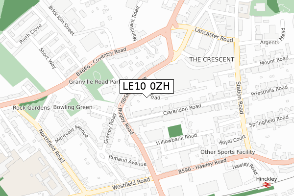
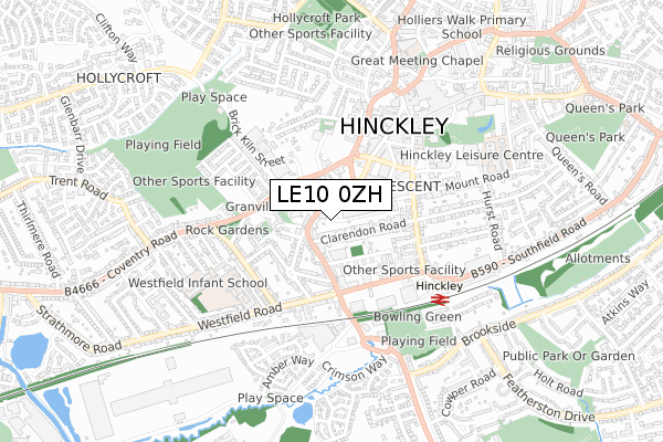
LE10 0ZH maps


Source: OS Open Zoomstack (Ordnance Survey)
Licence: Open Government Licence (requires attribution)
Attribution: Contains OS data © Crown copyright and database right 2025
Source: Open Postcode GeoLicence: Open Government Licence (requires attribution)
Attribution: Contains OS data © Crown copyright and database right 2025; Contains Royal Mail data © Royal Mail copyright and database right 2025; Source: Office for National Statistics licensed under the Open Government Licence v.3.0
LE10 0ZH geodata
| Easting | 442328 |
| Northing | 293512 |
| Latitude | 52.537848 |
| Longitude | -1.377357 |
Where is LE10 0ZH?
| Country | England |
| Postcode District | LE10 |
Politics
| Ward | Hinckley Castle |
|---|
| Constituency | Bosworth |
|---|
Transport
Nearest bus stops to LE10 0ZH
| Marchant Road (Coventry Road) | Hinckley | 180m |
| The Crescent Bus Station (The Crescent) | Hinckley | 195m |
| Marchant Road (Coventry Road) | Hinckley | 201m |
| The Crescent Bus Station (The Crescent) | Hinckley | 215m |
| Granville Road (Coventry Road) | Hinckley | 219m |
Nearest railway stations to LE10 0ZH
Broadband
Broadband access in LE10 0ZH (2020 data)
| Percentage of properties with Next Generation Access | 100.0% |
| Percentage of properties with Superfast Broadband | 100.0% |
| Percentage of properties with Ultrafast Broadband | 0.0% |
| Percentage of properties with Full Fibre Broadband | 0.0% |
Superfast Broadband is between 30Mbps and 300Mbps
Ultrafast Broadband is > 300Mbps
Broadband limitations in LE10 0ZH (2020 data)
| Percentage of properties unable to receive 2Mbps | 0.0% |
| Percentage of properties unable to receive 5Mbps | 0.0% |
| Percentage of properties unable to receive 10Mbps | 0.0% |
| Percentage of properties unable to receive 30Mbps | 0.0% |
Deprivation
73.7% of English postcodes are less deprived than
LE10 0ZH:
Food Standards Agency
Three nearest food hygiene ratings to LE10 0ZH (metres)
Pollys
Snap Fitness
Argos
➜ Get more ratings from the Food Standards Agency
Nearest post box to LE10 0ZH
| | Last Collection | |
|---|
| Location | Mon-Fri | Sat | Distance |
|---|
| Coventry Road | 17:30 | 11:30 | 198m |
| Northfield Road | 17:15 | 11:00 | 357m |
| Southfield Road | 17:30 | 11:00 | 431m |
LE10 0ZH ITL and LE10 0ZH LAU
The below table lists the International Territorial Level (ITL) codes (formerly Nomenclature of Territorial Units for Statistics (NUTS) codes) and Local Administrative Units (LAU) codes for LE10 0ZH:
| ITL 1 Code | Name |
|---|
| TLF | East Midlands (England) |
| ITL 2 Code | Name |
|---|
| TLF2 | Leicestershire, Rutland and Northamptonshire |
| ITL 3 Code | Name |
|---|
| TLF22 | Leicestershire CC and Rutland |
| LAU 1 Code | Name |
|---|
| E07000132 | Hinckley and Bosworth |
LE10 0ZH census areas
The below table lists the Census Output Area (OA), Lower Layer Super Output Area (LSOA), and Middle Layer Super Output Area (MSOA) for LE10 0ZH:
| Code | Name |
|---|
| OA | E00131177 | |
|---|
| LSOA | E01025852 | Hinckley and Bosworth 010B |
|---|
| MSOA | E02005386 | Hinckley and Bosworth 010 |
|---|
Nearest postcodes to LE10 0ZH


