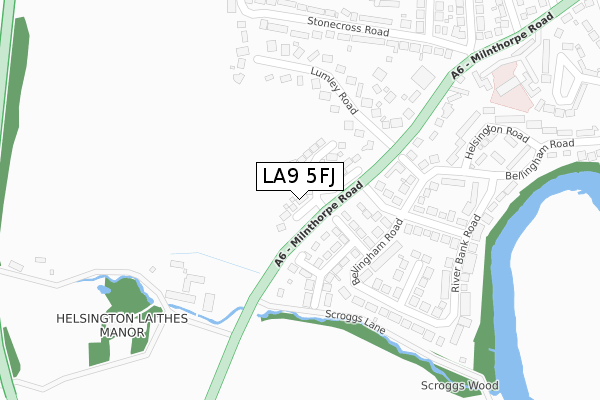
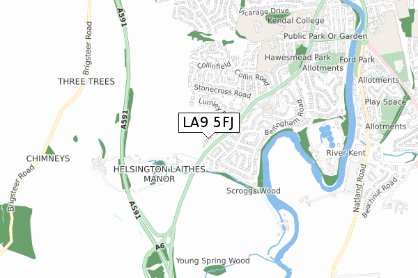
LA9 5FJ is located in the Kendal South electoral ward, within the unitary authority of Westmorland and Furness and the English Parliamentary constituency of Westmorland and Lonsdale. The Sub Integrated Care Board (ICB) Location is NHS Lancashire and South Cumbria ICB - 01K and the police force is Cumbria. This postcode has been in use since October 2019.


GetTheData
Source: OS Open Zoomstack (Ordnance Survey)
Licence: Open Government Licence (requires attribution)
Attribution: Contains OS data © Crown copyright and database right 2025
Source: Open Postcode Geo
Licence: Open Government Licence (requires attribution)
Attribution: Contains OS data © Crown copyright and database right 2025; Contains Royal Mail data © Royal Mail copyright and database right 2025; Source: Office for National Statistics licensed under the Open Government Licence v.3.0
| Easting | 350833 |
| Northing | 490945 |
| Latitude | 54.311728 |
| Longitude | -2.757220 |
GetTheData
Source: Open Postcode Geo
Licence: Open Government Licence
| Country | England |
| Postcode District | LA9 |
➜ See where LA9 is on a map ➜ Where is Kendal? | |
GetTheData
Source: Land Registry Price Paid Data
Licence: Open Government Licence
| Ward | Kendal South |
| Constituency | Westmorland And Lonsdale |
GetTheData
Source: ONS Postcode Database
Licence: Open Government Licence
11, PADDOCK DRIVE, KENDAL, LA9 5FJ 2024 18 NOV £520,000 |
51, PADDOCK DRIVE, KENDAL, LA9 5FJ 2024 9 OCT £519,995 |
53, PADDOCK DRIVE, KENDAL, LA9 5FJ 2024 26 FEB £649,995 |
55, PADDOCK DRIVE, KENDAL, LA9 5FJ 2023 6 NOV £749,995 |
23, PADDOCK DRIVE, KENDAL, LA9 5FJ 2023 24 OCT £539,995 |
59, PADDOCK DRIVE, KENDAL, LA9 5FJ 2023 17 JUL £509,995 |
49, PADDOCK DRIVE, KENDAL, LA9 5FJ 2023 30 JUN £629,995 |
73, PADDOCK DRIVE, KENDAL, LA9 5FJ 2023 28 APR £374,995 |
19, PADDOCK DRIVE, KENDAL, LA9 5FJ 2023 6 JAN £525,000 |
47, PADDOCK DRIVE, KENDAL, LA9 5FJ 2022 9 DEC £479,995 |
GetTheData
Source: HM Land Registry Price Paid Data
Licence: Contains HM Land Registry data © Crown copyright and database right 2025. This data is licensed under the Open Government Licence v3.0.
| Lumley Road (Milnthorpe Road) | Kendal | 209m |
| Lumley Road (Milnthorpe Road) | Kendal | 235m |
| Stonecross Road | Collinfield | 268m |
| Bellingham Road | Wattsfield | 350m |
| Hartside Road (Stonecross Road) | Collinfield | 389m |
| Oxenholme Lake District Station | 2.4km |
| Kendal Station | 2.5km |
| Burneside (Cumbria) Station | 4.9km |
GetTheData
Source: NaPTAN
Licence: Open Government Licence
GetTheData
Source: ONS Postcode Database
Licence: Open Government Licence


➜ Get more ratings from the Food Standards Agency
GetTheData
Source: Food Standards Agency
Licence: FSA terms & conditions
| Last Collection | |||
|---|---|---|---|
| Location | Mon-Fri | Sat | Distance |
| 82 Bellingham Road | 16:45 | 12:30 | 275m |
| Collin Hill | 16:45 | 12:00 | 428m |
| 1 Collin Road | 16:45 | 12:30 | 501m |
GetTheData
Source: Dracos
Licence: Creative Commons Attribution-ShareAlike
The below table lists the International Territorial Level (ITL) codes (formerly Nomenclature of Territorial Units for Statistics (NUTS) codes) and Local Administrative Units (LAU) codes for LA9 5FJ:
| ITL 1 Code | Name |
|---|---|
| TLD | North West (England) |
| ITL 2 Code | Name |
| TLD1 | Cumbria |
| ITL 3 Code | Name |
| TLD12 | East Cumbria |
| LAU 1 Code | Name |
| E07000031 | South Lakeland |
GetTheData
Source: ONS Postcode Directory
Licence: Open Government Licence
The below table lists the Census Output Area (OA), Lower Layer Super Output Area (LSOA), and Middle Layer Super Output Area (MSOA) for LA9 5FJ:
| Code | Name | |
|---|---|---|
| OA | E00097922 | |
| LSOA | E01019369 | South Lakeland 006D |
| MSOA | E02004020 | South Lakeland 006 |
GetTheData
Source: ONS Postcode Directory
Licence: Open Government Licence
| LA9 5JX | Kentwood Road | 182m |
| LA9 5HT | Lumley Road | 194m |
| LA9 5RN | Helsington Laithes | 215m |
| LA9 5JT | Kent Park Avenue | 276m |
| LA9 5HU | Lumley Road | 283m |
| LA9 5HR | Stonecross Road | 292m |
| LA9 5JU | Bellingham Road | 310m |
| LA9 5JY | Bellingham Road | 311m |
| LA9 5HP | Milnthorpe Road | 333m |
| LA9 5JE | Chambers Close | 363m |
GetTheData
Source: Open Postcode Geo; Land Registry Price Paid Data
Licence: Open Government Licence