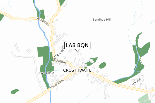
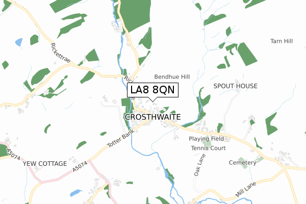
LA8 8QN maps, stats, and open data
LA8 8QN is located in the Bowness and Lyth electoral ward, within the unitary authority of Westmorland and Furness and the English Parliamentary constituency of Westmorland and Lonsdale. The Sub Integrated Care Board (ICB) Location is NHS Lancashire and South Cumbria ICB - 01K and the police force is Cumbria. This postcode has been in use since November 2017.
LA8 8QN maps


Licence: Open Government Licence (requires attribution)
Attribution: Contains OS data © Crown copyright and database right 2025
Source: Open Postcode Geo
Licence: Open Government Licence (requires attribution)
Attribution: Contains OS data © Crown copyright and database right 2025; Contains Royal Mail data © Royal Mail copyright and database right 2025; Source: Office for National Statistics licensed under the Open Government Licence v.3.0
LA8 8QN geodata
| Easting | 343737 |
| Northing | 491639 |
| Latitude | 54.317230 |
| Longitude | -2.866406 |
Where is LA8 8QN?
| Country | England |
| Postcode District | LA8 |
Politics
| Ward | Bowness And Lyth |
|---|---|
| Constituency | Westmorland And Lonsdale |
House Prices
Sales of detached houses in LA8 8QN
2, THE ORCHARD, CROSTHWAITE, KENDAL, LA8 8QN 2020 14 SEP £695,000 |
DAMSON HOUSE, 3, THE ORCHARD, CROSTHWAITE, KENDAL, LA8 8QN 2018 29 JUN £625,000 |
2017 17 NOV £503,500 |
Licence: Contains HM Land Registry data © Crown copyright and database right 2025. This data is licensed under the Open Government Licence v3.0.
Broadband
Broadband access in LA8 8QN (2020 data)
| Percentage of properties with Next Generation Access | 100.0% |
| Percentage of properties with Superfast Broadband | 100.0% |
| Percentage of properties with Ultrafast Broadband | 100.0% |
| Percentage of properties with Full Fibre Broadband | 100.0% |
Superfast Broadband is between 30Mbps and 300Mbps
Ultrafast Broadband is > 300Mbps
Broadband limitations in LA8 8QN (2020 data)
| Percentage of properties unable to receive 2Mbps | 0.0% |
| Percentage of properties unable to receive 5Mbps | 0.0% |
| Percentage of properties unable to receive 10Mbps | 0.0% |
| Percentage of properties unable to receive 30Mbps | 0.0% |
Deprivation
47.2% of English postcodes are less deprived than LA8 8QN:Food Standards Agency
Three nearest food hygiene ratings to LA8 8QN (metres)


➜ Get more ratings from the Food Standards Agency
Nearest post box to LA8 8QN
| Last Collection | |||
|---|---|---|---|
| Location | Mon-Fri | Sat | Distance |
| Dawson Fold Farm | 11:30 | 09:00 | 3,322m |
| Scarfoot | 11:30 | 11:30 | 4,494m |
| Ghyll Head | 16:15 | 11:00 | 4,667m |
LA8 8QN ITL and LA8 8QN LAU
The below table lists the International Territorial Level (ITL) codes (formerly Nomenclature of Territorial Units for Statistics (NUTS) codes) and Local Administrative Units (LAU) codes for LA8 8QN:
| ITL 1 Code | Name |
|---|---|
| TLD | North West (England) |
| ITL 2 Code | Name |
| TLD1 | Cumbria |
| ITL 3 Code | Name |
| TLD12 | East Cumbria |
| LAU 1 Code | Name |
| E07000031 | South Lakeland |
LA8 8QN census areas
The below table lists the Census Output Area (OA), Lower Layer Super Output Area (LSOA), and Middle Layer Super Output Area (MSOA) for LA8 8QN:
| Code | Name | |
|---|---|---|
| OA | E00097986 | |
| LSOA | E01019381 | South Lakeland 007B |
| MSOA | E02004021 | South Lakeland 007 |
Nearest postcodes to LA8 8QN
| LA8 8HX | 100m | |
| LA8 8HU | St Marys Green | 494m |
| LA8 8HZ | Starnthwaite Ghyll Cottages | 534m |
| LA8 8HT | 623m | |
| LA8 8JN | Starnthwaite Ghyll | 638m |
| LA8 8HS | 826m | |
| LA8 8BU | 842m | |
| LA8 8BT | 962m | |
| LA8 8JB | 966m | |
| LA8 8BS | 999m |