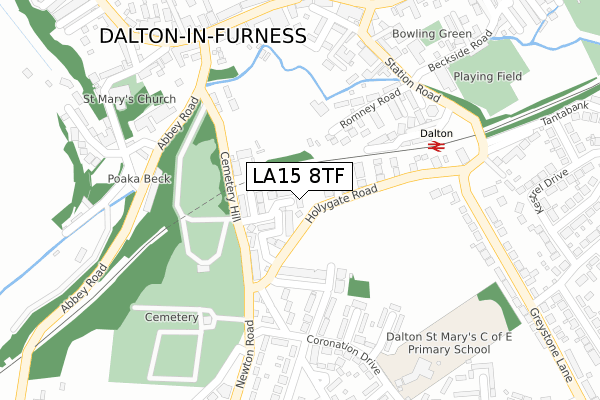
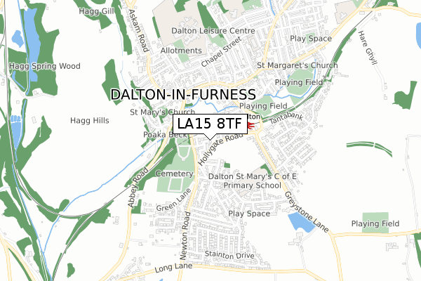
LA15 8TF is located in the Dalton South electoral ward, within the unitary authority of Westmorland and Furness and the English Parliamentary constituency of Barrow and Furness. The Sub Integrated Care Board (ICB) Location is NHS Lancashire and South Cumbria ICB - 01K and the police force is Cumbria. This postcode has been in use since January 2020.


GetTheData
Source: OS Open Zoomstack (Ordnance Survey)
Licence: Open Government Licence (requires attribution)
Attribution: Contains OS data © Crown copyright and database right 2025
Source: Open Postcode Geo
Licence: Open Government Licence (requires attribution)
Attribution: Contains OS data © Crown copyright and database right 2025; Contains Royal Mail data © Royal Mail copyright and database right 2025; Source: Office for National Statistics licensed under the Open Government Licence v.3.0
| Easting | 322856 |
| Northing | 473716 |
| Latitude | 54.153452 |
| Longitude | -3.182715 |
GetTheData
Source: Open Postcode Geo
Licence: Open Government Licence
| Country | England |
| Postcode District | LA15 |
➜ See where LA15 is on a map ➜ Where is Dalton-in-Furness? | |
GetTheData
Source: Land Registry Price Paid Data
Licence: Open Government Licence
| Ward | Dalton South |
| Constituency | Barrow And Furness |
GetTheData
Source: ONS Postcode Database
Licence: Open Government Licence
9, ESTHWAITE DRIVE, DALTON-IN-FURNESS, LA15 8TF 2020 17 DEC £297,500 |
2, ESTHWAITE DRIVE, DALTON-IN-FURNESS, LA15 8TF 2020 18 MAY £285,000 |
4, ESTHWAITE DRIVE, DALTON-IN-FURNESS, LA15 8TF 2020 28 FEB £265,000 |
11, ESTHWAITE DRIVE, DALTON-IN-FURNESS, LA15 8TF 2020 14 FEB £299,950 |
6, ESTHWAITE DRIVE, DALTON-IN-FURNESS, LA15 8TF 2020 17 JAN £299,950 |
➜ Dalton-in-Furness house prices
GetTheData
Source: HM Land Registry Price Paid Data
Licence: Contains HM Land Registry data © Crown copyright and database right 2025. This data is licensed under the Open Government Licence v3.0.
| Ruskin Avenue (Coronation Drive) | Dalton-in-furness | 251m |
| Rydal Close (Coronation Drive) | Dalton-in-furness | 254m |
| Town Hall (Station Road) | Dalton-in-furness | 291m |
| Rail Station (Greystone Lane) | Dalton-in-furness | 293m |
| Bank Corner (Station Road) | Dalton-in-furness | 318m |
| Dalton Station | 0.3km |
| Askam Station | 4.2km |
| Roose Station | 4.3km |
GetTheData
Source: NaPTAN
Licence: Open Government Licence
GetTheData
Source: ONS Postcode Database
Licence: Open Government Licence


➜ Get more ratings from the Food Standards Agency
GetTheData
Source: Food Standards Agency
Licence: FSA terms & conditions
| Last Collection | |||
|---|---|---|---|
| Location | Mon-Fri | Sat | Distance |
| Ulverston Road, Lindal | 15:15 | 08:00 | 3,034m |
| Lakes Parade | 17:30 | 11:15 | 3,187m |
| Swan Hotel, Little Urswick | 16:30 | 08:15 | 3,454m |
GetTheData
Source: Dracos
Licence: Creative Commons Attribution-ShareAlike
The below table lists the International Territorial Level (ITL) codes (formerly Nomenclature of Territorial Units for Statistics (NUTS) codes) and Local Administrative Units (LAU) codes for LA15 8TF:
| ITL 1 Code | Name |
|---|---|
| TLD | North West (England) |
| ITL 2 Code | Name |
| TLD1 | Cumbria |
| ITL 3 Code | Name |
| TLD11 | West Cumbria |
| LAU 1 Code | Name |
| E07000027 | Barrow-in-Furness |
GetTheData
Source: ONS Postcode Directory
Licence: Open Government Licence
The below table lists the Census Output Area (OA), Lower Layer Super Output Area (LSOA), and Middle Layer Super Output Area (MSOA) for LA15 8TF:
| Code | Name | |
|---|---|---|
| OA | E00096796 | |
| LSOA | E01019149 | Barrow-in-Furness 002B |
| MSOA | E02003978 | Barrow-in-Furness 002 |
GetTheData
Source: ONS Postcode Directory
Licence: Open Government Licence
| LA15 8LN | Hollygate Road | 45m |
| LA15 8HA | Hayeswater Drive | 71m |
| LA15 8LG | Devoke Water Gardens | 97m |
| LA15 8TA | Olive Close | 102m |
| LA15 8TB | Juniper Close | 135m |
| LA15 8XN | Loweswater Terrace | 147m |
| LA15 8LL | Cemetery Hill | 176m |
| LA15 8UE | Romney Road | 177m |
| LA15 8LP | Anticross | 183m |
| LA15 8PA | Dalton Fields Lane | 188m |
GetTheData
Source: Open Postcode Geo; Land Registry Price Paid Data
Licence: Open Government Licence