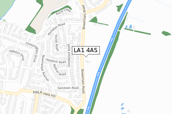
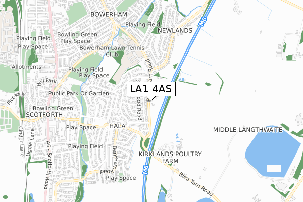
LA1 4AS is located in the Ellel electoral ward, within the local authority district of Lancaster and the English Parliamentary constituency of Lancaster and Fleetwood. The Sub Integrated Care Board (ICB) Location is NHS Lancashire and South Cumbria ICB - 01K and the police force is Lancashire. This postcode has been in use since February 2020.


GetTheData
Source: OS Open Zoomstack (Ordnance Survey)
Licence: Open Government Licence (requires attribution)
Attribution: Contains OS data © Crown copyright and database right 2025
Source: Open Postcode Geo
Licence: Open Government Licence (requires attribution)
Attribution: Contains OS data © Crown copyright and database right 2025; Contains Royal Mail data © Royal Mail copyright and database right 2025; Source: Office for National Statistics licensed under the Open Government Licence v.3.0
| Easting | 348896 |
| Northing | 459545 |
| Latitude | 54.029361 |
| Longitude | -2.781644 |
GetTheData
Source: Open Postcode Geo
Licence: Open Government Licence
| Country | England |
| Postcode District | LA1 |
➜ See where LA1 is on a map ➜ Where is Lancaster? | |
GetTheData
Source: Land Registry Price Paid Data
Licence: Open Government Licence
| Ward | Ellel |
| Constituency | Lancaster And Fleetwood |
GetTheData
Source: ONS Postcode Database
Licence: Open Government Licence
309, BOWERHAM ROAD, LANCASTER, LA1 4AS 2023 31 MAR £395,000 |
311, BOWERHAM ROAD, LANCASTER, LA1 4AS 2023 31 MAR £395,000 |
325, BOWERHAM ROAD, LANCASTER, LA1 4AS 2023 3 MAR £350,000 |
303, BOWERHAM ROAD, LANCASTER, LA1 4AS 2022 9 DEC £450,000 |
307, BOWERHAM ROAD, LANCASTER, LA1 4AS 2022 25 NOV £330,000 |
305, BOWERHAM ROAD, LANCASTER, LA1 4AS 2022 25 NOV £400,000 |
301, BOWERHAM ROAD, LANCASTER, LA1 4AS 2022 25 NOV £450,000 |
299, BOWERHAM ROAD, LANCASTER, LA1 4AS 2022 14 OCT £330,000 |
297, BOWERHAM ROAD, LANCASTER, LA1 4AS 2022 30 SEP £450,000 |
289, BOWERHAM ROAD, LANCASTER, LA1 4AS 2022 26 AUG £375,000 |
GetTheData
Source: HM Land Registry Price Paid Data
Licence: Contains HM Land Registry data © Crown copyright and database right 2025. This data is licensed under the Open Government Licence v3.0.
| Fox And Goose (Bowerham Lane) | The Racecourses | 188m |
| Ascot Close (Kempton Road) | The Racecourses | 233m |
| Ascot Close (Kempton Road) | The Racecourses | 249m |
| Fox And Goose (Bowerham Road) | Newlands | 265m |
| Haydock Road (Newmarket Avenue) | The Racecourses | 270m |
| Lancaster Station | 2.7km |
GetTheData
Source: NaPTAN
Licence: Open Government Licence
GetTheData
Source: ONS Postcode Database
Licence: Open Government Licence


➜ Get more ratings from the Food Standards Agency
GetTheData
Source: Food Standards Agency
Licence: FSA terms & conditions
| Last Collection | |||
|---|---|---|---|
| Location | Mon-Fri | Sat | Distance |
| 20 Goodwood Road | 16:00 | 11:45 | 170m |
| 3 Newlands Road | 16:15 | 12:15 | 338m |
| 2 Gressingham Drive | 16:00 | 11:45 | 588m |
GetTheData
Source: Dracos
Licence: Creative Commons Attribution-ShareAlike
The below table lists the International Territorial Level (ITL) codes (formerly Nomenclature of Territorial Units for Statistics (NUTS) codes) and Local Administrative Units (LAU) codes for LA1 4AS:
| ITL 1 Code | Name |
|---|---|
| TLD | North West (England) |
| ITL 2 Code | Name |
| TLD4 | Lancashire |
| ITL 3 Code | Name |
| TLD44 | Lancaster and Wyre |
| LAU 1 Code | Name |
| E07000121 | Lancaster |
GetTheData
Source: ONS Postcode Directory
Licence: Open Government Licence
The below table lists the Census Output Area (OA), Lower Layer Super Output Area (LSOA), and Middle Layer Super Output Area (MSOA) for LA1 4AS:
| Code | Name | |
|---|---|---|
| OA | E00127423 | |
| LSOA | E01025107 | Lancaster 019C |
| MSOA | E02005239 | Lancaster 019 |
GetTheData
Source: ONS Postcode Directory
Licence: Open Government Licence
| LA1 4LR | Bowerham Road | 93m |
| LA1 4LY | Goodwood Court | 133m |
| LA1 4LP | Bowerham Road | 143m |
| LA1 4LZ | Goodwood Road | 164m |
| LA1 4LX | Goodwood Road | 173m |
| LA1 4NE | Thirsk Road | 190m |
| LA1 4NB | Haydock Road | 194m |
| LA1 4LS | Kempton Road | 210m |
| LA1 4NA | Redcar Road | 231m |
| LA1 4LU | Kempton Road | 246m |
GetTheData
Source: Open Postcode Geo; Land Registry Price Paid Data
Licence: Open Government Licence