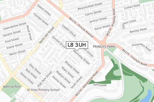
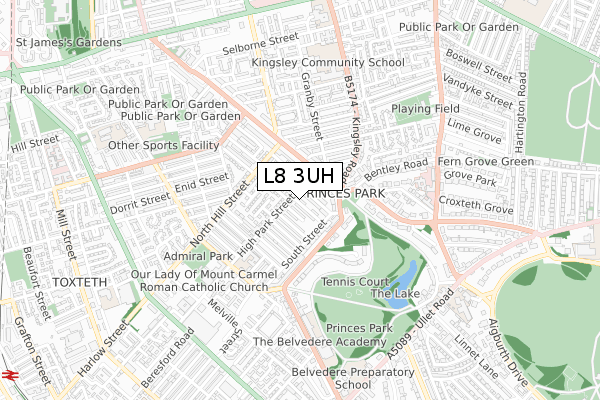
L8 3UH is located in the Toxteth electoral ward, within the metropolitan district of Liverpool and the English Parliamentary constituency of Liverpool, Riverside. The Sub Integrated Care Board (ICB) Location is NHS Cheshire and Merseyside ICB - 99A and the police force is Merseyside. This postcode has been in use since June 2018.


GetTheData
Source: OS Open Zoomstack (Ordnance Survey)
Licence: Open Government Licence (requires attribution)
Attribution: Contains OS data © Crown copyright and database right 2025
Source: Open Postcode Geo
Licence: Open Government Licence (requires attribution)
Attribution: Contains OS data © Crown copyright and database right 2025; Contains Royal Mail data © Royal Mail copyright and database right 2025; Source: Office for National Statistics licensed under the Open Government Licence v.3.0
| Easting | 336411 |
| Northing | 388500 |
| Latitude | 53.389509 |
| Longitude | -2.957605 |
GetTheData
Source: Open Postcode Geo
Licence: Open Government Licence
| Country | England |
| Postcode District | L8 |
➜ See where L8 is on a map ➜ Where is Liverpool? | |
GetTheData
Source: Land Registry Price Paid Data
Licence: Open Government Licence
| Ward | Toxteth |
| Constituency | Liverpool, Riverside |
GetTheData
Source: ONS Postcode Database
Licence: Open Government Licence
| Princes Gate West (Princes Park Gates) | Toxteth | 148m |
| High Park Street (Princes Park Gates) | Toxteth | 156m |
| Kingsley Road (Princes Park Gates) | Toxteth | 183m |
| Belvidere Road (Devonshire Road) | Princes Park | 272m |
| Devonshire Road West (Devonshire Road) | Princes Park | 273m |
| Brunswick Station | 1.4km |
| St Michaels Station | 1.6km |
| Edge Hill Station | 1.6km |
GetTheData
Source: NaPTAN
Licence: Open Government Licence
| Percentage of properties with Next Generation Access | 77.8% |
| Percentage of properties with Superfast Broadband | 77.8% |
| Percentage of properties with Ultrafast Broadband | 75.0% |
| Percentage of properties with Full Fibre Broadband | 0.0% |
Superfast Broadband is between 30Mbps and 300Mbps
Ultrafast Broadband is > 300Mbps
| Median download speed | 50.0Mbps |
| Average download speed | 89.4Mbps |
| Maximum download speed | 350.00Mbps |
| Median upload speed | 1.3Mbps |
| Average upload speed | 1.3Mbps |
| Maximum upload speed | 1.26Mbps |
| Percentage of properties unable to receive 2Mbps | 0.0% |
| Percentage of properties unable to receive 5Mbps | 0.0% |
| Percentage of properties unable to receive 10Mbps | 0.0% |
| Percentage of properties unable to receive 30Mbps | 0.0% |
GetTheData
Source: Ofcom
Licence: Ofcom Terms of Use (requires attribution)
GetTheData
Source: ONS Postcode Database
Licence: Open Government Licence


➜ Get more ratings from the Food Standards Agency
GetTheData
Source: Food Standards Agency
Licence: FSA terms & conditions
| Last Collection | |||
|---|---|---|---|
| Location | Mon-Fri | Sat | Distance |
| Princes Gate West | 17:30 | 12:00 | 139m |
| Powis Street | 17:30 | 12:00 | 154m |
| Granby Street | 17:00 | 12:00 | 247m |
GetTheData
Source: Dracos
Licence: Creative Commons Attribution-ShareAlike
The below table lists the International Territorial Level (ITL) codes (formerly Nomenclature of Territorial Units for Statistics (NUTS) codes) and Local Administrative Units (LAU) codes for L8 3UH:
| ITL 1 Code | Name |
|---|---|
| TLD | North West (England) |
| ITL 2 Code | Name |
| TLD7 | Merseyside |
| ITL 3 Code | Name |
| TLD72 | Liverpool |
| LAU 1 Code | Name |
| E08000012 | Liverpool |
GetTheData
Source: ONS Postcode Directory
Licence: Open Government Licence
The below table lists the Census Output Area (OA), Lower Layer Super Output Area (LSOA), and Middle Layer Super Output Area (MSOA) for L8 3UH:
| Code | Name | |
|---|---|---|
| OA | E00176609 | |
| LSOA | E01006677 | Liverpool 043D |
| MSOA | E02001389 | Liverpool 043 |
GetTheData
Source: ONS Postcode Directory
Licence: Open Government Licence
| L8 3UE | Kelvin Grove | 79m |
| L8 3TY | Devonshire Road | 101m |
| L8 3UQ | High Park Street | 136m |
| L8 3TX | Devonshire Road | 152m |
| L8 2UL | Princes Road | 172m |
| L8 8JY | Fernhill Drive | 186m |
| L8 3TH | Cavendish Gardens | 200m |
| L8 0SU | Princes Gate East | 216m |
| L8 8LD | Grinshill Close | 223m |
| L8 3TZ | Devonshire Road | 234m |
GetTheData
Source: Open Postcode Geo; Land Registry Price Paid Data
Licence: Open Government Licence