Property/Postcode Data Search:
L39 4RZ maps, stats, and open data
L39 4RZ is located in the Rural South electoral ward, within the local authority district of West Lancashire and the English Parliamentary constituency of West Lancashire. The Sub Integrated Care Board (ICB) Location is NHS Lancashire and South Cumbria ICB - 02G and the police force is Lancashire. This postcode has been in use since December 2017.
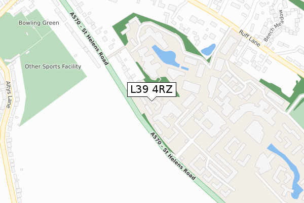
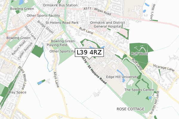
L39 4RZ maps


Source: OS Open Zoomstack (Ordnance Survey)
Licence: Open Government Licence (requires attribution)
Attribution: Contains OS data © Crown copyright and database right 2025
Source: Open Postcode Geo
Licence: Open Government Licence (requires attribution)
Attribution: Contains OS data © Crown copyright and database right 2025; Contains Royal Mail data © Royal Mail copyright and database right 2025; Source: Office for National Statistics licensed under the Open Government Licence v.3.0
Licence: Open Government Licence (requires attribution)
Attribution: Contains OS data © Crown copyright and database right 2025
Source: Open Postcode Geo
Licence: Open Government Licence (requires attribution)
Attribution: Contains OS data © Crown copyright and database right 2025; Contains Royal Mail data © Royal Mail copyright and database right 2025; Source: Office for National Statistics licensed under the Open Government Licence v.3.0
L39 4RZ geodata
| Easting | 342043 |
| Northing | 407441 |
| Latitude | 53.560387 |
| Longitude | -2.876432 |
Where is L39 4RZ?
| Country | England |
| Postcode District | L39 |
Politics
| Ward | Rural South |
|---|---|
| Constituency | West Lancashire |
Transport
Nearest bus stops to L39 4RZ
| Edge Hill University (St Helens Road) | Edge Hill | 195m |
| Edge Hill University (Edge Hill Grounds) | Edge Hill | 209m |
| Edge Hill University (St Helens Road) | Edge Hill | 236m |
| Playing Field (St Helens Road) | Ormskirk | 341m |
| Playing Field (Knowsley Road) | Ormskirk | 407m |
Nearest railway stations to L39 4RZ
| Ormskirk Station | 1km |
| Aughton Park Station | 1.4km |
| Town Green Station | 2.7km |
Deprivation
11.7% of English postcodes are less deprived than L39 4RZ:Food Standards Agency
Three nearest food hygiene ratings to L39 4RZ (metres)
Edge Hill Enterprises Ltd

Sporting Edge
191m
Aramark Ltd

Edge Hill University
208m
Morrisons Daily

The Hub
208m
➜ Get more ratings from the Food Standards Agency
Nearest post box to L39 4RZ
| Last Collection | |||
|---|---|---|---|
| Location | Mon-Fri | Sat | Distance |
| Altys Lane | 17:45 | 12:00 | 471m |
| Ormskirk Post Office | 18:30 | 12:30 | 970m |
| Aughton Post Office | 17:30 | 12:00 | 1,005m |
L39 4RZ ITL and L39 4RZ LAU
The below table lists the International Territorial Level (ITL) codes (formerly Nomenclature of Territorial Units for Statistics (NUTS) codes) and Local Administrative Units (LAU) codes for L39 4RZ:
| ITL 1 Code | Name |
|---|---|
| TLD | North West (England) |
| ITL 2 Code | Name |
| TLD4 | Lancashire |
| ITL 3 Code | Name |
| TLD47 | Chorley and West Lancashire |
| LAU 1 Code | Name |
| E07000127 | West Lancashire |
L39 4RZ census areas
The below table lists the Census Output Area (OA), Lower Layer Super Output Area (LSOA), and Middle Layer Super Output Area (MSOA) for L39 4RZ:
| Code | Name | |
|---|---|---|
| OA | E00168817 | |
| LSOA | E01025490 | West Lancashire 007C |
| MSOA | E02005310 | West Lancashire 007 |
Nearest postcodes to L39 4RZ
| L39 4YE | Blairgowrie Gardens | 269m |
| L39 4QW | St Helens Road | 313m |
| L39 4QZ | Ruff Lane | 345m |
| L39 4QT | St Helens Road | 358m |
| L39 4RA | Weldon Drive | 406m |
| L39 4QU | Milton Drive | 437m |
| L39 4QX | Ruff Lane | 449m |
| L39 4UL | Ruff Lane | 466m |
| L39 4UP | Ruff Lane | 469m |
| L39 4RG | Altys Lane | 478m |