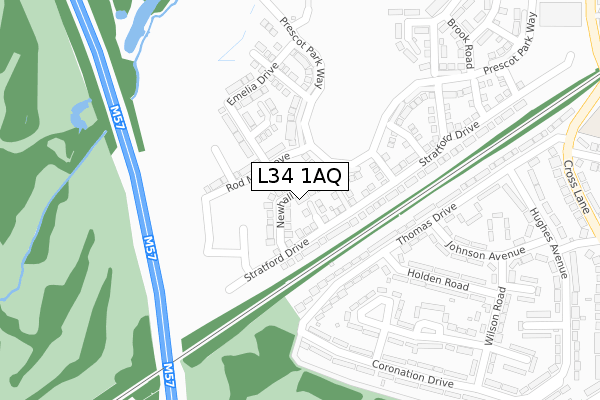
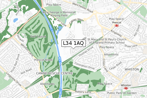
L34 1AQ is located in the Prescot North electoral ward, within the metropolitan district of Knowsley and the English Parliamentary constituency of Knowsley. The Sub Integrated Care Board (ICB) Location is NHS Cheshire and Merseyside ICB - 01J and the police force is Merseyside. This postcode has been in use since March 2019.


GetTheData
Source: OS Open Zoomstack (Ordnance Survey)
Licence: Open Government Licence (requires attribution)
Attribution: Contains OS data © Crown copyright and database right 2025
Source: Open Postcode Geo
Licence: Open Government Licence (requires attribution)
Attribution: Contains OS data © Crown copyright and database right 2025; Contains Royal Mail data © Royal Mail copyright and database right 2025; Source: Office for National Statistics licensed under the Open Government Licence v.3.0
| Easting | 346265 |
| Northing | 391753 |
| Latitude | 53.419841 |
| Longitude | -2.810010 |
GetTheData
Source: Open Postcode Geo
Licence: Open Government Licence
| Country | England |
| Postcode District | L34 |
➜ See where L34 is on a map ➜ Where is Prescot? | |
GetTheData
Source: Land Registry Price Paid Data
Licence: Open Government Licence
| Ward | Prescot North |
| Constituency | Knowsley |
GetTheData
Source: ONS Postcode Database
Licence: Open Government Licence
2024 13 SEP £310,000 |
2024 25 JUL £360,000 |
2024 27 JUN £345,000 |
2022 22 NOV £320,000 |
2022 23 SEP £300,000 |
2021 17 DEC £262,995 |
2021 1 NOV £219,500 |
40, NEWHALL ROAD, PRESCOT, L34 1AQ 2019 27 NOV £226,995 |
2019 27 NOV £226,995 |
38, NEWHALL ROAD, PRESCOT, L34 1AQ 2019 6 NOV £267,995 |
GetTheData
Source: HM Land Registry Price Paid Data
Licence: Contains HM Land Registry data © Crown copyright and database right 2025. This data is licensed under the Open Government Licence v3.0.
| Holden Road (Thomas Drive) | Prescot | 178m |
| Dennett Road (Coronation Drive) | Prescot | 280m |
| Hughes Avenue (Thomas Drive) | Prescot | 334m |
| Wilson Road (Coronation Drive) | Prescot | 402m |
| Johnson Avenue (Hughes Avenue) | Prescot | 409m |
| Prescot Station | 0.8km |
| Whiston Station | 1.1km |
| Eccleston Park Station | 2.3km |
GetTheData
Source: NaPTAN
Licence: Open Government Licence
| Percentage of properties with Next Generation Access | 100.0% |
| Percentage of properties with Superfast Broadband | 100.0% |
| Percentage of properties with Ultrafast Broadband | 88.9% |
| Percentage of properties with Full Fibre Broadband | 84.4% |
Superfast Broadband is between 30Mbps and 300Mbps
Ultrafast Broadband is > 300Mbps
| Percentage of properties unable to receive 2Mbps | 0.0% |
| Percentage of properties unable to receive 5Mbps | 0.0% |
| Percentage of properties unable to receive 10Mbps | 0.0% |
| Percentage of properties unable to receive 30Mbps | 0.0% |
GetTheData
Source: Ofcom
Licence: Ofcom Terms of Use (requires attribution)
GetTheData
Source: ONS Postcode Database
Licence: Open Government Licence


➜ Get more ratings from the Food Standards Agency
GetTheData
Source: Food Standards Agency
Licence: FSA terms & conditions
| Last Collection | |||
|---|---|---|---|
| Location | Mon-Fri | Sat | Distance |
| Prescot Station | 17:30 | 12:00 | 857m |
| Police Station/ High Street | 17:30 | 12:00 | 1,088m |
| Beechwood Grove | 17:15 | 12:00 | 1,188m |
GetTheData
Source: Dracos
Licence: Creative Commons Attribution-ShareAlike
The below table lists the International Territorial Level (ITL) codes (formerly Nomenclature of Territorial Units for Statistics (NUTS) codes) and Local Administrative Units (LAU) codes for L34 1AQ:
| ITL 1 Code | Name |
|---|---|
| TLD | North West (England) |
| ITL 2 Code | Name |
| TLD7 | Merseyside |
| ITL 3 Code | Name |
| TLD71 | East Merseyside |
| LAU 1 Code | Name |
| E08000011 | Knowsley |
GetTheData
Source: ONS Postcode Directory
Licence: Open Government Licence
The below table lists the Census Output Area (OA), Lower Layer Super Output Area (LSOA), and Middle Layer Super Output Area (MSOA) for L34 1AQ:
| Code | Name | |
|---|---|---|
| OA | E00032774 | |
| LSOA | E01006464 | Knowsley 007D |
| MSOA | E02001333 | Knowsley 007 |
GetTheData
Source: ONS Postcode Directory
Licence: Open Government Licence
| L35 5EQ | Thomas Drive | 138m |
| L35 5ED | Thomas Drive | 172m |
| L35 5EG | Thomas Drive | 190m |
| L35 5ER | Coronation Drive | 244m |
| L35 5EW | Holden Road | 262m |
| L35 5EN | Holden Road | 267m |
| L35 5EZ | Dennett Road | 269m |
| L35 5EB | Thomas Drive | 269m |
| L35 5EY | Dennett Road | 289m |
| L35 5HB | Johnson Avenue | 319m |
GetTheData
Source: Open Postcode Geo; Land Registry Price Paid Data
Licence: Open Government Licence