L32 3AD maps, stats, and open data
L32 3AD is located in the Cherryfield electoral ward, within the metropolitan district of Knowsley and the English Parliamentary constituency of Knowsley. The Sub Integrated Care Board (ICB) Location is NHS Cheshire and Merseyside ICB - 01J and the police force is Merseyside. This postcode has been in use since June 2018.
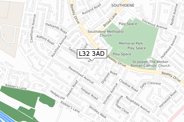
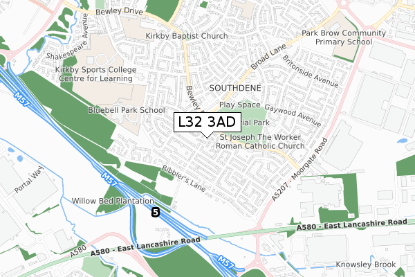
L32 3AD maps


Licence: Open Government Licence (requires attribution)
Attribution: Contains OS data © Crown copyright and database right 2025
Source: Open Postcode Geo
Licence: Open Government Licence (requires attribution)
Attribution: Contains OS data © Crown copyright and database right 2025; Contains Royal Mail data © Royal Mail copyright and database right 2025; Source: Office for National Statistics licensed under the Open Government Licence v.3.0
L32 3AD geodata
| Easting | 341548 |
| Northing | 397326 |
| Latitude | 53.469425 |
| Longitude | -2.882014 |
Where is L32 3AD?
| Country | England |
| Postcode District | L32 |
Politics
| Ward | Cherryfield |
|---|---|
| Constituency | Knowsley |
House Prices
Sales of detached houses in L32 3AD
2024 30 SEP £239,950 |
2024 30 JUL £225,000 |
2023 20 NOV £235,000 |
2022 20 DEC £232,000 |
2021 14 MAY £187,500 |
5, PALM GROVE, SOUTHDENE, LIVERPOOL, L32 3AD 2020 9 OCT £185,995 |
1, PALM GROVE, SOUTHDENE, LIVERPOOL, L32 3AD 2020 24 SEP £219,995 |
3, PALM GROVE, SOUTHDENE, LIVERPOOL, L32 3AD 2020 11 SEP £199,995 |
7, PALM GROVE, SOUTHDENE, LIVERPOOL, L32 3AD 2020 1 JUN £173,995 |
2, PALM GROVE, SOUTHDENE, LIVERPOOL, L32 3AD 2019 28 JUN £169,995 |
Licence: Contains HM Land Registry data © Crown copyright and database right 2025. This data is licensed under the Open Government Licence v3.0.
Transport
Nearest bus stops to L32 3AD
| Broad Lane | Southdene | 118m |
| Heskin Road (Ravenhead Avenue) | Southdene | 129m |
| Heskin Road (Ravenhead Avenue) | Southdene | 129m |
| Broad Lane | Southdene | 130m |
| Bewley Drive (Broad Lane) | Southdene | 157m |
Nearest railway stations to L32 3AD
| Kirkby Station | 2.3km |
| Fazakerley Station | 3.6km |
| Aintree Station | 5km |
Broadband
Broadband access in L32 3AD (2020 data)
| Percentage of properties with Next Generation Access | 100.0% |
| Percentage of properties with Superfast Broadband | 100.0% |
| Percentage of properties with Ultrafast Broadband | 86.7% |
| Percentage of properties with Full Fibre Broadband | 86.7% |
Superfast Broadband is between 30Mbps and 300Mbps
Ultrafast Broadband is > 300Mbps
Broadband limitations in L32 3AD (2020 data)
| Percentage of properties unable to receive 2Mbps | 0.0% |
| Percentage of properties unable to receive 5Mbps | 0.0% |
| Percentage of properties unable to receive 10Mbps | 0.0% |
| Percentage of properties unable to receive 30Mbps | 0.0% |
Deprivation
99.2% of English postcodes are less deprived than L32 3AD:Food Standards Agency
Three nearest food hygiene ratings to L32 3AD (metres)


➜ Get more ratings from the Food Standards Agency
Nearest post box to L32 3AD
| Last Collection | |||
|---|---|---|---|
| Location | Mon-Fri | Sat | Distance |
| Broad Lane/Medbourne Crescent | 17:00 | 12:00 | 221m |
| Kirkby Post Office | 18:00 | 12:00 | 1,334m |
| Amanda Road | 16:00 | 12:00 | 1,903m |
L32 3AD ITL and L32 3AD LAU
The below table lists the International Territorial Level (ITL) codes (formerly Nomenclature of Territorial Units for Statistics (NUTS) codes) and Local Administrative Units (LAU) codes for L32 3AD:
| ITL 1 Code | Name |
|---|---|
| TLD | North West (England) |
| ITL 2 Code | Name |
| TLD7 | Merseyside |
| ITL 3 Code | Name |
| TLD71 | East Merseyside |
| LAU 1 Code | Name |
| E08000011 | Knowsley |
L32 3AD census areas
The below table lists the Census Output Area (OA), Lower Layer Super Output Area (LSOA), and Middle Layer Super Output Area (MSOA) for L32 3AD:
| Code | Name | |
|---|---|---|
| OA | E00032530 | |
| LSOA | E01006417 | Knowsley 003B |
| MSOA | E02001329 | Knowsley 003 |
Nearest postcodes to L32 3AD
| L32 7SF | Blossom Grove | 115m |
| L32 3YB | Digmoor Walk | 117m |
| L32 3XZ | Ravenhead Avenue | 120m |
| L32 7SE | Cherry Gardens | 129m |
| L32 3YD | Digmoor Road | 131m |
| L32 3XY | Ravenhead Avenue | 137m |
| L32 3YA | Heskin Road | 158m |
| L32 7QG | Shirdley Avenue | 160m |
| L32 3XX | Felspar Road | 194m |
| L32 6QA | Broad Lane | 195m |