Property/Postcode Data Search:
L17 7DZ maps, stats, and open data
L17 7DZ is located in the St Michaels electoral ward, within the metropolitan district of Liverpool and the English Parliamentary constituency of Liverpool, Riverside. The Sub Integrated Care Board (ICB) Location is NHS Cheshire and Merseyside ICB - 99A and the police force is Merseyside. This postcode has been in use since August 2019.
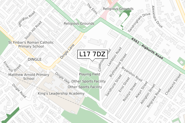
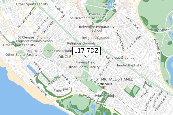
L17 7DZ maps


Source: OS Open Zoomstack (Ordnance Survey)
Licence: Open Government Licence (requires attribution)
Attribution: Contains OS data © Crown copyright and database right 2025
Source: Open Postcode Geo
Licence: Open Government Licence (requires attribution)
Attribution: Contains OS data © Crown copyright and database right 2025; Contains Royal Mail data © Royal Mail copyright and database right 2025; Source: Office for National Statistics licensed under the Open Government Licence v.3.0
Licence: Open Government Licence (requires attribution)
Attribution: Contains OS data © Crown copyright and database right 2025
Source: Open Postcode Geo
Licence: Open Government Licence (requires attribution)
Attribution: Contains OS data © Crown copyright and database right 2025; Contains Royal Mail data © Royal Mail copyright and database right 2025; Source: Office for National Statistics licensed under the Open Government Licence v.3.0
L17 7DZ geodata
| Easting | 336455 |
| Northing | 387391 |
| Latitude | 53.379547 |
| Longitude | -2.956719 |
Where is L17 7DZ?
| Country | England |
| Postcode District | L17 |
Politics
| Ward | St Michaels |
|---|---|
| Constituency | Liverpool, Riverside |
Transport
Nearest bus stops to L17 7DZ
| Kinnaird Street (Dingle Lane) | Dingle | 133m |
| Shorefields School (Dingle Vale) | Dingle | 162m |
| Shorefields School (Dingle Vale) | Dingle | 180m |
| Chillingham Street (Dingle Lane) | Dingle | 188m |
| Kedleston Street (Park Road) | Toxteth | 222m |
Nearest railway stations to L17 7DZ
| St Michaels Station | 0.5km |
| Brunswick Station | 1.4km |
| Aigburth Station | 2.6km |
Deprivation
89.2% of English postcodes are less deprived than L17 7DZ:Food Standards Agency
Three nearest food hygiene ratings to L17 7DZ (metres)
Dingle Wines

29 Dingle Lane
156m
The Happy Garden

50 Dingle Lane
180m
Dingle Lane Mini Market

43 Dingle Lane
195m
➜ Get more ratings from the Food Standards Agency
Nearest post box to L17 7DZ
| Last Collection | |||
|---|---|---|---|
| Location | Mon-Fri | Sat | Distance |
| Bryanston Road | 17:15 | 12:00 | 175m |
| Sandringham Drive | 17:00 | 12:00 | 256m |
| Aigburth Road Post Office | 17:15 | 12:00 | 363m |
L17 7DZ ITL and L17 7DZ LAU
The below table lists the International Territorial Level (ITL) codes (formerly Nomenclature of Territorial Units for Statistics (NUTS) codes) and Local Administrative Units (LAU) codes for L17 7DZ:
| ITL 1 Code | Name |
|---|---|
| TLD | North West (England) |
| ITL 2 Code | Name |
| TLD7 | Merseyside |
| ITL 3 Code | Name |
| TLD72 | Liverpool |
| LAU 1 Code | Name |
| E08000012 | Liverpool |
L17 7DZ census areas
The below table lists the Census Output Area (OA), Lower Layer Super Output Area (LSOA), and Middle Layer Super Output Area (MSOA) for L17 7DZ:
| Code | Name | |
|---|---|---|
| OA | E00033596 | |
| LSOA | E01032506 | Liverpool 050G |
| MSOA | E02001396 | Liverpool 050 |
Nearest postcodes to L17 7DZ
| L17 7BY | Colebrooke Road | 101m |
| L8 9SA | Kinnaird Street | 103m |
| L17 7DG | Blythswood Street | 108m |
| L17 7DB | Lambton Road | 123m |
| L17 7DA | Lambton Road | 127m |
| L8 9SD | Longford Street | 128m |
| L8 9SB | Hindlip Street | 140m |
| L17 7DE | Blythswood Street | 144m |
| L17 7BX | Sandhurst Street | 156m |
| L8 9SH | Monkswell Street | 157m |