Property/Postcode Data Search:
L14 7BD maps, stats, and open data
L14 7BD is located in the Swanside electoral ward, within the metropolitan district of Knowsley and the English Parliamentary constituency of Knowsley. The Sub Integrated Care Board (ICB) Location is NHS Cheshire and Merseyside ICB - 01J and the police force is Merseyside. This postcode has been in use since March 2019.
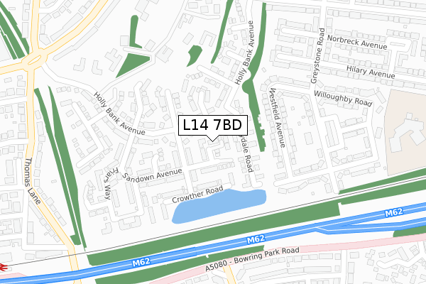
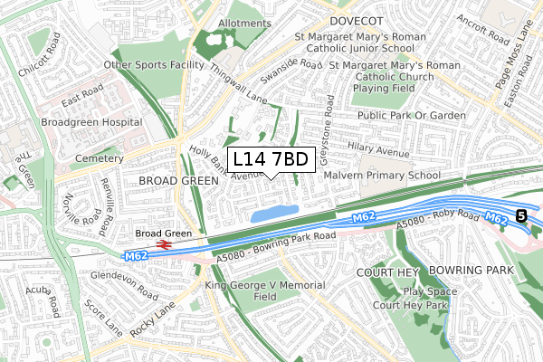
L14 7BD maps


Source: OS Open Zoomstack (Ordnance Survey)
Licence: Open Government Licence (requires attribution)
Attribution: Contains OS data © Crown copyright and database right 2025
Source: Open Postcode Geo
Licence: Open Government Licence (requires attribution)
Attribution: Contains OS data © Crown copyright and database right 2025; Contains Royal Mail data © Royal Mail copyright and database right 2025; Source: Office for National Statistics licensed under the Open Government Licence v.3.0
Licence: Open Government Licence (requires attribution)
Attribution: Contains OS data © Crown copyright and database right 2025
Source: Open Postcode Geo
Licence: Open Government Licence (requires attribution)
Attribution: Contains OS data © Crown copyright and database right 2025; Contains Royal Mail data © Royal Mail copyright and database right 2025; Source: Office for National Statistics licensed under the Open Government Licence v.3.0
L14 7BD geodata
| Easting | 341191 |
| Northing | 390628 |
| Latitude | 53.409188 |
| Longitude | -2.886138 |
Where is L14 7BD?
| Country | England |
| Postcode District | L14 |
Politics
| Ward | Swanside |
|---|---|
| Constituency | Knowsley |
House Prices
Sales of detached houses in L14 7BD
2024 15 OCT £425,000 |
5, THURSTAN GROVE, LIVERPOOL, L14 7BD 2019 27 JUN £259,995 |
10, THURSTAN GROVE, LIVERPOOL, L14 7BD 2019 9 MAY £359,995 |
9, THURSTAN GROVE, LIVERPOOL, L14 7BD 2019 2 MAY £359,995 |
2019 26 APR £298,995 |
7, THURSTAN GROVE, LIVERPOOL, L14 7BD 2019 18 APR £258,995 |
6, THURSTAN GROVE, LIVERPOOL, L14 7BD 2019 12 APR £271,995 |
12, THURSTAN GROVE, LIVERPOOL, L14 7BD 2019 2 APR £259,995 |
4, THURSTAN GROVE, ROBY, LIVERPOOL, L14 7BD 2019 22 MAR £354,995 |
11, THURSTAN GROVE, ROBY, LIVERPOOL, L14 7BD 2019 8 MAR £270,995 |
Source: HM Land Registry Price Paid Data
Licence: Contains HM Land Registry data © Crown copyright and database right 2025. This data is licensed under the Open Government Licence v3.0.
Licence: Contains HM Land Registry data © Crown copyright and database right 2025. This data is licensed under the Open Government Licence v3.0.
Transport
Nearest bus stops to L14 7BD
| Ashfield Way (Holly Bank Avenue) | Swanside | 238m |
| Ashfield Way (Holly Bank Avenue (Geo)) | Swanside | 248m |
| Chelwood Avenue (Bowring Park Road) | Belle Vale | 279m |
| Chelwood Avenue (Bowring Park Road) | Belle Vale | 297m |
| Inchape Road (Chelwood Avenue) | Belle Vale | 350m |
Nearest railway stations to L14 7BD
| Broad Green Station | 0.6km |
| Roby Station | 2km |
| Wavertree Technology Park Station | 2.5km |
Broadband
Broadband speed in L14 7BD (2019 data)
Download
| Median download speed | 32.9Mbps |
| Average download speed | 28.8Mbps |
| Maximum download speed | 38.99Mbps |
Upload
| Median upload speed | 6.8Mbps |
| Average upload speed | 6.3Mbps |
| Maximum upload speed | 8.16Mbps |
Deprivation
66.6% of English postcodes are less deprived than L14 7BD:Food Standards Agency
Three nearest food hygiene ratings to L14 7BD (metres)
Roby News

93 Greystone Road
277m
Jackie's Sandwich Express

1 Chelwood Avenue
316m
Everydayz

2 Chelwood Avenue
325m
➜ Get more ratings from the Food Standards Agency
Nearest post box to L14 7BD
| Last Collection | |||
|---|---|---|---|
| Location | Mon-Fri | Sat | Distance |
| Broadgreen Post Office | 16:30 | 12:00 | 315m |
| Rocky Lane | 16:00 | 12:00 | 553m |
| Thornton Road | 16:15 | 12:00 | 605m |
L14 7BD ITL and L14 7BD LAU
The below table lists the International Territorial Level (ITL) codes (formerly Nomenclature of Territorial Units for Statistics (NUTS) codes) and Local Administrative Units (LAU) codes for L14 7BD:
| ITL 1 Code | Name |
|---|---|
| TLD | North West (England) |
| ITL 2 Code | Name |
| TLD7 | Merseyside |
| ITL 3 Code | Name |
| TLD71 | East Merseyside |
| LAU 1 Code | Name |
| E08000011 | Knowsley |
L14 7BD census areas
The below table lists the Census Output Area (OA), Lower Layer Super Output Area (LSOA), and Middle Layer Super Output Area (MSOA) for L14 7BD:
| Code | Name | |
|---|---|---|
| OA | E00032867 | |
| LSOA | E01006485 | Knowsley 014B |
| MSOA | E02001340 | Knowsley 014 |
Nearest postcodes to L14 7BD
| L14 7AJ | Berrydale Road | 61m |
| L14 7AT | Treswell Road | 63m |
| L14 7AH | Berrydale Road | 90m |
| L14 7AB | Holly Bank Avenue | 114m |
| L14 7AP | Oakvale Road | 127m |
| L14 7AS | Sandown Avenue | 129m |
| L14 7AL | Berrydale Road | 130m |
| L14 6UZ | Westfield Avenue | 145m |
| L14 7AF | Evercroft Road | 146m |
| L14 7AG | Holly Bank Avenue | 170m |