L14 7AY maps, stats, and open data
- Home
- Postcode
- L
- L14
- L14 7
L14 7AY is located in the Swanside electoral ward, within the metropolitan district of Knowsley and the English Parliamentary constituency of Knowsley. The Sub Integrated Care Board (ICB) Location is NHS Cheshire and Merseyside ICB - 01J and the police force is Merseyside. This postcode has been in use since September 2017.
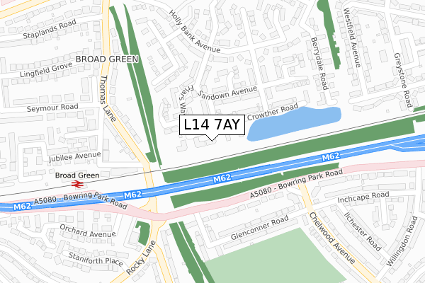
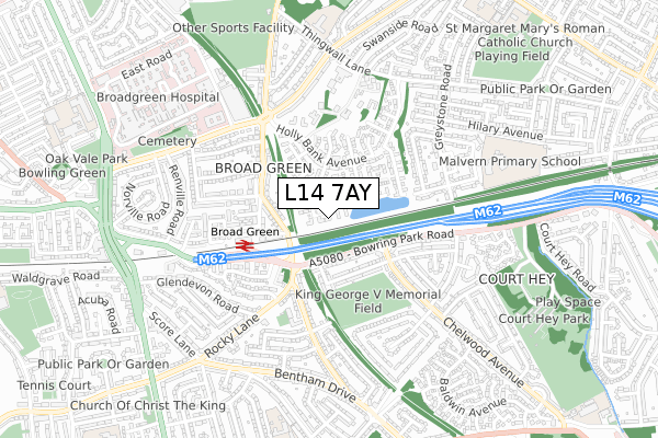
L14 7AY maps


Source: OS Open Zoomstack (Ordnance Survey)
Licence: Open Government Licence (requires attribution)
Attribution: Contains OS data © Crown copyright and database right 2025
Source: Open Postcode GeoLicence: Open Government Licence (requires attribution)
Attribution: Contains OS data © Crown copyright and database right 2025; Contains Royal Mail data © Royal Mail copyright and database right 2025; Source: Office for National Statistics licensed under the Open Government Licence v.3.0
L14 7AY geodata
| Easting | 341013 |
| Northing | 390435 |
| Latitude | 53.407434 |
| Longitude | -2.888779 |
Where is L14 7AY?
| Country | England |
| Postcode District | L14 |
Politics
| Ward | Swanside |
|---|
| Constituency | Knowsley |
|---|
Transport
Nearest bus stops to L14 7AY
| Chelwood Avenue (Bowring Park Road) | Belle Vale | 216m |
| Chelwood Avenue (Bowring Park Road) | Belle Vale | 217m |
| Rocky Lane (Bowring Park Road) | Childwall | 262m |
| Inchape Road (Chelwood Avenue) | Belle Vale | 279m |
| Seymour Road (Thomas Lane) | Broadgreen | 288m |
Nearest railway stations to L14 7AY
| Broad Green Station | 0.3km |
| Roby Station | 2.2km |
| Wavertree Technology Park Station | 2.3km |
Broadband
Broadband access in L14 7AY (2020 data)
| Percentage of properties with Next Generation Access | 100.0% |
| Percentage of properties with Superfast Broadband | 100.0% |
| Percentage of properties with Ultrafast Broadband | 0.0% |
| Percentage of properties with Full Fibre Broadband | 0.0% |
Superfast Broadband is between 30Mbps and 300Mbps
Ultrafast Broadband is > 300Mbps
Broadband speed in L14 7AY (2019 data)
Download
| Median download speed | 22.2Mbps |
| Average download speed | 20.6Mbps |
| Maximum download speed | 40.00Mbps |
Upload
| Median upload speed | 4.7Mbps |
| Average upload speed | 4.6Mbps |
| Maximum upload speed | 9.47Mbps |
Broadband limitations in L14 7AY (2020 data)
| Percentage of properties unable to receive 2Mbps | 0.0% |
| Percentage of properties unable to receive 5Mbps | 0.0% |
| Percentage of properties unable to receive 10Mbps | 0.0% |
| Percentage of properties unable to receive 30Mbps | 0.0% |
Deprivation
54.6% of English postcodes are less deprived than
L14 7AY:
Food Standards Agency
Three nearest food hygiene ratings to L14 7AY (metres)
Everydayz
Jackie's Sandwich Express
BROADGREEN LOCAL
➜ Get more ratings from the Food Standards Agency
Nearest post box to L14 7AY
| | Last Collection | |
|---|
| Location | Mon-Fri | Sat | Distance |
|---|
| Broadgreen Post Office | 16:30 | 12:00 | 266m |
| Rocky Lane | 16:00 | 12:00 | 295m |
| Thornton Road | 16:15 | 12:00 | 556m |
L14 7AY ITL and L14 7AY LAU
The below table lists the International Territorial Level (ITL) codes (formerly Nomenclature of Territorial Units for Statistics (NUTS) codes) and Local Administrative Units (LAU) codes for L14 7AY:
| ITL 1 Code | Name |
|---|
| TLD | North West (England) |
| ITL 2 Code | Name |
|---|
| TLD7 | Merseyside |
| ITL 3 Code | Name |
|---|
| TLD71 | East Merseyside |
| LAU 1 Code | Name |
|---|
| E08000011 | Knowsley |
L14 7AY census areas
The below table lists the Census Output Area (OA), Lower Layer Super Output Area (LSOA), and Middle Layer Super Output Area (MSOA) for L14 7AY:
| Code | Name |
|---|
| OA | E00032881 | |
|---|
| LSOA | E01006488 | Knowsley 014E |
|---|
| MSOA | E02001340 | Knowsley 014 |
|---|
Nearest postcodes to L14 7AY


