KT9 1BH maps, stats, and open data
- Home
- Postcode
- KT
- KT9
- KT9 1
KT9 1BH is located in the Hinchley Wood and Weston Green electoral ward, within the local authority district of Elmbridge and the English Parliamentary constituency of Esher and Walton. The Sub Integrated Care Board (ICB) Location is NHS Surrey Heartlands ICB - 92A and the police force is Surrey. This postcode has been in use since June 2019.
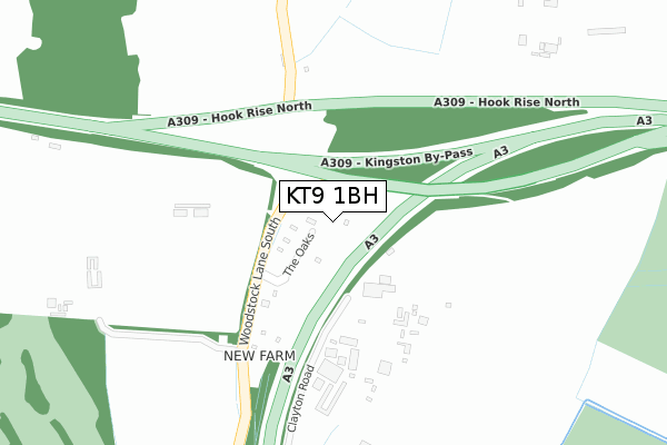
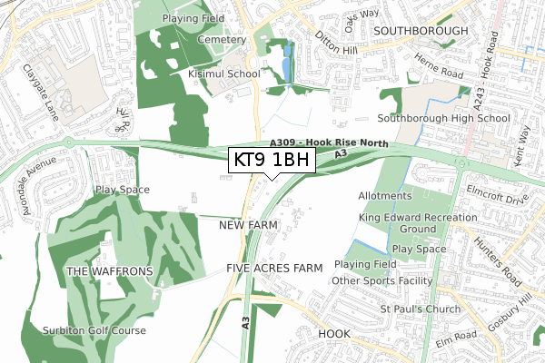
KT9 1BH maps


Source: OS Open Zoomstack (Ordnance Survey)
Licence: Open Government Licence (requires attribution)
Attribution: Contains OS data © Crown copyright and database right 2025
Source: Open Postcode GeoLicence: Open Government Licence (requires attribution)
Attribution: Contains OS data © Crown copyright and database right 2025; Contains Royal Mail data © Royal Mail copyright and database right 2025; Source: Office for National Statistics licensed under the Open Government Licence v.3.0
KT9 1BH geodata
| Easting | 517274 |
| Northing | 165288 |
| Latitude | 51.374544 |
| Longitude | -0.316465 |
Where is KT9 1BH?
| Country | England |
| Postcode District | KT9 |
Politics
| Ward | Hinchley Wood And Weston Green |
|---|
| Constituency | Esher And Walton |
|---|
Transport
Nearest bus stops to KT9 1BH
| Claygate Lane (Kingston By-pass) | Hinchley Wood | 795m |
| Claygate Lane (Kingston By-pass) | Hinchley Wood | 805m |
| Elmcroft Drive | Hook | 826m |
| The North Star (Hook Road) | Hook | 835m |
| Elmcroft Drive | Hook | 839m |
Nearest railway stations to KT9 1BH
| Chessington North Station | 1.6km |
| Hinchley Wood Station | 1.7km |
| Chessington South Station | 2.1km |
Broadband
Broadband access in KT9 1BH (2020 data)
| Percentage of properties with Next Generation Access | 100.0% |
| Percentage of properties with Superfast Broadband | 0.0% |
| Percentage of properties with Ultrafast Broadband | 0.0% |
| Percentage of properties with Full Fibre Broadband | 0.0% |
Superfast Broadband is between 30Mbps and 300Mbps
Ultrafast Broadband is > 300Mbps
Broadband limitations in KT9 1BH (2020 data)
| Percentage of properties unable to receive 2Mbps | 0.0% |
| Percentage of properties unable to receive 5Mbps | 0.0% |
| Percentage of properties unable to receive 10Mbps | 0.0% |
| Percentage of properties unable to receive 30Mbps | 100.0% |
Deprivation
5.8% of English postcodes are less deprived than
KT9 1BH:
Food Standards Agency
Three nearest food hygiene ratings to KT9 1BH (metres)
Squires Garden Centre
Acorn To Oak Nursery And Preschool Ltd
Kingston Rugby Club
King Edward Recreation Ground
675m
➜ Get more ratings from the Food Standards Agency
Nearest post box to KT9 1BH
| | Last Collection | |
|---|
| Location | Mon-Fri | Sat | Distance |
|---|
| 19 Devon Way | 17:45 | 12:15 | 763m |
| Vallis Way | 17:45 | 12:15 | 817m |
| Leatherhead Road | 17:30 | 11:30 | 823m |
KT9 1BH ITL and KT9 1BH LAU
The below table lists the International Territorial Level (ITL) codes (formerly Nomenclature of Territorial Units for Statistics (NUTS) codes) and Local Administrative Units (LAU) codes for KT9 1BH:
| ITL 1 Code | Name |
|---|
| TLJ | South East (England) |
| ITL 2 Code | Name |
|---|
| TLJ2 | Surrey, East and West Sussex |
| ITL 3 Code | Name |
|---|
| TLJ25 | West Surrey |
| LAU 1 Code | Name |
|---|
| E07000207 | Elmbridge |
KT9 1BH census areas
The below table lists the Census Output Area (OA), Lower Layer Super Output Area (LSOA), and Middle Layer Super Output Area (MSOA) for KT9 1BH:
| Code | Name |
|---|
| OA | E00154665 | |
|---|
| LSOA | E01030319 | Elmbridge 009A |
|---|
| MSOA | E02006325 | Elmbridge 009 |
|---|
Nearest postcodes to KT9 1BH


