KT8 0AL maps, stats, and open data
- Home
- Postcode
- KT
- KT8
- KT8 0
KT8 0AL is located in the Thames Ditton electoral ward, within the local authority district of Elmbridge and the English Parliamentary constituency of Esher and Walton. The Sub Integrated Care Board (ICB) Location is NHS Surrey Heartlands ICB - 92A and the police force is Surrey. This postcode has been in use since June 2018.
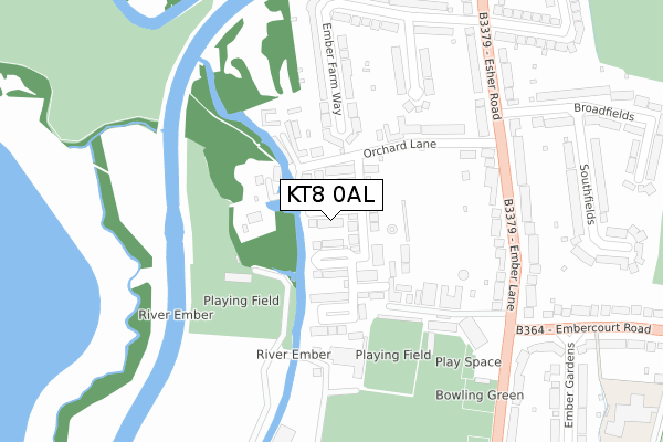
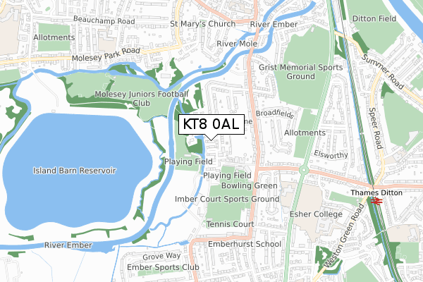
KT8 0AL maps


Source: OS Open Zoomstack (Ordnance Survey)
Licence: Open Government Licence (requires attribution)
Attribution: Contains OS data © Crown copyright and database right 2025
Source: Open Postcode GeoLicence: Open Government Licence (requires attribution)
Attribution: Contains OS data © Crown copyright and database right 2025; Contains Royal Mail data © Royal Mail copyright and database right 2025; Source: Office for National Statistics licensed under the Open Government Licence v.3.0
KT8 0AL geodata
| Easting | 514686 |
| Northing | 167207 |
| Latitude | 51.392321 |
| Longitude | -0.353014 |
Where is KT8 0AL?
| Country | England |
| Postcode District | KT8 |
Politics
| Ward | Thames Ditton |
|---|
| Constituency | Esher And Walton |
|---|
Transport
Nearest bus stops to KT8 0AL
| Orchard Lane (Esher Road) | East Molesey | 273m |
| Orchard Lane (Esher Road) | East Molesey | 286m |
| Imber Court (Ember Lane) | Thames Ditton | 351m |
| Imber Court (Ember Lane) | Thames Ditton | 371m |
| Ember Gardens (Embercourt Road) | Thames Ditton | 398m |
Nearest railway stations to KT8 0AL
| Thames Ditton Station | 1km |
| Hampton Court Station | 1.3km |
| Esher Station | 1.4km |
Broadband
Broadband access in KT8 0AL (2020 data)
| Percentage of properties with Next Generation Access | 100.0% |
| Percentage of properties with Superfast Broadband | 100.0% |
| Percentage of properties with Ultrafast Broadband | 100.0% |
| Percentage of properties with Full Fibre Broadband | 100.0% |
Superfast Broadband is between 30Mbps and 300Mbps
Ultrafast Broadband is > 300Mbps
Broadband limitations in KT8 0AL (2020 data)
| Percentage of properties unable to receive 2Mbps | 0.0% |
| Percentage of properties unable to receive 5Mbps | 0.0% |
| Percentage of properties unable to receive 10Mbps | 0.0% |
| Percentage of properties unable to receive 30Mbps | 0.0% |
Deprivation
3.4% of English postcodes are less deprived than
KT8 0AL:
Food Standards Agency
Three nearest food hygiene ratings to KT8 0AL (metres)
The Dough Shack Van 4 - FG63 VBU
Imber Court Sports Ground
269m
The Dough Shack Van 1 - OV60 ONF
Imber Court Sports Ground
269m
The Dough Shack Van 3 - DP15 AFO
Imber Court Sports Ground
269m
➜ Get more ratings from the Food Standards Agency
Nearest post box to KT8 0AL
| | Last Collection | |
|---|
| Location | Mon-Fri | Sat | Distance |
|---|
| Ember Lane | 17:30 | 12:00 | 297m |
| Ember Farm Way/Esher Road | 17:30 | 12:00 | 358m |
| Esher Place Avenue | 17:45 | 12:15 | 584m |
KT8 0AL ITL and KT8 0AL LAU
The below table lists the International Territorial Level (ITL) codes (formerly Nomenclature of Territorial Units for Statistics (NUTS) codes) and Local Administrative Units (LAU) codes for KT8 0AL:
| ITL 1 Code | Name |
|---|
| TLJ | South East (England) |
| ITL 2 Code | Name |
|---|
| TLJ2 | Surrey, East and West Sussex |
| ITL 3 Code | Name |
|---|
| TLJ25 | West Surrey |
| LAU 1 Code | Name |
|---|
| E07000207 | Elmbridge |
KT8 0AL census areas
The below table lists the Census Output Area (OA), Lower Layer Super Output Area (LSOA), and Middle Layer Super Output Area (MSOA) for KT8 0AL:
| Code | Name |
|---|
| OA | E00154692 | |
|---|
| LSOA | E01030327 | Elmbridge 002B |
|---|
| MSOA | E02006318 | Elmbridge 002 |
|---|
Nearest postcodes to KT8 0AL


