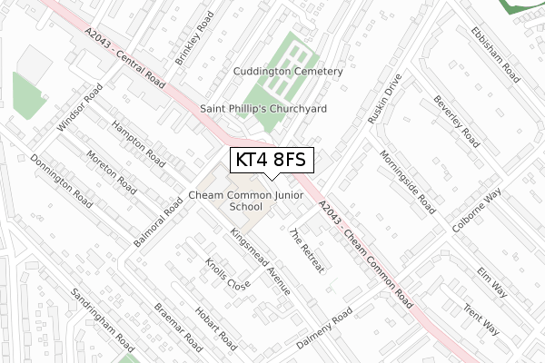
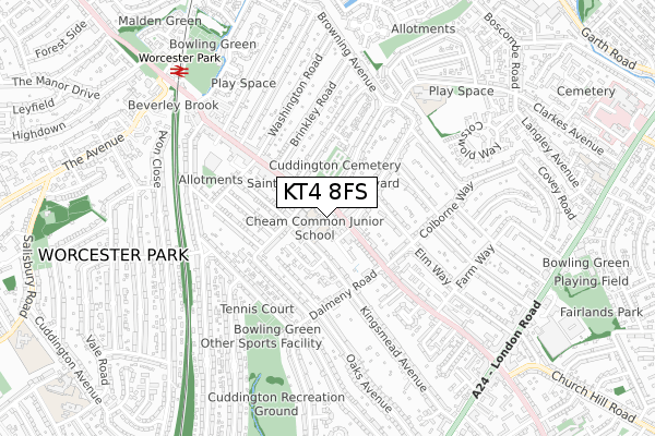
KT4 8FS is located in the Worcester Park South electoral ward, within the London borough of Sutton and the English Parliamentary constituency of Sutton and Cheam. The Sub Integrated Care Board (ICB) Location is NHS South West London ICB - 36L and the police force is Metropolitan Police. This postcode has been in use since November 2017.


GetTheData
Source: OS Open Zoomstack (Ordnance Survey)
Licence: Open Government Licence (requires attribution)
Attribution: Contains OS data © Crown copyright and database right 2025
Source: Open Postcode Geo
Licence: Open Government Licence (requires attribution)
Attribution: Contains OS data © Crown copyright and database right 2025; Contains Royal Mail data © Royal Mail copyright and database right 2025; Source: Office for National Statistics licensed under the Open Government Licence v.3.0
| Easting | 522795 |
| Northing | 165592 |
| Latitude | 51.376111 |
| Longitude | -0.237078 |
GetTheData
Source: Open Postcode Geo
Licence: Open Government Licence
| Country | England |
| Postcode District | KT4 |
➜ See where KT4 is on a map ➜ Where is London? | |
GetTheData
Source: Land Registry Price Paid Data
Licence: Open Government Licence
| Ward | Worcester Park South |
| Constituency | Sutton And Cheam |
GetTheData
Source: ONS Postcode Database
Licence: Open Government Licence
THE LODGE, 1A, TIMBERYARD MEWS, WORCESTER PARK, KT4 8FS 2020 14 JAN £640,000 |
GetTheData
Source: HM Land Registry Price Paid Data
Licence: Contains HM Land Registry data © Crown copyright and database right 2025. This data is licensed under the Open Government Licence v3.0.
| Lindsay Road (Central Road) | Worcester Park | 77m |
| Lindsay Road (Cheam Common Road) | Worcester Park | 108m |
| Brabham Court | Worcester Park | 226m |
| Woodbine Lane | North Cheam | 375m |
| Woodbine Lane | North Cheam | 451m |
| Worcester Park Station | 0.8km |
| Stoneleigh Station | 1.6km |
| Malden Manor Station | 1.9km |
GetTheData
Source: NaPTAN
Licence: Open Government Licence
| Percentage of properties with Next Generation Access | 100.0% |
| Percentage of properties with Superfast Broadband | 100.0% |
| Percentage of properties with Ultrafast Broadband | 0.0% |
| Percentage of properties with Full Fibre Broadband | 0.0% |
Superfast Broadband is between 30Mbps and 300Mbps
Ultrafast Broadband is > 300Mbps
| Median download speed | 77.6Mbps |
| Average download speed | 61.6Mbps |
| Maximum download speed | 80.00Mbps |
| Median upload speed | 19.5Mbps |
| Average upload speed | 13.9Mbps |
| Maximum upload speed | 20.00Mbps |
| Percentage of properties unable to receive 2Mbps | 0.0% |
| Percentage of properties unable to receive 5Mbps | 0.0% |
| Percentage of properties unable to receive 10Mbps | 0.0% |
| Percentage of properties unable to receive 30Mbps | 0.0% |
GetTheData
Source: Ofcom
Licence: Ofcom Terms of Use (requires attribution)
GetTheData
Source: ONS Postcode Database
Licence: Open Government Licence


➜ Get more ratings from the Food Standards Agency
GetTheData
Source: Food Standards Agency
Licence: FSA terms & conditions
| Last Collection | |||
|---|---|---|---|
| Location | Mon-Fri | Sat | Distance |
| 42 Central Road | 17:45 | 12:15 | 234m |
| Cheam Common Road | 17:30 | 12:00 | 287m |
| Cheamside | 17:45 | 12:15 | 360m |
GetTheData
Source: Dracos
Licence: Creative Commons Attribution-ShareAlike
The below table lists the International Territorial Level (ITL) codes (formerly Nomenclature of Territorial Units for Statistics (NUTS) codes) and Local Administrative Units (LAU) codes for KT4 8FS:
| ITL 1 Code | Name |
|---|---|
| TLI | London |
| ITL 2 Code | Name |
| TLI6 | Outer London - South |
| ITL 3 Code | Name |
| TLI63 | Merton, Kingston upon Thames and Sutton |
| LAU 1 Code | Name |
| E09000029 | Sutton |
GetTheData
Source: ONS Postcode Directory
Licence: Open Government Licence
The below table lists the Census Output Area (OA), Lower Layer Super Output Area (LSOA), and Middle Layer Super Output Area (MSOA) for KT4 8FS:
| Code | Name | |
|---|---|---|
| OA | E00020728 | |
| LSOA | E01004122 | Sutton 008B |
| MSOA | E02000847 | Sutton 008 |
GetTheData
Source: ONS Postcode Directory
Licence: Open Government Licence
| KT4 8ST | Cheam Common Road | 30m |
| KT4 8QW | Cheam Common Road | 71m |
| KT4 8SH | Balmoral Road | 74m |
| KT4 8QJ | Cheam Common Road | 91m |
| KT4 8QN | Crystal Place | 92m |
| KT4 8QS | Cheam Common Road | 115m |
| KT4 8HZ | Central Road | 132m |
| KT4 8SU | The Retreat | 155m |
| KT4 8SR | Balmoral Road | 164m |
| KT4 8EG | Central Road | 166m |
GetTheData
Source: Open Postcode Geo; Land Registry Price Paid Data
Licence: Open Government Licence