KT22 0AS maps, stats, and open data
- Home
- Postcode
- KT
- KT22
- KT22 0
KT22 0AS is located in the Leatherhead North electoral ward, within the local authority district of Mole Valley and the English Parliamentary constituency of Mole Valley. The Sub Integrated Care Board (ICB) Location is NHS Surrey Heartlands ICB - 92A and the police force is Surrey. This postcode has been in use since April 2019.
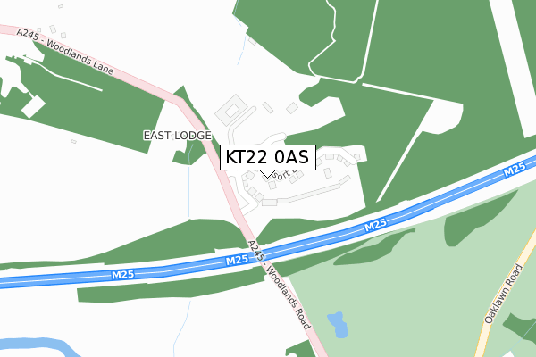
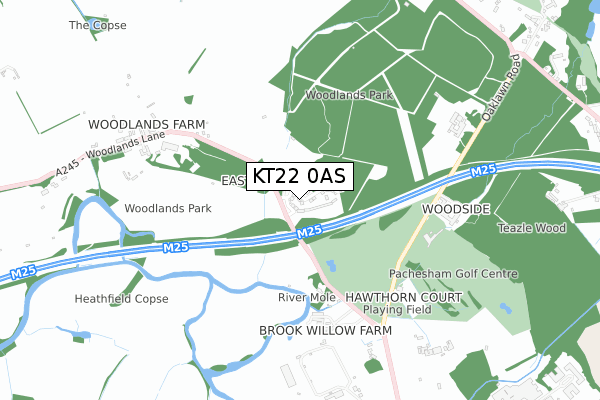
KT22 0AS maps


Source: OS Open Zoomstack (Ordnance Survey)
Licence: Open Government Licence (requires attribution)
Attribution: Contains OS data © Crown copyright and database right 2025
Source: Open Postcode GeoLicence: Open Government Licence (requires attribution)
Attribution: Contains OS data © Crown copyright and database right 2025; Contains Royal Mail data © Royal Mail copyright and database right 2025; Source: Office for National Statistics licensed under the Open Government Licence v.3.0
KT22 0AS geodata
| Easting | 514798 |
| Northing | 158564 |
| Latitude | 51.314615 |
| Longitude | -0.354189 |
Where is KT22 0AS?
| Country | England |
| Postcode District | KT22 |
Politics
| Ward | Leatherhead North |
|---|
| Constituency | Mole Valley |
|---|
Transport
Nearest bus stops to KT22 0AS
| Oxshott Mead (Leatherhead Road) | Oxshott | 1,043m |
| Oxshott Mead (Leatherhead Road) | Oxshott | 1,058m |
| Pachesham Park (Oxshott Road) | Pachesham Park | 1,171m |
| Charlwood Drive Merrylands (Leatherhead Road) | Oxshott | 1,178m |
| Charlwood Drive Merrylands (Leatherhead Road) | Oxshott | 1,181m |
Nearest railway stations to KT22 0AS
| Leatherhead Station | 2.3km |
| Cobham & Stoke d'Abernon Station | 2.5km |
| Oxshott Station | 2.5km |
Broadband
Broadband access in KT22 0AS (2020 data)
| Percentage of properties with Next Generation Access | 100.0% |
| Percentage of properties with Superfast Broadband | 35.7% |
| Percentage of properties with Ultrafast Broadband | 35.7% |
| Percentage of properties with Full Fibre Broadband | 35.7% |
Superfast Broadband is between 30Mbps and 300Mbps
Ultrafast Broadband is > 300Mbps
Broadband limitations in KT22 0AS (2020 data)
| Percentage of properties unable to receive 2Mbps | 0.0% |
| Percentage of properties unable to receive 5Mbps | 0.0% |
| Percentage of properties unable to receive 10Mbps | 42.9% |
| Percentage of properties unable to receive 30Mbps | 64.3% |
Deprivation
35.6% of English postcodes are less deprived than
KT22 0AS:
Food Standards Agency
Three nearest food hygiene ratings to KT22 0AS (metres)
Signature Dining @ Queen Elizabeth Foundation
Cobham Area Food Bank
Unit 6 Brook Willow Farm
499m
Pachesham Golf Centre
Pachesham Golf Centre
551m
➜ Get more ratings from the Food Standards Agency
Nearest post box to KT22 0AS
| | Last Collection | |
|---|
| Location | Mon-Fri | Sat | Distance |
|---|
| Woodlands Lane | 17:30 | 07:15 | 706m |
| Oaklawn Road | 17:00 | 11:30 | 1,034m |
| Wrens Hill | 17:15 | 11:30 | 1,405m |
KT22 0AS ITL and KT22 0AS LAU
The below table lists the International Territorial Level (ITL) codes (formerly Nomenclature of Territorial Units for Statistics (NUTS) codes) and Local Administrative Units (LAU) codes for KT22 0AS:
| ITL 1 Code | Name |
|---|
| TLJ | South East (England) |
| ITL 2 Code | Name |
|---|
| TLJ2 | Surrey, East and West Sussex |
| ITL 3 Code | Name |
|---|
| TLJ26 | East Surrey |
| LAU 1 Code | Name |
|---|
| E07000210 | Mole Valley |
KT22 0AS census areas
The below table lists the Census Output Area (OA), Lower Layer Super Output Area (LSOA), and Middle Layer Super Output Area (MSOA) for KT22 0AS:
| Code | Name |
|---|
| OA | E00155823 | |
|---|
| LSOA | E01030548 | Mole Valley 003A |
|---|
| MSOA | E02006364 | Mole Valley 003 |
|---|
Nearest postcodes to KT22 0AS


