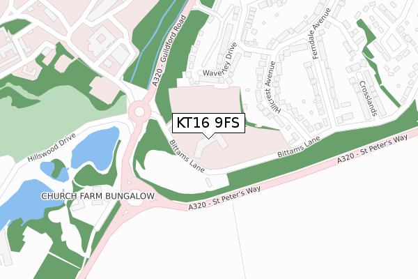
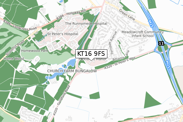
KT16 9FS is located in the Longcross, Lyne & Chertsey South electoral ward, within the local authority district of Runnymede and the English Parliamentary constituency of Runnymede and Weybridge. The Sub Integrated Care Board (ICB) Location is NHS Surrey Heartlands ICB - 92A and the police force is Surrey. This postcode has been in use since November 2017.


GetTheData
Source: OS Open Zoomstack (Ordnance Survey)
Licence: Open Government Licence (requires attribution)
Attribution: Contains OS data © Crown copyright and database right 2025
Source: Open Postcode Geo
Licence: Open Government Licence (requires attribution)
Attribution: Contains OS data © Crown copyright and database right 2025; Contains Royal Mail data © Royal Mail copyright and database right 2025; Source: Office for National Statistics licensed under the Open Government Licence v.3.0
| Easting | 502892 |
| Northing | 164865 |
| Latitude | 51.373528 |
| Longitude | -0.523142 |
GetTheData
Source: Open Postcode Geo
Licence: Open Government Licence
| Country | England |
| Postcode District | KT16 |
➜ See where KT16 is on a map ➜ Where is Chertsey? | |
GetTheData
Source: Land Registry Price Paid Data
Licence: Open Government Licence
| Ward | Longcross, Lyne & Chertsey South |
| Constituency | Runnymede And Weybridge |
GetTheData
Source: ONS Postcode Database
Licence: Open Government Licence
| St Peters Hospital (Guildford Road) | Chertsey South | 166m |
| St Peters Hospital (Hospital Grounds) | Chertsey South | 243m |
| St Peters Hospital (St Peters Hospital Grounds) | Chertsey South | 348m |
| Ferndale Avenue (Little Green Lane) | Chertsey South | 587m |
| Ferndale Avenue (Little Green Lane) | Chertsey South | 596m |
| Chertsey Station | 1.8km |
| Addlestone Station | 2.7km |
| Byfleet & New Haw Station | 3.9km |
GetTheData
Source: NaPTAN
Licence: Open Government Licence
| Percentage of properties with Next Generation Access | 100.0% |
| Percentage of properties with Superfast Broadband | 100.0% |
| Percentage of properties with Ultrafast Broadband | 0.0% |
| Percentage of properties with Full Fibre Broadband | 0.0% |
Superfast Broadband is between 30Mbps and 300Mbps
Ultrafast Broadband is > 300Mbps
| Percentage of properties unable to receive 2Mbps | 0.0% |
| Percentage of properties unable to receive 5Mbps | 0.0% |
| Percentage of properties unable to receive 10Mbps | 0.0% |
| Percentage of properties unable to receive 30Mbps | 0.0% |
GetTheData
Source: Ofcom
Licence: Ofcom Terms of Use (requires attribution)
GetTheData
Source: ONS Postcode Database
Licence: Open Government Licence


➜ Get more ratings from the Food Standards Agency
GetTheData
Source: Food Standards Agency
Licence: FSA terms & conditions
| Last Collection | |||
|---|---|---|---|
| Location | Mon-Fri | Sat | Distance |
| Botleys Park | 17:15 | 12:00 | 212m |
| Ferndown Avenue | 17:15 | 12:00 | 589m |
| Little Green Lane Post Office | 17:15 | 12:00 | 628m |
GetTheData
Source: Dracos
Licence: Creative Commons Attribution-ShareAlike
The below table lists the International Territorial Level (ITL) codes (formerly Nomenclature of Territorial Units for Statistics (NUTS) codes) and Local Administrative Units (LAU) codes for KT16 9FS:
| ITL 1 Code | Name |
|---|---|
| TLJ | South East (England) |
| ITL 2 Code | Name |
| TLJ2 | Surrey, East and West Sussex |
| ITL 3 Code | Name |
| TLJ25 | West Surrey |
| LAU 1 Code | Name |
| E07000212 | Runnymede |
GetTheData
Source: ONS Postcode Directory
Licence: Open Government Licence
The below table lists the Census Output Area (OA), Lower Layer Super Output Area (LSOA), and Middle Layer Super Output Area (MSOA) for KT16 9FS:
| Code | Name | |
|---|---|---|
| OA | E00156466 | |
| LSOA | E01030678 | Runnymede 008B |
| MSOA | E02006400 | Runnymede 008 |
GetTheData
Source: ONS Postcode Directory
Licence: Open Government Licence
| KT16 9RG | Bittams Lane | 101m |
| KT16 9PF | Waverley Drive | 147m |
| KT16 9RE | Hillcrest Avenue | 192m |
| KT16 9RF | Bittams Lane | 243m |
| KT16 9RU | Guildford Road | 253m |
| KT16 9PG | Waverley Drive | 299m |
| KT16 9RD | Hillcrest Avenue | 302m |
| KT16 9RA | Ferndale Avenue | 324m |
| KT16 9QZ | Bittams Lane | 342m |
| KT16 9PE | Waverley Drive | 352m |
GetTheData
Source: Open Postcode Geo; Land Registry Price Paid Data
Licence: Open Government Licence