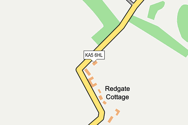
KA5 6HL is located in the Ballochmyle electoral ward, within the council area of East Ayrshire and the Scottish Parliamentary constituency of Kilmarnock and Loudoun. The Community Health Partnership is East Ayrshire Community Health Partnership and the police force is Scotland. This postcode has been in use since January 1980.


GetTheData
Source: OS OpenMap – Local (Ordnance Survey)
Source: OS VectorMap District (Ordnance Survey)
Licence: Open Government Licence (requires attribution)
| Easting | 252908 |
| Northing | 628175 |
| Latitude | 55.525086 |
| Longitude | -4.331688 |
GetTheData
Source: Open Postcode Geo
Licence: Open Government Licence
| Country | Scotland |
| Postcode District | KA5 |
➜ See where KA5 is on a map | |
GetTheData
Source: Land Registry Price Paid Data
Licence: Open Government Licence
| Ward | Ballochmyle |
| Constituency | Kilmarnock And Loudoun |
GetTheData
Source: ONS Postcode Database
Licence: Open Government Licence
Estimated total energy consumption in KA5 6HL by fuel type, 2015.
| Consumption (kWh) | 59,314 |
|---|---|
| Meter count | 9 |
| Mean (kWh/meter) | 6,590 |
| Median (kWh/meter) | 6,837 |
GetTheData
Source: Postcode level gas estimates: 2015 (experimental)
Source: Postcode level electricity estimates: 2015 (experimental)
Licence: Open Government Licence
GetTheData
Source: ONS Postcode Database
Licence: Open Government Licence

➜ Get more ratings from the Food Standards Agency
GetTheData
Source: Food Standards Agency
Licence: FSA terms & conditions
| Last Collection | |||
|---|---|---|---|
| Location | Mon-Fri | Sat | Distance |
| Cowan Place | 16:45 | 11:00 | 2,006m |
| St Cuthbert Street | 16:45 | 11:00 | 2,187m |
| Post Office | 16:45 | 11:00 | 2,318m |
GetTheData
Source: Dracos
Licence: Creative Commons Attribution-ShareAlike
The below table lists the International Territorial Level (ITL) codes (formerly Nomenclature of Territorial Units for Statistics (NUTS) codes) and Local Administrative Units (LAU) codes for KA5 6HL:
| ITL 1 Code | Name |
|---|---|
| TLM | Scotland |
| ITL 2 Code | Name |
| TLM9 | Southern Scotland |
| ITL 3 Code | Name |
| TLM93 | East Ayrshire and North Ayrshire mainland |
| LAU 1 Code | Name |
| S30000017 | East Ayrshire |
GetTheData
Source: ONS Postcode Directory
Licence: Open Government Licence
The below table lists the Census Output Area (OA), Lower Layer Super Output Area (LSOA), and Middle Layer Super Output Area (MSOA) for KA5 6HL:
| Code | Name | |
|---|---|---|
| OA | S00100656 | |
| LSOA | S01007904 | Cumnock Rural - 08 |
| MSOA | S02001481 | Cumnock Rural |
GetTheData
Source: ONS Postcode Directory
Licence: Open Government Licence