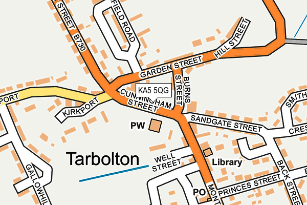
KA5 5QG is located in the Kyle electoral ward, within the council area of South Ayrshire and the Scottish Parliamentary constituency of Central Ayrshire. The Community Health Partnership is South Ayrshire Community Health Partnership and the police force is Scotland. This postcode has been in use since January 1980.


GetTheData
Source: OS OpenMap – Local (Ordnance Survey)
Source: OS VectorMap District (Ordnance Survey)
Licence: Open Government Licence (requires attribution)
| Easting | 243033 |
| Northing | 627224 |
| Latitude | 55.513473 |
| Longitude | -4.487422 |
GetTheData
Source: Open Postcode Geo
Licence: Open Government Licence
| Country | Scotland |
| Postcode District | KA5 |
➜ See where KA5 is on a map ➜ Where is Tarbolton? | |
GetTheData
Source: Land Registry Price Paid Data
Licence: Open Government Licence
| Ward | Kyle |
| Constituency | Central Ayrshire |
GetTheData
Source: ONS Postcode Database
Licence: Open Government Licence
| Cunningham Street (Garden Street) | Tarbolton | 80m |
| Cunningham Street (Montgomerie Street) | Tarbolton | 98m |
| Princes Street (Montgomerie Street) | Tarbolton | 198m |
| James Street (Montgomerie Street) | Tarbolton | 364m |
| James Street (Montgomerie Street) | Tarbolton | 407m |
GetTheData
Source: NaPTAN
Licence: Open Government Licence
| Percentage of properties with Next Generation Access | 100.0% |
| Percentage of properties with Superfast Broadband | 100.0% |
| Percentage of properties with Ultrafast Broadband | 0.0% |
| Percentage of properties with Full Fibre Broadband | 0.0% |
Superfast Broadband is between 30Mbps and 300Mbps
Ultrafast Broadband is > 300Mbps
| Percentage of properties unable to receive 2Mbps | 0.0% |
| Percentage of properties unable to receive 5Mbps | 0.0% |
| Percentage of properties unable to receive 10Mbps | 0.0% |
| Percentage of properties unable to receive 30Mbps | 0.0% |
GetTheData
Source: Ofcom
Licence: Ofcom Terms of Use (requires attribution)
GetTheData
Source: ONS Postcode Database
Licence: Open Government Licence


➜ Get more ratings from the Food Standards Agency
GetTheData
Source: Food Standards Agency
Licence: FSA terms & conditions
| Last Collection | |||
|---|---|---|---|
| Location | Mon-Fri | Sat | Distance |
| Post Office | 16:00 | 10:00 | 212m |
| Gallowhill Avenue | 16:00 | 10:00 | 281m |
| Mansefield Road | 16:00 | 10:00 | 496m |
GetTheData
Source: Dracos
Licence: Creative Commons Attribution-ShareAlike
The below table lists the International Territorial Level (ITL) codes (formerly Nomenclature of Territorial Units for Statistics (NUTS) codes) and Local Administrative Units (LAU) codes for KA5 5QG:
| ITL 1 Code | Name |
|---|---|
| TLM | Scotland |
| ITL 2 Code | Name |
| TLM9 | Southern Scotland |
| ITL 3 Code | Name |
| TLM94 | South Ayrshire |
| LAU 1 Code | Name |
| S30000024 | South Ayrshire |
GetTheData
Source: ONS Postcode Directory
Licence: Open Government Licence
The below table lists the Census Output Area (OA), Lower Layer Super Output Area (LSOA), and Middle Layer Super Output Area (MSOA) for KA5 5QG:
| Code | Name | |
|---|---|---|
| OA | S00130086 | |
| LSOA | S01012541 | Annbank, Mossblown and Tarbolton - the Coalfields - 07 |
| MSOA | S02002349 | Annbank, Mossblown and Tarbolton - the Coalfields |
GetTheData
Source: ONS Postcode Directory
Licence: Open Government Licence