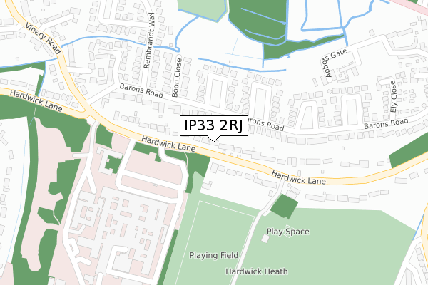
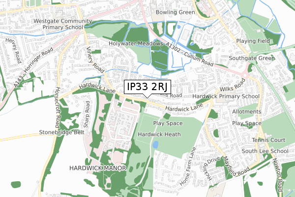
IP33 2RJ is located in the Southgate electoral ward, within the local authority district of West Suffolk and the English Parliamentary constituency of Bury St Edmunds. The Sub Integrated Care Board (ICB) Location is NHS Suffolk and North East Essex ICB - 07K and the police force is Suffolk. This postcode has been in use since May 2019.


GetTheData
Source: OS Open Zoomstack (Ordnance Survey)
Licence: Open Government Licence (requires attribution)
Attribution: Contains OS data © Crown copyright and database right 2025
Source: Open Postcode Geo
Licence: Open Government Licence (requires attribution)
Attribution: Contains OS data © Crown copyright and database right 2025; Contains Royal Mail data © Royal Mail copyright and database right 2025; Source: Office for National Statistics licensed under the Open Government Licence v.3.0
| Easting | 585116 |
| Northing | 262400 |
| Latitude | 52.228695 |
| Longitude | 0.709111 |
GetTheData
Source: Open Postcode Geo
Licence: Open Government Licence
| Country | England |
| Postcode District | IP33 |
➜ See where IP33 is on a map | |
GetTheData
Source: Land Registry Price Paid Data
Licence: Open Government Licence
| Ward | Southgate |
| Constituency | Bury St Edmunds |
GetTheData
Source: ONS Postcode Database
Licence: Open Government Licence
| West Suffolk Hospital (On Site) | Bury St Edmunds | 439m |
| West Suffolk Hospital (Hardwick Lane) | Bury St Edmunds | 546m |
| West Suffolk Hospital (Hardwick Lane) | Bury St Edmunds | 549m |
| The Lodge (Hardwick Lane) | Bury St Edmunds | 578m |
| The Lodge (Hardwick Lane) | Bury St Edmunds | 586m |
| Bury St Edmunds Station | 2.8km |
GetTheData
Source: NaPTAN
Licence: Open Government Licence
GetTheData
Source: ONS Postcode Database
Licence: Open Government Licence


➜ Get more ratings from the Food Standards Agency
GetTheData
Source: Food Standards Agency
Licence: FSA terms & conditions
| Last Collection | |||
|---|---|---|---|
| Location | Mon-Fri | Sat | Distance |
| Hardwick Lane | 17:00 | 11:30 | 571m |
| Barons Road | 17:00 | 11:30 | 640m |
| Mayfield Road | 17:15 | 11:30 | 783m |
GetTheData
Source: Dracos
Licence: Creative Commons Attribution-ShareAlike
The below table lists the International Territorial Level (ITL) codes (formerly Nomenclature of Territorial Units for Statistics (NUTS) codes) and Local Administrative Units (LAU) codes for IP33 2RJ:
| ITL 1 Code | Name |
|---|---|
| TLH | East |
| ITL 2 Code | Name |
| TLH1 | East Anglia |
| ITL 3 Code | Name |
| TLH14 | Suffolk CC |
| LAU 1 Code | Name |
| E07000245 | West Suffolk |
GetTheData
Source: ONS Postcode Directory
Licence: Open Government Licence
The below table lists the Census Output Area (OA), Lower Layer Super Output Area (LSOA), and Middle Layer Super Output Area (MSOA) for IP33 2RJ:
| Code | Name | |
|---|---|---|
| OA | E00153679 | |
| LSOA | E01030142 | St Edmundsbury 009B |
| MSOA | E02006281 | St Edmundsbury 009 |
GetTheData
Source: ONS Postcode Directory
Licence: Open Government Licence
| IP33 2QU | Hardwick Park Gardens | 351m |
| IP33 2QL | Home Farm Lane | 506m |
| IP33 2NB | Sharp Road | 546m |
| IP33 2RA | Hardwick Lane | 552m |
| IP33 2TH | Links Close | 613m |
| IP33 2PZ | Farm Close | 621m |
| IP33 2LF | Barons Road | 624m |
| IP33 2PY | Croft Rise | 632m |
| IP33 2PX | Hickling Drive | 645m |
| IP33 2TG | Broadland Road | 655m |
GetTheData
Source: Open Postcode Geo; Land Registry Price Paid Data
Licence: Open Government Licence