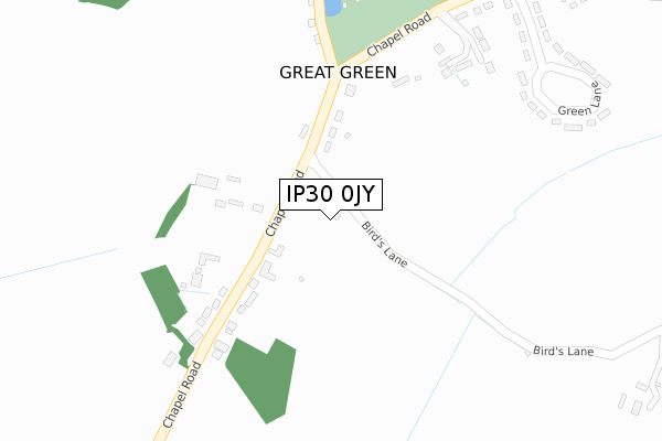
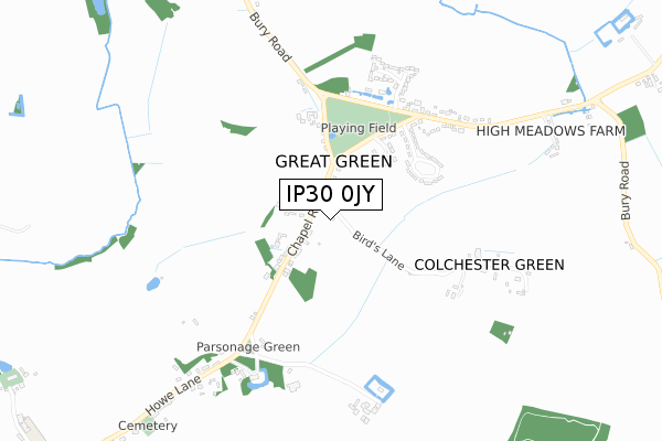
IP30 0JY is located in the Lavenham electoral ward, within the local authority district of Babergh and the English Parliamentary constituency of South Suffolk. The Sub Integrated Care Board (ICB) Location is NHS Suffolk and North East Essex ICB - 07K and the police force is Suffolk. This postcode has been in use since June 2019.


GetTheData
Source: OS Open Zoomstack (Ordnance Survey)
Licence: Open Government Licence (requires attribution)
Attribution: Contains OS data © Crown copyright and database right 2025
Source: Open Postcode Geo
Licence: Open Government Licence (requires attribution)
Attribution: Contains OS data © Crown copyright and database right 2025; Contains Royal Mail data © Royal Mail copyright and database right 2025; Source: Office for National Statistics licensed under the Open Government Licence v.3.0
| Easting | 591606 |
| Northing | 255583 |
| Latitude | 52.165263 |
| Longitude | 0.800168 |
GetTheData
Source: Open Postcode Geo
Licence: Open Government Licence
| Country | England |
| Postcode District | IP30 |
➜ See where IP30 is on a map | |
GetTheData
Source: Land Registry Price Paid Data
Licence: Open Government Licence
| Ward | Lavenham |
| Constituency | South Suffolk |
GetTheData
Source: ONS Postcode Database
Licence: Open Government Licence
| Chapel Road (Unclassified) | Great Green | 248m |
| Chapel Road (Unclassified) | Great Green | 249m |
| Dukes Meadow | Great Green | 490m |
| Dukes Meadow | Great Green | 494m |
| Memorial (Stows Hill) | Cockfield | 1,389m |
GetTheData
Source: NaPTAN
Licence: Open Government Licence
GetTheData
Source: ONS Postcode Database
Licence: Open Government Licence

➜ Get more ratings from the Food Standards Agency
GetTheData
Source: Food Standards Agency
Licence: FSA terms & conditions
| Last Collection | |||
|---|---|---|---|
| Location | Mon-Fri | Sat | Distance |
| Great Green | 16:45 | 07:30 | 239m |
| Post Office, Howe Lane | 17:00 | 11:15 | 1,204m |
| The Station | 09:00 | 07:30 | 1,580m |
GetTheData
Source: Dracos
Licence: Creative Commons Attribution-ShareAlike
The below table lists the International Territorial Level (ITL) codes (formerly Nomenclature of Territorial Units for Statistics (NUTS) codes) and Local Administrative Units (LAU) codes for IP30 0JY:
| ITL 1 Code | Name |
|---|---|
| TLH | East |
| ITL 2 Code | Name |
| TLH1 | East Anglia |
| ITL 3 Code | Name |
| TLH14 | Suffolk CC |
| LAU 1 Code | Name |
| E07000200 | Babergh |
GetTheData
Source: ONS Postcode Directory
Licence: Open Government Licence
The below table lists the Census Output Area (OA), Lower Layer Super Output Area (LSOA), and Middle Layer Super Output Area (MSOA) for IP30 0JY:
| Code | Name | |
|---|---|---|
| OA | E00152413 | |
| LSOA | E01029907 | Babergh 001C |
| MSOA | E02006227 | Babergh 001 |
GetTheData
Source: ONS Postcode Directory
Licence: Open Government Licence
| IP30 0HE | Chapel Road | 155m |
| IP30 0HQ | Great Green | 306m |
| IP30 0HL | Green Lane | 437m |
| IP30 0HJ | Great Green | 479m |
| IP30 0HN | Great Green | 530m |
| IP30 0HB | Parsonage Green | 540m |
| IP30 0HR | Dukes Meadow | 574m |
| IP30 0HG | Colchester Green | 607m |
| IP30 0HW | Felsham Road | 640m |
| IP30 0HH | 862m |
GetTheData
Source: Open Postcode Geo; Land Registry Price Paid Data
Licence: Open Government Licence