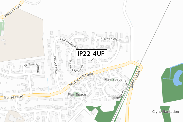
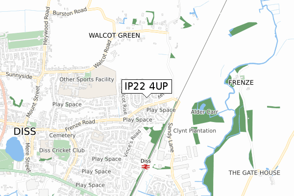
IP22 4UP is located in the Diss & Roydon electoral ward, within the local authority district of South Norfolk and the English Parliamentary constituency of South Norfolk. The Sub Integrated Care Board (ICB) Location is NHS Norfolk and Waveney ICB - 26A and the police force is Norfolk. This postcode has been in use since April 2019.


GetTheData
Source: OS Open Zoomstack (Ordnance Survey)
Licence: Open Government Licence (requires attribution)
Attribution: Contains OS data © Crown copyright and database right 2025
Source: Open Postcode Geo
Licence: Open Government Licence (requires attribution)
Attribution: Contains OS data © Crown copyright and database right 2025; Contains Royal Mail data © Royal Mail copyright and database right 2025; Source: Office for National Statistics licensed under the Open Government Licence v.3.0
| Easting | 612734 |
| Northing | 280250 |
| Latitude | 52.378971 |
| Longitude | 1.124158 |
GetTheData
Source: Open Postcode Geo
Licence: Open Government Licence
| Country | England |
| Postcode District | IP22 |
➜ See where IP22 is on a map ➜ Where is Diss? | |
GetTheData
Source: Land Registry Price Paid Data
Licence: Open Government Licence
| Ward | Diss & Roydon |
| Constituency | South Norfolk |
GetTheData
Source: ONS Postcode Database
Licence: Open Government Licence
| Falcon Avenue | Diss | 205m |
| Field House Gardens (Frenze Road) | Diss | 427m |
| Field House Gardens (Frenze Road) | Diss | 460m |
| High School (Walcot Road) | Diss | 669m |
| Stores (Skelton Road) | Diss | 750m |
| Diss Station | 0.6km |
GetTheData
Source: NaPTAN
Licence: Open Government Licence
| Percentage of properties with Next Generation Access | 100.0% |
| Percentage of properties with Superfast Broadband | 100.0% |
| Percentage of properties with Ultrafast Broadband | 0.0% |
| Percentage of properties with Full Fibre Broadband | 0.0% |
Superfast Broadband is between 30Mbps and 300Mbps
Ultrafast Broadband is > 300Mbps
| Percentage of properties unable to receive 2Mbps | 0.0% |
| Percentage of properties unable to receive 5Mbps | 0.0% |
| Percentage of properties unable to receive 10Mbps | 0.0% |
| Percentage of properties unable to receive 30Mbps | 0.0% |
GetTheData
Source: Ofcom
Licence: Ofcom Terms of Use (requires attribution)
GetTheData
Source: ONS Postcode Database
Licence: Open Government Licence


➜ Get more ratings from the Food Standards Agency
GetTheData
Source: Food Standards Agency
Licence: FSA terms & conditions
| Last Collection | |||
|---|---|---|---|
| Location | Mon-Fri | Sat | Distance |
| Walcot Rise | 17:30 | 10:15 | 244m |
| Railway Station | 17:30 | 12:10 | 576m |
| Vinces Road | 17:05 | 09:45 | 817m |
GetTheData
Source: Dracos
Licence: Creative Commons Attribution-ShareAlike
The below table lists the International Territorial Level (ITL) codes (formerly Nomenclature of Territorial Units for Statistics (NUTS) codes) and Local Administrative Units (LAU) codes for IP22 4UP:
| ITL 1 Code | Name |
|---|---|
| TLH | East |
| ITL 2 Code | Name |
| TLH1 | East Anglia |
| ITL 3 Code | Name |
| TLH17 | Breckland and South Norfolk |
| LAU 1 Code | Name |
| E07000149 | South Norfolk |
GetTheData
Source: ONS Postcode Directory
Licence: Open Government Licence
The below table lists the Census Output Area (OA), Lower Layer Super Output Area (LSOA), and Middle Layer Super Output Area (MSOA) for IP22 4UP:
| Code | Name | |
|---|---|---|
| OA | E00136765 | |
| LSOA | E01033539 | South Norfolk 015G |
| MSOA | E02005611 | South Norfolk 015 |
GetTheData
Source: ONS Postcode Directory
Licence: Open Government Licence
| IP22 4PQ | Hawk Crescent | 97m |
| IP22 4UB | Frenze Hall Lane | 119m |
| IP22 4PE | Falcon Avenue | 128m |
| IP22 4UG | Windsor Court | 133m |
| IP22 4ZD | Sycamore Way | 147m |
| IP22 4XW | Frenze Hall Lane | 168m |
| IP22 4UE | Prince William Way | 168m |
| IP22 4PG | Peregrine Close | 169m |
| IP22 4PD | Walcot Rise | 176m |
| IP22 4UD | King George Mews | 193m |
GetTheData
Source: Open Postcode Geo; Land Registry Price Paid Data
Licence: Open Government Licence