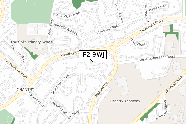
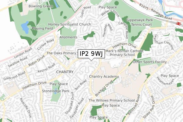
IP2 9WJ is located in the Sprites electoral ward, within the local authority district of Ipswich and the English Parliamentary constituency of Ipswich. The Sub Integrated Care Board (ICB) Location is NHS Suffolk and North East Essex ICB - 06L and the police force is Suffolk. This postcode has been in use since March 2018.


GetTheData
Source: OS Open Zoomstack (Ordnance Survey)
Licence: Open Government Licence (requires attribution)
Attribution: Contains OS data © Crown copyright and database right 2025
Source: Open Postcode Geo
Licence: Open Government Licence (requires attribution)
Attribution: Contains OS data © Crown copyright and database right 2025; Contains Royal Mail data © Royal Mail copyright and database right 2025; Source: Office for National Statistics licensed under the Open Government Licence v.3.0
| Easting | 614488 |
| Northing | 243286 |
| Latitude | 52.046461 |
| Longitude | 1.126486 |
GetTheData
Source: Open Postcode Geo
Licence: Open Government Licence
| Country | England |
| Postcode District | IP2 |
➜ See where IP2 is on a map ➜ Where is Ipswich? | |
GetTheData
Source: Land Registry Price Paid Data
Licence: Open Government Licence
| Ward | Sprites |
| Constituency | Ipswich |
GetTheData
Source: ONS Postcode Database
Licence: Open Government Licence
| Sheldrake Drive (Mallard Way) | Chantry | 143m |
| Sheldrake Drive (Mallard Way) | Chantry | 155m |
| Sorrel Close (Hawthorn Drive) | Chantry | 184m |
| Aster Road (Hawthorn Drive) | Chantry | 201m |
| Sorrel Close (Hawthorn Drive) | Chantry | 201m |
| Ipswich Station | 1.3km |
| Derby Road (Ipswich) Station | 3.9km |
| Westerfield Station | 4.7km |
GetTheData
Source: NaPTAN
Licence: Open Government Licence
| Percentage of properties with Next Generation Access | 100.0% |
| Percentage of properties with Superfast Broadband | 100.0% |
| Percentage of properties with Ultrafast Broadband | 0.0% |
| Percentage of properties with Full Fibre Broadband | 0.0% |
Superfast Broadband is between 30Mbps and 300Mbps
Ultrafast Broadband is > 300Mbps
| Median download speed | 37.9Mbps |
| Average download speed | 31.6Mbps |
| Maximum download speed | 71.54Mbps |
| Median upload speed | 10.0Mbps |
| Average upload speed | 8.7Mbps |
| Maximum upload speed | 19.53Mbps |
| Percentage of properties unable to receive 2Mbps | 0.0% |
| Percentage of properties unable to receive 5Mbps | 0.0% |
| Percentage of properties unable to receive 10Mbps | 0.0% |
| Percentage of properties unable to receive 30Mbps | 0.0% |
GetTheData
Source: Ofcom
Licence: Ofcom Terms of Use (requires attribution)
GetTheData
Source: ONS Postcode Database
Licence: Open Government Licence


➜ Get more ratings from the Food Standards Agency
GetTheData
Source: Food Standards Agency
Licence: FSA terms & conditions
| Last Collection | |||
|---|---|---|---|
| Location | Mon-Fri | Sat | Distance |
| Stoke Park Drive | 17:30 | 12:00 | 759m |
| 2 Iris Close | 17:30 | 12:30 | 765m |
| Holcolme Crescent | 17:30 | 12:00 | 816m |
GetTheData
Source: Dracos
Licence: Creative Commons Attribution-ShareAlike
The below table lists the International Territorial Level (ITL) codes (formerly Nomenclature of Territorial Units for Statistics (NUTS) codes) and Local Administrative Units (LAU) codes for IP2 9WJ:
| ITL 1 Code | Name |
|---|---|
| TLH | East |
| ITL 2 Code | Name |
| TLH1 | East Anglia |
| ITL 3 Code | Name |
| TLH14 | Suffolk CC |
| LAU 1 Code | Name |
| E07000202 | Ipswich |
GetTheData
Source: ONS Postcode Directory
Licence: Open Government Licence
The below table lists the Census Output Area (OA), Lower Layer Super Output Area (LSOA), and Middle Layer Super Output Area (MSOA) for IP2 9WJ:
| Code | Name | |
|---|---|---|
| OA | E00152976 | |
| LSOA | E01030012 | Ipswich 013A |
| MSOA | E02006257 | Ipswich 013 |
GetTheData
Source: ONS Postcode Directory
Licence: Open Government Licence
| IP2 9NY | Sheldrake Drive | 40m |
| IP2 9NZ | Widgeon Close | 63m |
| IP2 0QD | Hawthorn Drive | 66m |
| IP2 0QB | Hawthorn Drive | 90m |
| IP2 0QE | Hawthorn Drive | 100m |
| IP2 9LS | Mallard Way | 106m |
| IP2 0QA | Marigold Avenue | 120m |
| IP2 0PX | Pimpernel Road | 127m |
| IP2 0QF | Hawthorn Drive | 148m |
| IP2 0PU | Larkspur Road | 148m |
GetTheData
Source: Open Postcode Geo; Land Registry Price Paid Data
Licence: Open Government Licence