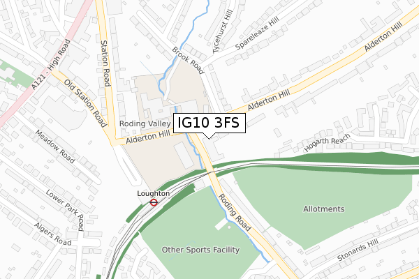
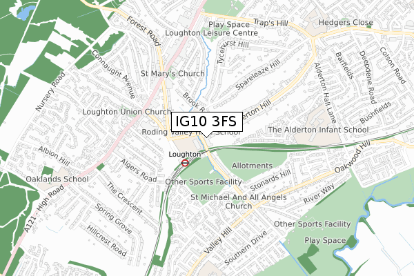
IG10 3FS is located in the Loughton St Mary's electoral ward, within the local authority district of Epping Forest and the English Parliamentary constituency of Epping Forest. The Sub Integrated Care Board (ICB) Location is NHS Hertfordshire and West Essex ICB - 07H and the police force is Essex. This postcode has been in use since August 2017.


GetTheData
Source: OS Open Zoomstack (Ordnance Survey)
Licence: Open Government Licence (requires attribution)
Attribution: Contains OS data © Crown copyright and database right 2025
Source: Open Postcode Geo
Licence: Open Government Licence (requires attribution)
Attribution: Contains OS data © Crown copyright and database right 2025; Contains Royal Mail data © Royal Mail copyright and database right 2025; Source: Office for National Statistics licensed under the Open Government Licence v.3.0
| Easting | 542463 |
| Northing | 195773 |
| Latitude | 51.642721 |
| Longitude | 0.057511 |
GetTheData
Source: Open Postcode Geo
Licence: Open Government Licence
| Country | England |
| Postcode District | IG10 |
➜ See where IG10 is on a map ➜ Where is Loughton? | |
GetTheData
Source: Land Registry Price Paid Data
Licence: Open Government Licence
| Ward | Loughton St Mary's |
| Constituency | Epping Forest |
GetTheData
Source: ONS Postcode Database
Licence: Open Government Licence
| Roding Road | Loughton | 117m |
| Brook Road (Alderton Hill) | Loughton | 162m |
| Roding Road | Loughton | 183m |
| Brook Road (Alderton Hill) | Loughton | 184m |
| Loughton Station (Station Approach) | Loughton | 187m |
| Loughton Underground Station | Loughton | 199m |
| Chingford Station | 3.5km |
| Highams Park Station | 5.5km |
GetTheData
Source: NaPTAN
Licence: Open Government Licence
| Percentage of properties with Next Generation Access | 100.0% |
| Percentage of properties with Superfast Broadband | 100.0% |
| Percentage of properties with Ultrafast Broadband | 0.0% |
| Percentage of properties with Full Fibre Broadband | 0.0% |
Superfast Broadband is between 30Mbps and 300Mbps
Ultrafast Broadband is > 300Mbps
| Median download speed | 55.0Mbps |
| Average download speed | 48.6Mbps |
| Maximum download speed | 80.00Mbps |
| Median upload speed | 10.0Mbps |
| Average upload speed | 10.0Mbps |
| Maximum upload speed | 20.00Mbps |
| Percentage of properties unable to receive 2Mbps | 0.0% |
| Percentage of properties unable to receive 5Mbps | 0.0% |
| Percentage of properties unable to receive 10Mbps | 0.0% |
| Percentage of properties unable to receive 30Mbps | 0.0% |
GetTheData
Source: Ofcom
Licence: Ofcom Terms of Use (requires attribution)
GetTheData
Source: ONS Postcode Database
Licence: Open Government Licence


➜ Get more ratings from the Food Standards Agency
GetTheData
Source: Food Standards Agency
Licence: FSA terms & conditions
| Last Collection | |||
|---|---|---|---|
| Location | Mon-Fri | Sat | Distance |
| Loughton Station | 18:30 | 12:00 | 204m |
| Brook Road | 17:15 | 12:00 | 206m |
| Alderton Hill | 17:15 | 12:00 | 531m |
GetTheData
Source: Dracos
Licence: Creative Commons Attribution-ShareAlike
The below table lists the International Territorial Level (ITL) codes (formerly Nomenclature of Territorial Units for Statistics (NUTS) codes) and Local Administrative Units (LAU) codes for IG10 3FS:
| ITL 1 Code | Name |
|---|---|
| TLH | East |
| ITL 2 Code | Name |
| TLH3 | Essex |
| ITL 3 Code | Name |
| TLH35 | West Essex |
| LAU 1 Code | Name |
| E07000072 | Epping Forest |
GetTheData
Source: ONS Postcode Directory
Licence: Open Government Licence
The below table lists the Census Output Area (OA), Lower Layer Super Output Area (LSOA), and Middle Layer Super Output Area (MSOA) for IG10 3FS:
| Code | Name | |
|---|---|---|
| OA | E00110691 | |
| LSOA | E01021789 | Epping Forest 012D |
| MSOA | E02004538 | Epping Forest 012 |
GetTheData
Source: ONS Postcode Directory
Licence: Open Government Licence
| IG10 1BP | Brook Road | 126m |
| IG10 3ED | Roding Road | 176m |
| IG10 4NP | Station Road | 200m |
| IG10 3HP | Hogarth Reach | 244m |
| IG10 1BW | Brook Road | 271m |
| IG10 4NX | Station Road | 284m |
| IG10 4NZ | Station Road | 309m |
| IG10 1BN | Brooklyn Avenue | 323m |
| IG10 1BX | Tycehurst Hill | 323m |
| IG10 1BU | Tycehurst Hill | 326m |
GetTheData
Source: Open Postcode Geo; Land Registry Price Paid Data
Licence: Open Government Licence