HX3 6BY maps, stats, and open data
- Home
- Postcode
- HX
- HX3
- HX3 6
HX3 6BY is located in the Northowram and Shelf electoral ward, within the metropolitan district of Calderdale and the English Parliamentary constituency of Halifax. The Sub Integrated Care Board (ICB) Location is NHS West Yorkshire ICB - 02T and the police force is West Yorkshire. This postcode has been in use since November 2017.
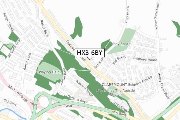
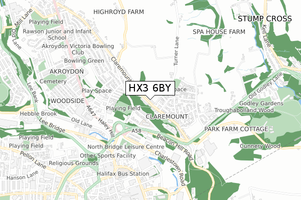
HX3 6BY maps


Source: OS Open Zoomstack (Ordnance Survey)
Licence: Open Government Licence (requires attribution)
Attribution: Contains OS data © Crown copyright and database right 2025
Source: Open Postcode GeoLicence: Open Government Licence (requires attribution)
Attribution: Contains OS data © Crown copyright and database right 2025; Contains Royal Mail data © Royal Mail copyright and database right 2025; Source: Office for National Statistics licensed under the Open Government Licence v.3.0
HX3 6BY geodata
| Easting | 409654 |
| Northing | 426018 |
| Latitude | 53.730485 |
| Longitude | -1.855150 |
Where is HX3 6BY?
| Country | England |
| Postcode District | HX3 |
Politics
| Ward | Northowram And Shelf |
|---|
| Constituency | Halifax |
|---|
Transport
Nearest bus stops to HX3 6BY
| The Belgrave Social Club (Claremount Road) | Claremount | 81m |
| The Belgrave Social Club (Claremount Road) | Claremount | 104m |
| The Arches (Claremount Road) | Claremount | 123m |
| The Arches (Claremount Road) | Claremount | 140m |
| Belgrave Avenue Belgrave Gdns (Belgrave Avenue) | Claremount | 252m |
Nearest railway stations to HX3 6BY
| Halifax Station | 1.1km |
| Sowerby Bridge Station | 4.2km |
Broadband
Broadband access in HX3 6BY (2020 data)
| Percentage of properties with Next Generation Access | 100.0% |
| Percentage of properties with Superfast Broadband | 100.0% |
| Percentage of properties with Ultrafast Broadband | 0.0% |
| Percentage of properties with Full Fibre Broadband | 0.0% |
Superfast Broadband is between 30Mbps and 300Mbps
Ultrafast Broadband is > 300Mbps
Broadband speed in HX3 6BY (2019 data)
Download
| Median download speed | 18.9Mbps |
| Average download speed | 35.5Mbps |
| Maximum download speed | 80.00Mbps |
Upload
| Median upload speed | 1.3Mbps |
| Average upload speed | 7.0Mbps |
| Maximum upload speed | 19.53Mbps |
Broadband limitations in HX3 6BY (2020 data)
| Percentage of properties unable to receive 2Mbps | 0.0% |
| Percentage of properties unable to receive 5Mbps | 0.0% |
| Percentage of properties unable to receive 10Mbps | 0.0% |
| Percentage of properties unable to receive 30Mbps | 0.0% |
Deprivation
58.9% of English postcodes are less deprived than
HX3 6BY:
Food Standards Agency
Three nearest food hygiene ratings to HX3 6BY (metres)
Belgrave Social Club
St Thomas The Apostle
Rosie's Deli
➜ Get more ratings from the Food Standards Agency
Nearest post box to HX3 6BY
| | Last Collection | |
|---|
| Location | Mon-Fri | Sat | Distance |
|---|
| North Bridge Business Box | 18:30 | 11:45 | 537m |
| North Bridge | 18:30 | 12:00 | 538m |
| 115 Haley Hill | 17:30 | 11:45 | 602m |
HX3 6BY ITL and HX3 6BY LAU
The below table lists the International Territorial Level (ITL) codes (formerly Nomenclature of Territorial Units for Statistics (NUTS) codes) and Local Administrative Units (LAU) codes for HX3 6BY:
| ITL 1 Code | Name |
|---|
| TLE | Yorkshire and The Humber |
| ITL 2 Code | Name |
|---|
| TLE4 | West Yorkshire |
| ITL 3 Code | Name |
|---|
| TLE44 | Calderdale and Kirklees |
| LAU 1 Code | Name |
|---|
| E08000033 | Calderdale |
HX3 6BY census areas
The below table lists the Census Output Area (OA), Lower Layer Super Output Area (LSOA), and Middle Layer Super Output Area (MSOA) for HX3 6BY:
| Code | Name |
|---|
| OA | E00055107 | |
|---|
| LSOA | E01010934 | Calderdale 008A |
|---|
| MSOA | E02002251 | Calderdale 008 |
|---|
Nearest postcodes to HX3 6BY


