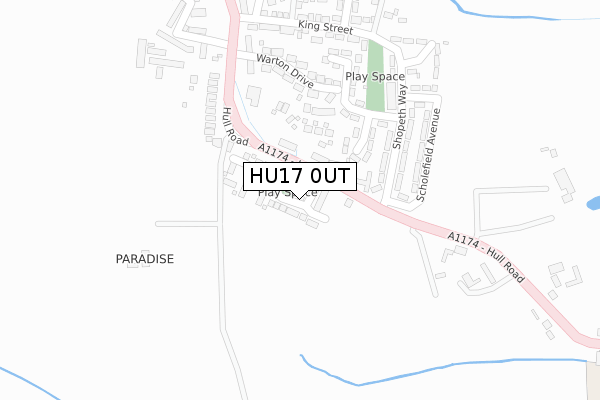
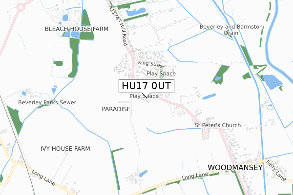
HU17 0UT is located in the Minster and Woodmansey electoral ward, within the unitary authority of East Riding of Yorkshire and the English Parliamentary constituency of Beverley and Holderness. The Sub Integrated Care Board (ICB) Location is NHS Humber and North Yorkshire ICB - 02Y and the police force is Humberside. This postcode has been in use since March 2018.


GetTheData
Source: OS Open Zoomstack (Ordnance Survey)
Licence: Open Government Licence (requires attribution)
Attribution: Contains OS data © Crown copyright and database right 2025
Source: Open Postcode Geo
Licence: Open Government Licence (requires attribution)
Attribution: Contains OS data © Crown copyright and database right 2025; Contains Royal Mail data © Royal Mail copyright and database right 2025; Source: Office for National Statistics licensed under the Open Government Licence v.3.0
| Easting | 505571 |
| Northing | 437706 |
| Latitude | 53.824931 |
| Longitude | -0.397644 |
GetTheData
Source: Open Postcode Geo
Licence: Open Government Licence
| Country | England |
| Postcode District | HU17 |
➜ See where HU17 is on a map ➜ Where is Woodmansey? | |
GetTheData
Source: Land Registry Price Paid Data
Licence: Open Government Licence
| Ward | Minster And Woodmansey |
| Constituency | Beverley And Holderness |
GetTheData
Source: ONS Postcode Database
Licence: Open Government Licence
2022 29 JUL £320,000 |
2020 10 SEP £290,000 |
2, PARADISE DRIVE, WOODMANSEY, BEVERLEY, HU17 0UT 2019 12 JUL £265,000 |
26, PARADISE DRIVE, WOODMANSEY, BEVERLEY, HU17 0UT 2019 22 MAR £355,000 |
29, PARADISE DRIVE, WOODMANSEY, BEVERLEY, HU17 0UT 2019 18 MAR £255,000 |
30, PARADISE DRIVE, WOODMANSEY, BEVERLEY, HU17 0UT 2019 15 FEB £255,000 |
2019 25 JAN £285,000 |
21, PARADISE DRIVE, WOODMANSEY, BEVERLEY, HU17 0UT 2018 7 DEC £320,000 |
15, PARADISE DRIVE, WOODMANSEY, BEVERLEY, HU17 0UT 2018 8 OCT £320,000 |
20, PARADISE DRIVE, WOODMANSEY, BEVERLEY, HU17 0UT 2018 27 JUL £340,000 |
GetTheData
Source: HM Land Registry Price Paid Data
Licence: Contains HM Land Registry data © Crown copyright and database right 2025. This data is licensed under the Open Government Licence v3.0.
| Woodmansey Hull Road (Hull Road) | Woodmansey | 105m |
| Woodmansey Hull Road (Hull Road) | Woodmansey | 206m |
| Woodmansey Hull Road (Hull Road) | Woodmansey | 260m |
| Woodmansey Beverley Rd (Hull Road) | Woodmansey | 273m |
| Woodmansey Hull Road (Hull Road) | Woodmansey | 577m |
| Beverley Station | 2.6km |
| Cottingham Station | 4.8km |
GetTheData
Source: NaPTAN
Licence: Open Government Licence
| Percentage of properties with Next Generation Access | 100.0% |
| Percentage of properties with Superfast Broadband | 100.0% |
| Percentage of properties with Ultrafast Broadband | 100.0% |
| Percentage of properties with Full Fibre Broadband | 100.0% |
Superfast Broadband is between 30Mbps and 300Mbps
Ultrafast Broadband is > 300Mbps
| Median download speed | 225.0Mbps |
| Average download speed | 249.4Mbps |
| Maximum download speed | 400.00Mbps |
| Median upload speed | 2.5Mbps |
| Average upload speed | 14.6Mbps |
| Maximum upload speed | 35.00Mbps |
| Percentage of properties unable to receive 2Mbps | 0.0% |
| Percentage of properties unable to receive 5Mbps | 0.0% |
| Percentage of properties unable to receive 10Mbps | 0.0% |
| Percentage of properties unable to receive 30Mbps | 0.0% |
GetTheData
Source: Ofcom
Licence: Ofcom Terms of Use (requires attribution)
GetTheData
Source: ONS Postcode Database
Licence: Open Government Licence


➜ Get more ratings from the Food Standards Agency
GetTheData
Source: Food Standards Agency
Licence: FSA terms & conditions
| Last Collection | |||
|---|---|---|---|
| Location | Mon-Fri | Sat | Distance |
| Woodmansey Post Office | 17:30 | 12:45 | 240m |
| Hull Road | 18:00 | 12:45 | 962m |
| Beckview Road | 17:45 | 12:30 | 1,935m |
GetTheData
Source: Dracos
Licence: Creative Commons Attribution-ShareAlike
The below table lists the International Territorial Level (ITL) codes (formerly Nomenclature of Territorial Units for Statistics (NUTS) codes) and Local Administrative Units (LAU) codes for HU17 0UT:
| ITL 1 Code | Name |
|---|---|
| TLE | Yorkshire and The Humber |
| ITL 2 Code | Name |
| TLE1 | East Yorkshire and Northern Lincolnshire |
| ITL 3 Code | Name |
| TLE12 | East Riding of Yorkshire |
| LAU 1 Code | Name |
| E06000011 | East Riding of Yorkshire |
GetTheData
Source: ONS Postcode Directory
Licence: Open Government Licence
The below table lists the Census Output Area (OA), Lower Layer Super Output Area (LSOA), and Middle Layer Super Output Area (MSOA) for HU17 0UT:
| Code | Name | |
|---|---|---|
| OA | E00065780 | |
| LSOA | E01013039 | East Riding of Yorkshire 020C |
| MSOA | E02002703 | East Riding of Yorkshire 020 |
GetTheData
Source: ONS Postcode Directory
Licence: Open Government Licence
| HU17 0TH | Hull Road | 113m |
| HU17 0TJ | Shopeth Way | 186m |
| HU17 0FB | Warton Drive | 189m |
| HU17 0TL | Queensway | 191m |
| HU17 0TN | Scholefield Avenue | 230m |
| HU17 0TE | King Street | 302m |
| HU17 0TF | Kings Mead | 359m |
| HU17 0UL | Charlton Court | 369m |
| HU17 0TD | Primrose Park | 379m |
| HU17 0UG | Oaksley Carr | 615m |
GetTheData
Source: Open Postcode Geo; Land Registry Price Paid Data
Licence: Open Government Licence