HU10 7FF maps, stats, and open data
HU10 7FF is located in the Willerby and Kirk Ella electoral ward, within the unitary authority of East Riding of Yorkshire and the English Parliamentary constituency of Haltemprice and Howden. The Sub Integrated Care Board (ICB) Location is NHS Humber and North Yorkshire ICB - 02Y and the police force is Humberside. This postcode has been in use since January 2018.
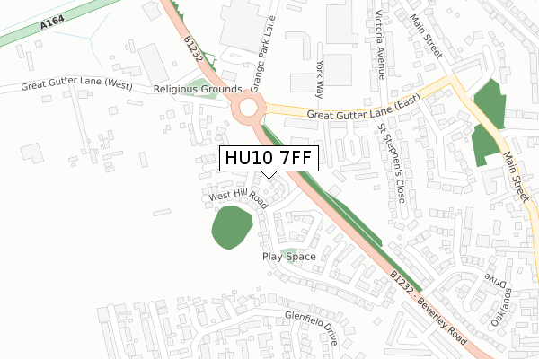
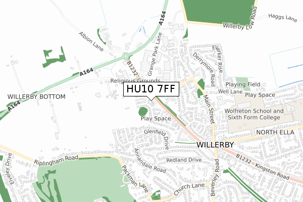
HU10 7FF maps


Licence: Open Government Licence (requires attribution)
Attribution: Contains OS data © Crown copyright and database right 2025
Source: Open Postcode Geo
Licence: Open Government Licence (requires attribution)
Attribution: Contains OS data © Crown copyright and database right 2025; Contains Royal Mail data © Royal Mail copyright and database right 2025; Source: Office for National Statistics licensed under the Open Government Licence v.3.0
HU10 7FF geodata
| Easting | 501973 |
| Northing | 430489 |
| Latitude | 53.760806 |
| Longitude | -0.454666 |
Where is HU10 7FF?
| Country | England |
| Postcode District | HU10 |
Politics
| Ward | Willerby And Kirk Ella |
|---|---|
| Constituency | Haltemprice And Howden |
House Prices
Sales of detached houses in HU10 7FF
2022 15 FEB £368,000 |
2022 11 FEB £292,000 |
2018 5 OCT £364,995 |
1, POPPY DRIVE, KIRK ELLA, HULL, HU10 7FF 2018 27 APR £339,995 |
2, POPPY DRIVE, KIRK ELLA, HULL, HU10 7FF 2017 21 DEC £364,995 |
3, POPPY DRIVE, KIRK ELLA, HULL, HU10 7FF 2017 15 DEC £249,995 |
2017 7 DEC £249,995 |
Licence: Contains HM Land Registry data © Crown copyright and database right 2025. This data is licensed under the Open Government Licence v3.0.
Transport
Nearest bus stops to HU10 7FF
| Willerby Great Gutter Lane (Great Gutter Lane) | Willerby | 137m |
| Willerby Great Gutter Lane (Great Gutter Lane) | Willerby | 145m |
| Willerby Shopping Park (Grange Park Lane) | Willerby | 250m |
| Willerby Great Gutter Lane (Great Gutter Lane East) | Willerby | 275m |
| Willerby Great Gutter Lane (Great Gutter Lane East) | Willerby | 280m |
Nearest railway stations to HU10 7FF
| Cottingham Station | 3.9km |
| Hessle Station | 4.9km |
| Ferriby Station | 6km |
Broadband
Broadband access in HU10 7FF (2020 data)
| Percentage of properties with Next Generation Access | 100.0% |
| Percentage of properties with Superfast Broadband | 100.0% |
| Percentage of properties with Ultrafast Broadband | 100.0% |
| Percentage of properties with Full Fibre Broadband | 100.0% |
Superfast Broadband is between 30Mbps and 300Mbps
Ultrafast Broadband is > 300Mbps
Broadband limitations in HU10 7FF (2020 data)
| Percentage of properties unable to receive 2Mbps | 0.0% |
| Percentage of properties unable to receive 5Mbps | 0.0% |
| Percentage of properties unable to receive 10Mbps | 0.0% |
| Percentage of properties unable to receive 30Mbps | 0.0% |
Deprivation
1.1% of English postcodes are less deprived than HU10 7FF:Food Standards Agency
Three nearest food hygiene ratings to HU10 7FF (metres)


➜ Get more ratings from the Food Standards Agency
Nearest post box to HU10 7FF
| Last Collection | |||
|---|---|---|---|
| Location | Mon-Fri | Sat | Distance |
| Well Lane Willerby | 17:30 | 12:00 | 424m |
| Annandale Road Kirkella | 17:15 | 11:45 | 539m |
| Willerby Square Post Office | 17:00 | 12:15 | 698m |
HU10 7FF ITL and HU10 7FF LAU
The below table lists the International Territorial Level (ITL) codes (formerly Nomenclature of Territorial Units for Statistics (NUTS) codes) and Local Administrative Units (LAU) codes for HU10 7FF:
| ITL 1 Code | Name |
|---|---|
| TLE | Yorkshire and The Humber |
| ITL 2 Code | Name |
| TLE1 | East Yorkshire and Northern Lincolnshire |
| ITL 3 Code | Name |
| TLE12 | East Riding of Yorkshire |
| LAU 1 Code | Name |
| E06000011 | East Riding of Yorkshire |
HU10 7FF census areas
The below table lists the Census Output Area (OA), Lower Layer Super Output Area (LSOA), and Middle Layer Super Output Area (MSOA) for HU10 7FF:
| Code | Name | |
|---|---|---|
| OA | E00066161 | |
| LSOA | E01013116 | East Riding of Yorkshire 028D |
| MSOA | E02002711 | East Riding of Yorkshire 028 |
Nearest postcodes to HU10 7FF
| HU10 6FP | St Georges Court | 148m |
| HU10 6FL | Great Gutter Lane East | 173m |
| HU10 6FJ | St Georges Court | 173m |
| HU10 6FN | St Georges Court | 187m |
| HU10 6DG | St Stephens Close | 226m |
| HU10 7NF | Ashworth Drive | 271m |
| HU10 6DE | Great Gutter Lane | 308m |
| HU10 7UL | Glenfield Drive | 310m |
| HU10 7XB | Glendale Close | 313m |
| HU10 6DD | Victoria Avenue | 319m |