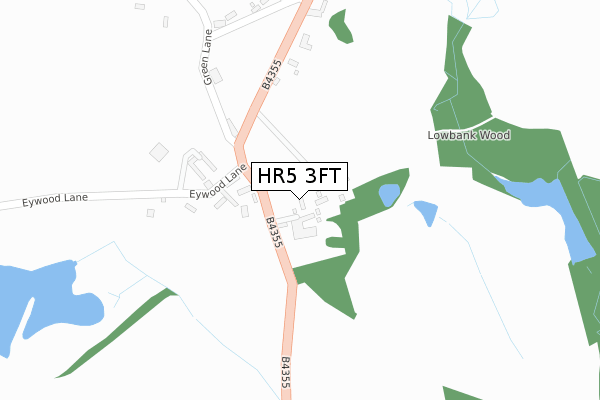
HR5 3FT is located in the Arrow electoral ward, within the unitary authority of Herefordshire, County of and the English Parliamentary constituency of North Herefordshire. The Sub Integrated Care Board (ICB) Location is NHS Herefordshire and Worcestershire ICB - 18C and the police force is West Mercia. This postcode has been in use since December 2019.


GetTheData
Source: OS Open Zoomstack (Ordnance Survey)
Licence: Open Government Licence (requires attribution)
Attribution: Contains OS data © Crown copyright and database right 2025
Source: Open Postcode Geo
Licence: Open Government Licence (requires attribution)
Attribution: Contains OS data © Crown copyright and database right 2025; Contains Royal Mail data © Royal Mail copyright and database right 2025; Source: Office for National Statistics licensed under the Open Government Licence v.3.0
| Easting | 333678 |
| Northing | 255356 |
| Latitude | 52.192446 |
| Longitude | -2.971650 |
GetTheData
Source: Open Postcode Geo
Licence: Open Government Licence
| Country | England |
| Postcode District | HR5 |
➜ See where HR5 is on a map ➜ Where is Lyonshall? | |
GetTheData
Source: Land Registry Price Paid Data
Licence: Open Government Licence
| Ward | Arrow |
| Constituency | North Herefordshire |
GetTheData
Source: ONS Postcode Database
Licence: Open Government Licence
THE HIVE, 7, WEBBS MEADOW, LYONSHALL, KINGTON, HR5 3FT 2021 23 DEC £140,000 |
CURL BROOK COTTAGE, 13, WEBBS MEADOW, LYONSHALL, KINGTON, HR5 3FT 2021 25 MAR £165,000 |
PLOT 113, WEBBS MEADOW, LYONSHALL, KINGTON, HR5 3FT 2021 5 FEB £175,000 |
11, WEBBS MEADOW, LYONSHALL, KINGTON, HR5 3FT 2020 22 DEC £125,000 |
2, WEBBS MEADOW, LYONSHALL, KINGTON, HR5 3FT 2020 27 AUG £190,000 |
3, WEBBS MEADOW, LYONSHALL, KINGTON, HR5 3FT 2020 24 JUL £198,000 |
GetTheData
Source: HM Land Registry Price Paid Data
Licence: Contains HM Land Registry data © Crown copyright and database right 2025. This data is licensed under the Open Government Licence v3.0.
| Forge Row (A480) | Lyonshall | 153m |
| Burnt Orchard (A480) | Lyonshall | 156m |
| Royal George Ph (Unclassified Road) | Lyonshall | 243m |
| Royal George Ph (A480) | Lyonshall | 249m |
| The Close (A480) | Lyonshall | 439m |
GetTheData
Source: NaPTAN
Licence: Open Government Licence
GetTheData
Source: ONS Postcode Database
Licence: Open Government Licence


➜ Get more ratings from the Food Standards Agency
GetTheData
Source: Food Standards Agency
Licence: FSA terms & conditions
| Last Collection | |||
|---|---|---|---|
| Location | Mon-Fri | Sat | Distance |
| The Square | 17:00 | 11:00 | 4,342m |
| The Wych | 15:00 | 09:00 | 4,823m |
GetTheData
Source: Dracos
Licence: Creative Commons Attribution-ShareAlike
The below table lists the International Territorial Level (ITL) codes (formerly Nomenclature of Territorial Units for Statistics (NUTS) codes) and Local Administrative Units (LAU) codes for HR5 3FT:
| ITL 1 Code | Name |
|---|---|
| TLG | West Midlands (England) |
| ITL 2 Code | Name |
| TLG1 | Herefordshire, Worcestershire and Warwickshire |
| ITL 3 Code | Name |
| TLG11 | Herefordshire, County of |
| LAU 1 Code | Name |
| E06000019 | Herefordshire, County of |
GetTheData
Source: ONS Postcode Directory
Licence: Open Government Licence
The below table lists the Census Output Area (OA), Lower Layer Super Output Area (LSOA), and Middle Layer Super Output Area (MSOA) for HR5 3FT:
| Code | Name | |
|---|---|---|
| OA | E00070970 | |
| LSOA | E01014056 | Herefordshire 006E |
| MSOA | E02002910 | Herefordshire 006 |
GetTheData
Source: ONS Postcode Directory
Licence: Open Government Licence
| HR5 3JP | 130m | |
| HR5 3JW | 162m | |
| HR5 3JN | 169m | |
| HR5 3LJ | 276m | |
| HR5 3NB | Burgage Close | 293m |
| HR5 3LS | 338m | |
| HR5 3LG | Stepstile | 365m |
| HR5 3LP | The Close | 467m |
| HR5 3LL | 622m | |
| HR5 3JS | 759m |
GetTheData
Source: Open Postcode Geo; Land Registry Price Paid Data
Licence: Open Government Licence