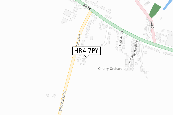
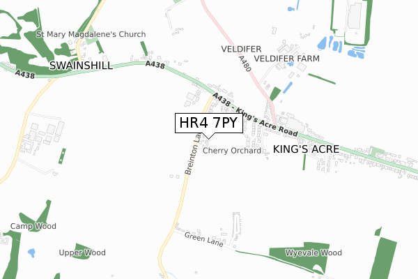
HR4 7PY maps, stats, and open data
HR4 7PY is located in the Credenhill electoral ward, within the unitary authority of Herefordshire, County of and the English Parliamentary constituency of North Herefordshire. The Sub Integrated Care Board (ICB) Location is NHS Herefordshire and Worcestershire ICB - 18C and the police force is West Mercia. This postcode has been in use since December 2017.
HR4 7PY maps


Licence: Open Government Licence (requires attribution)
Attribution: Contains OS data © Crown copyright and database right 2025
Source: Open Postcode Geo
Licence: Open Government Licence (requires attribution)
Attribution: Contains OS data © Crown copyright and database right 2025; Contains Royal Mail data © Royal Mail copyright and database right 2025; Source: Office for National Statistics licensed under the Open Government Licence v.3.0
HR4 7PY geodata
| Easting | 346674 |
| Northing | 241422 |
| Latitude | 52.068596 |
| Longitude | -2.779362 |
Where is HR4 7PY?
| Country | England |
| Postcode District | HR4 |
Politics
| Ward | Credenhill |
|---|---|
| Constituency | North Herefordshire |
House Prices
Sales of detached houses in HR4 7PY
2019 15 APR £525,000 |
4, BREINTON LEYSE, SWAINSHILL, HEREFORD, HR4 7PY 2019 16 JAN £585,000 |
2, BREINTON LEYSE, SWAINSHILL, HEREFORD, HR4 7PY 2018 25 OCT £550,000 |
1, BREINTON LEYSE, SWAINSHILL, HEREFORD, HR4 7PY 2018 22 OCT £557,000 |
5, BREINTON LEYSE, SWAINSHILL, HEREFORD, HR4 7PY 2017 28 NOV £595,000 |
Licence: Contains HM Land Registry data © Crown copyright and database right 2025. This data is licensed under the Open Government Licence v3.0.
Transport
Nearest bus stops to HR4 7PY
| Wyevale Way (A480) | King's Acre | 424m |
| Wyevale Garden Centre (Kings Acre Road/A438) | King's Acre | 427m |
| Wyevale Garden Centre (Kings Acre Road (A438)) | King's Acre | 440m |
| Wyevale Way (A480) | King's Acre | 441m |
| Green Lane Park Home Estate (Green Lane) | Breinton Common | 670m |
Nearest railway stations to HR4 7PY
| Hereford Station | 4.9km |
Broadband
Broadband access in HR4 7PY (2020 data)
| Percentage of properties with Next Generation Access | 100.0% |
| Percentage of properties with Superfast Broadband | 100.0% |
| Percentage of properties with Ultrafast Broadband | 0.0% |
| Percentage of properties with Full Fibre Broadband | 0.0% |
Superfast Broadband is between 30Mbps and 300Mbps
Ultrafast Broadband is > 300Mbps
Broadband limitations in HR4 7PY (2020 data)
| Percentage of properties unable to receive 2Mbps | 0.0% |
| Percentage of properties unable to receive 5Mbps | 0.0% |
| Percentage of properties unable to receive 10Mbps | 0.0% |
| Percentage of properties unable to receive 30Mbps | 0.0% |
Deprivation
36.4% of English postcodes are less deprived than HR4 7PY:Food Standards Agency
Three nearest food hygiene ratings to HR4 7PY (metres)


➜ Get more ratings from the Food Standards Agency
Nearest post box to HR4 7PY
| Last Collection | |||
|---|---|---|---|
| Location | Mon-Fri | Sat | Distance |
| Lower Eaton | 16:15 | 09:30 | 2,493m |
| Ruckhall Common | 16:30 | 08:45 | 2,644m |
| Sandown Drive | 18:30 | 11:45 | 2,645m |
HR4 7PY ITL and HR4 7PY LAU
The below table lists the International Territorial Level (ITL) codes (formerly Nomenclature of Territorial Units for Statistics (NUTS) codes) and Local Administrative Units (LAU) codes for HR4 7PY:
| ITL 1 Code | Name |
|---|---|
| TLG | West Midlands (England) |
| ITL 2 Code | Name |
| TLG1 | Herefordshire, Worcestershire and Warwickshire |
| ITL 3 Code | Name |
| TLG11 | Herefordshire, County of |
| LAU 1 Code | Name |
| E06000019 | Herefordshire, County of |
HR4 7PY census areas
The below table lists the Census Output Area (OA), Lower Layer Super Output Area (LSOA), and Middle Layer Super Output Area (MSOA) for HR4 7PY:
| Code | Name | |
|---|---|---|
| OA | E00070731 | |
| LSOA | E01014012 | Herefordshire 007B |
| MSOA | E02002911 | Herefordshire 007 |
Nearest postcodes to HR4 7PY
| HR4 7PX | Breinton Lane | 94m |
| HR4 0SH | Four Acres | 198m |
| HR4 0SG | Kings Acre Road | 211m |
| HR4 0TH | Yew Tree Gardens | 270m |
| HR4 0SN | Kings Acre Road | 334m |
| HR4 0SL | Kings Acre Road | 563m |
| HR4 7PL | Cranstone | 569m |
| HR4 7PU | 605m | |
| HR4 0SJ | Cranston Mews | 620m |
| HR4 0TL | Lambourne Gardens | 641m |