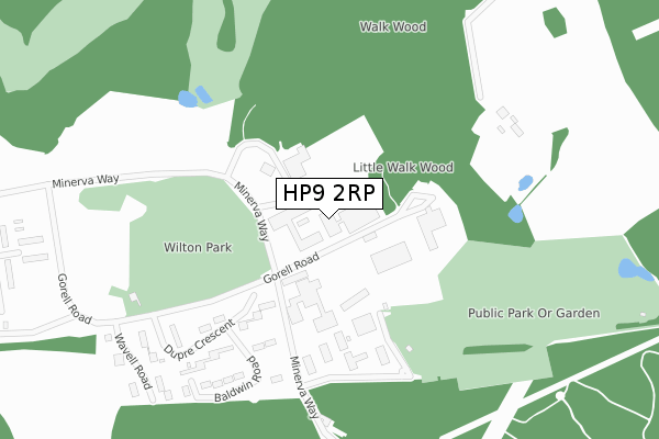
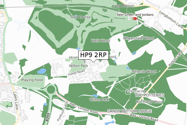
HP9 2RP is located in the Gerrards Cross electoral ward, within the unitary authority of Buckinghamshire and the English Parliamentary constituency of Beaconsfield. The Sub Integrated Care Board (ICB) Location is NHS Buckinghamshire, Oxfordshire and Berkshire West ICB - 14Y and the police force is Thames Valley. This postcode has been in use since October 2017.


GetTheData
Source: OS Open Zoomstack (Ordnance Survey)
Licence: Open Government Licence (requires attribution)
Attribution: Contains OS data © Crown copyright and database right 2025
Source: Open Postcode Geo
Licence: Open Government Licence (requires attribution)
Attribution: Contains OS data © Crown copyright and database right 2025; Contains Royal Mail data © Royal Mail copyright and database right 2025; Source: Office for National Statistics licensed under the Open Government Licence v.3.0
| Easting | 495952 |
| Northing | 190432 |
| Latitude | 51.604564 |
| Longitude | -0.615873 |
GetTheData
Source: Open Postcode Geo
Licence: Open Government Licence
| Country | England |
| Postcode District | HP9 |
➜ See where HP9 is on a map ➜ Where is Beaconsfield? | |
GetTheData
Source: Land Registry Price Paid Data
Licence: Open Government Licence
| Ward | Gerrards Cross |
| Constituency | Beaconsfield |
GetTheData
Source: ONS Postcode Database
Licence: Open Government Licence
| Railway Station (Longbottom Lane) | Seer Green | 886m |
| Railway Station (Longbottom Lane) | Seer Green | 906m |
| Potkiln Lane (London Road) | Bulstrode Park | 914m |
| Potkiln Lane (London Road) | Bulstrode Park | 962m |
| Cricket Ground (London Road) | Beaconsfield Old Town | 1,010m |
| Seer Green Station | 0.8km |
| Beaconsfield Station | 2.1km |
| Gerrards Cross Station | 4.5km |
GetTheData
Source: NaPTAN
Licence: Open Government Licence
| Percentage of properties with Next Generation Access | 0.0% |
| Percentage of properties with Superfast Broadband | 0.0% |
| Percentage of properties with Ultrafast Broadband | 0.0% |
| Percentage of properties with Full Fibre Broadband | 0.0% |
Superfast Broadband is between 30Mbps and 300Mbps
Ultrafast Broadband is > 300Mbps
| Percentage of properties unable to receive 2Mbps | 0.0% |
| Percentage of properties unable to receive 5Mbps | 0.0% |
| Percentage of properties unable to receive 10Mbps | 100.0% |
| Percentage of properties unable to receive 30Mbps | 100.0% |
GetTheData
Source: Ofcom
Licence: Ofcom Terms of Use (requires attribution)
Estimated total energy consumption in HP9 2RP by fuel type, 2015.
| Consumption (kWh) | 103,563 |
|---|---|
| Meter count | 9 |
| Mean (kWh/meter) | 11,507 |
| Median (kWh/meter) | 1 |
GetTheData
Source: Postcode level gas estimates: 2015 (experimental)
Source: Postcode level electricity estimates: 2015 (experimental)
Licence: Open Government Licence
GetTheData
Source: ONS Postcode Database
Licence: Open Government Licence


➜ Get more ratings from the Food Standards Agency
GetTheData
Source: Food Standards Agency
Licence: FSA terms & conditions
| Last Collection | |||
|---|---|---|---|
| Location | Mon-Fri | Sat | Distance |
| Longbottom | 17:00 | 09:30 | 1,029m |
| Meter Box | 17:30 | 09:00 | 1,198m |
| London Road | 17:30 | 12:00 | 1,201m |
GetTheData
Source: Dracos
Licence: Creative Commons Attribution-ShareAlike
The below table lists the International Territorial Level (ITL) codes (formerly Nomenclature of Territorial Units for Statistics (NUTS) codes) and Local Administrative Units (LAU) codes for HP9 2RP:
| ITL 1 Code | Name |
|---|---|
| TLJ | South East (England) |
| ITL 2 Code | Name |
| TLJ1 | Berkshire, Buckinghamshire and Oxfordshire |
| ITL 3 Code | Name |
| TLJ13 | Buckinghamshire |
| LAU 1 Code | Name |
| E06000060 | Buckinghamshire |
GetTheData
Source: ONS Postcode Directory
Licence: Open Government Licence
The below table lists the Census Output Area (OA), Lower Layer Super Output Area (LSOA), and Middle Layer Super Output Area (MSOA) for HP9 2RP:
| Code | Name | |
|---|---|---|
| OA | E00089812 | |
| LSOA | E01017800 | South Bucks 001E |
| MSOA | E02003688 | South Bucks 001 |
GetTheData
Source: ONS Postcode Directory
Licence: Open Government Licence
| HP9 2XB | Potkiln Lane | 691m |
| HP9 2RX | Pyebush Lane | 924m |
| HP9 2UL | Long Bottom Lane | 950m |
| HP9 2JA | Burnham Avenue | 964m |
| HP9 2UU | Dean Wood Road | 1010m |
| HP9 2WH | Wilton Park | 1059m |
| HP9 2JB | London End | 1063m |
| HP9 2QQ | Bayne Hill Close | 1078m |
| HP9 2HT | Park Lane | 1098m |
| HP9 2LA | Lakes Lane | 1106m |
GetTheData
Source: Open Postcode Geo; Land Registry Price Paid Data
Licence: Open Government Licence